Heritage Walk No.2 (for Kids)
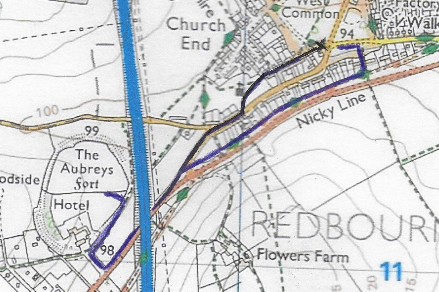
Start at the “The Jolly Gardener” (marked with a cross on the map) at the south end of the Common.
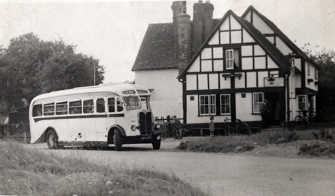
Take a look at the house called Jolly Gardener
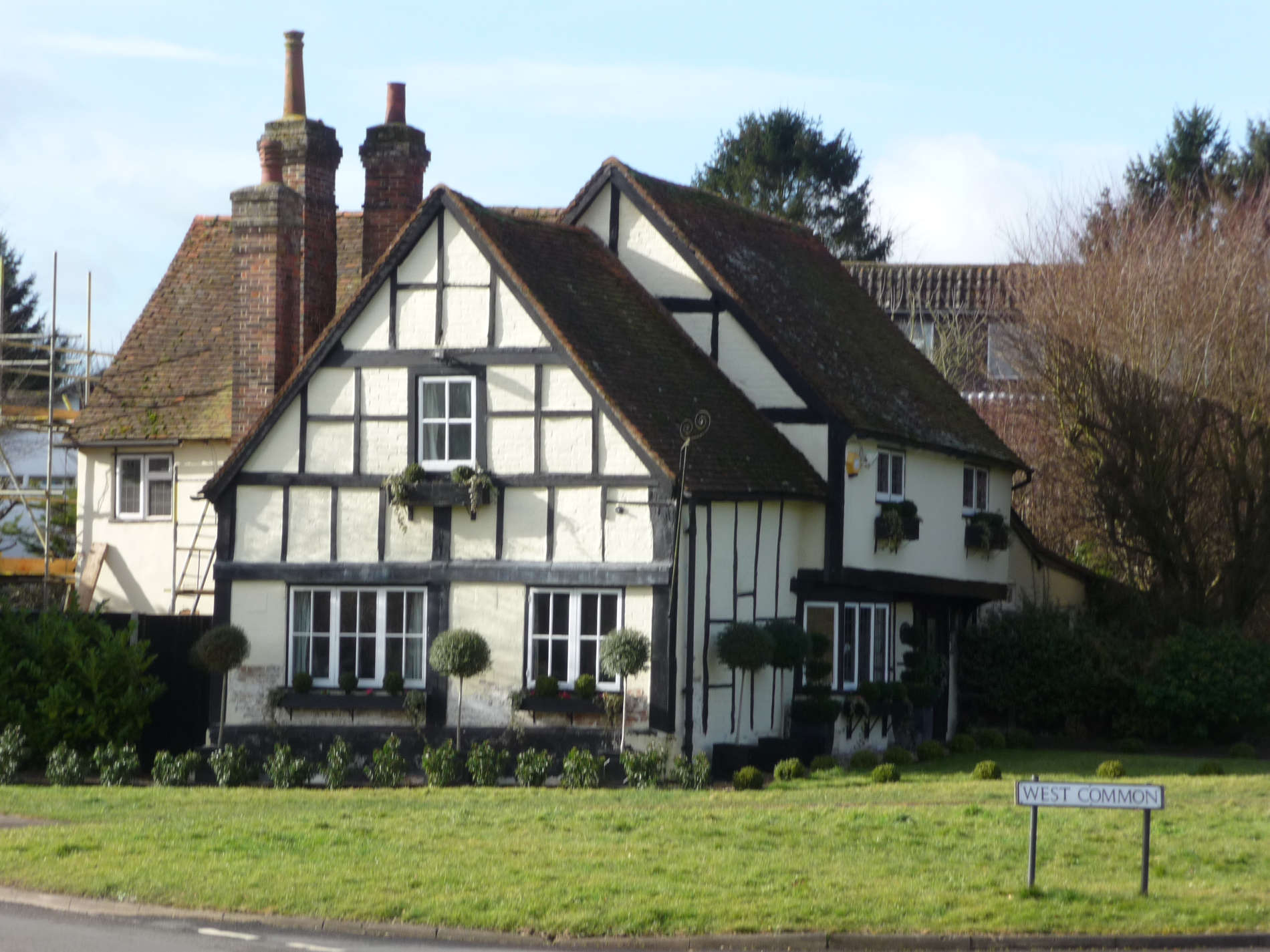
- What do you think this house was once?
- How can we tell that it is very old?
There was a straw plaiting school here for girls 150 years ago. Plaits of straw were sewn together to make hats.
Take a walk to the right of The Jolly Gardener down Church End
Look at No.8 on the left
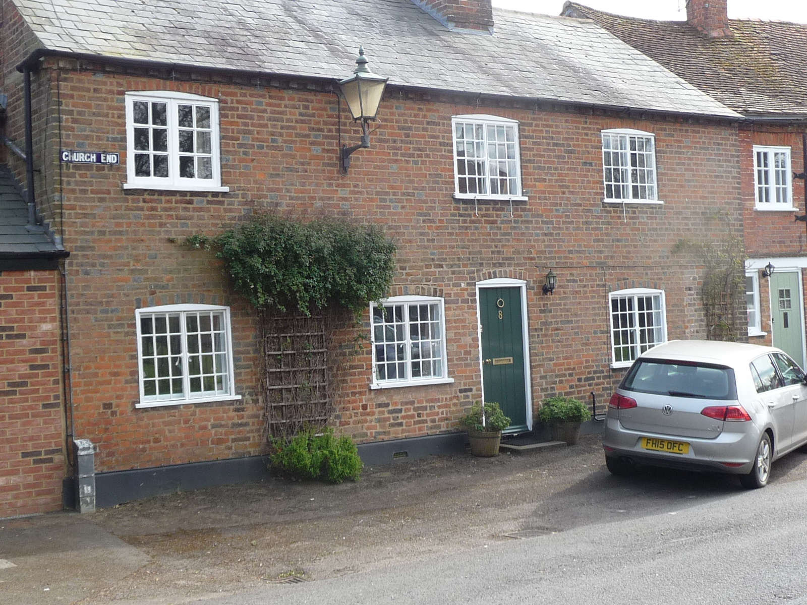
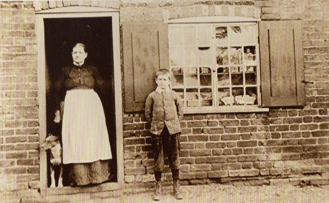
- This was a sweet shop 150 years ago. Can you work out where the old photo was taken?
- Perhaps you should have your photo taken where the boy is standing.
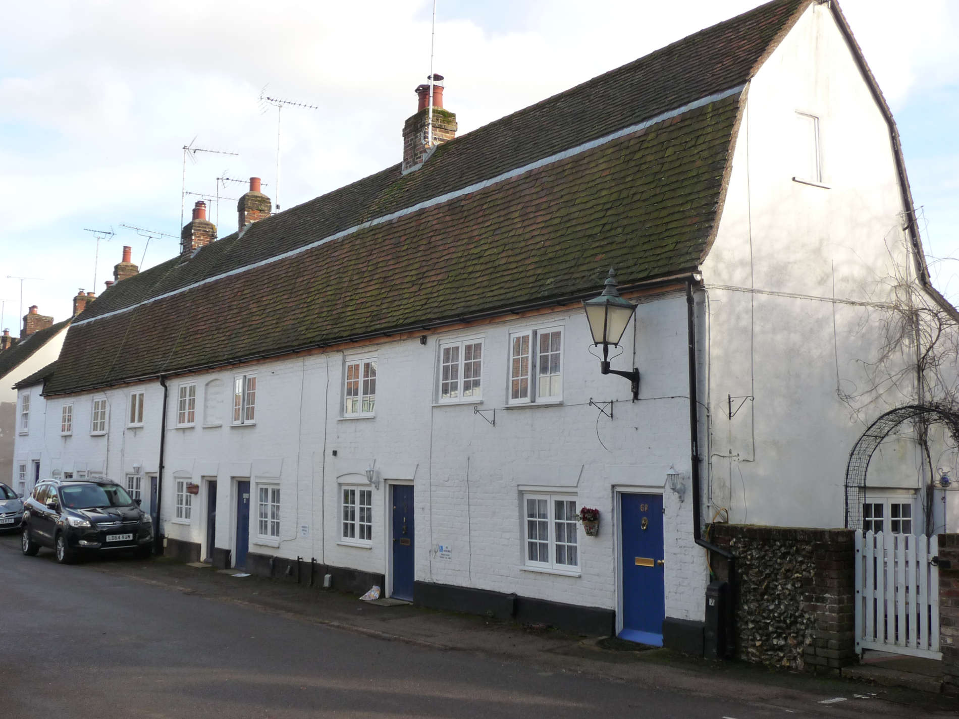
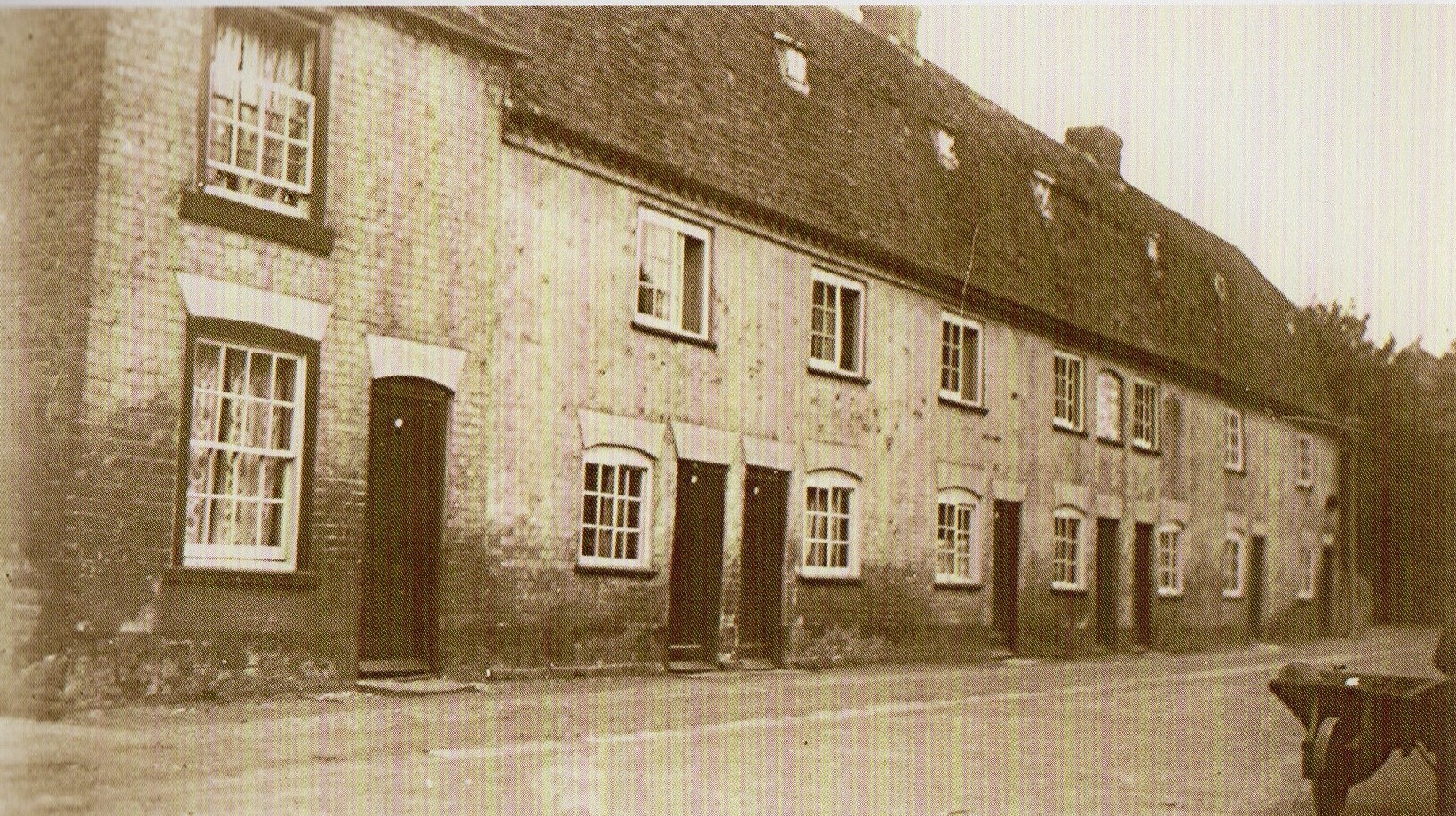
Continue your walk. On the left you can see a very long row of joined cottages from No.14 up to No.30
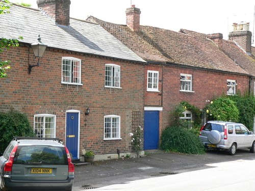
- How many are there?
- You can see that some of them have been changed. The doors are in different positions. Can you see where doors have been blocked up?
- Look up. Why do you think the roofs are at different levels?
These houses are over 200 years old and formed the centre of the old village of Redbourn before it moved to the main road – the old Roman Watling Street.
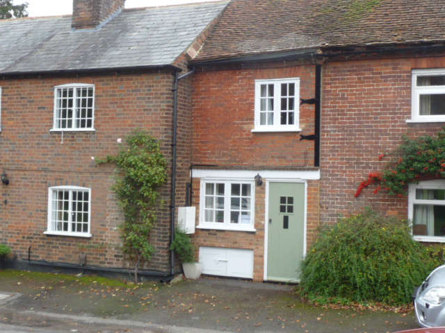
Look to the right at No.11
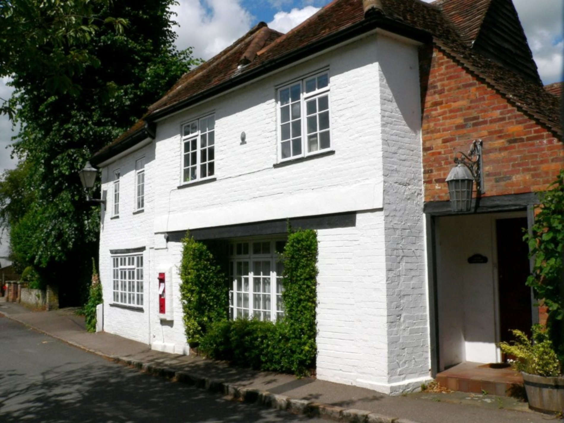
- Looking at the front of this house, can you guess what it used to be?
- When you have found the clue, which monarch is mentioned on it?
- The house is one of the oldest in the road – over 400 years old and served as the village shop.
- To the right of the house, can you see something that would help people go from the ground floor to the first floor?
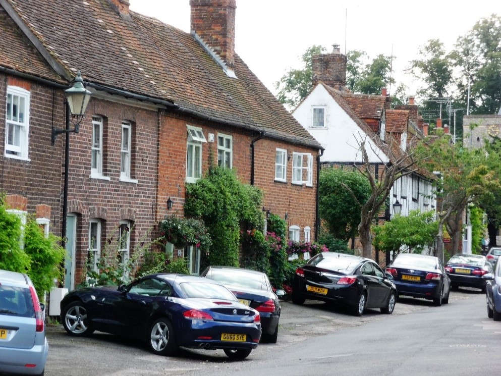
Now look to the left hand side of the road again. Find Nos.40-44.
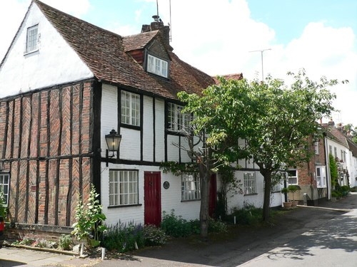
These houses were built nearly 400 years ago.
What are the materials used to build these houses ? Look at the side of the building.
I expect you have already spotted “The Hollybush” pub.
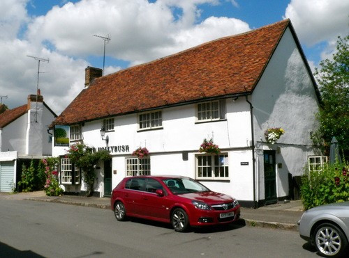
This building is over 500 years old.
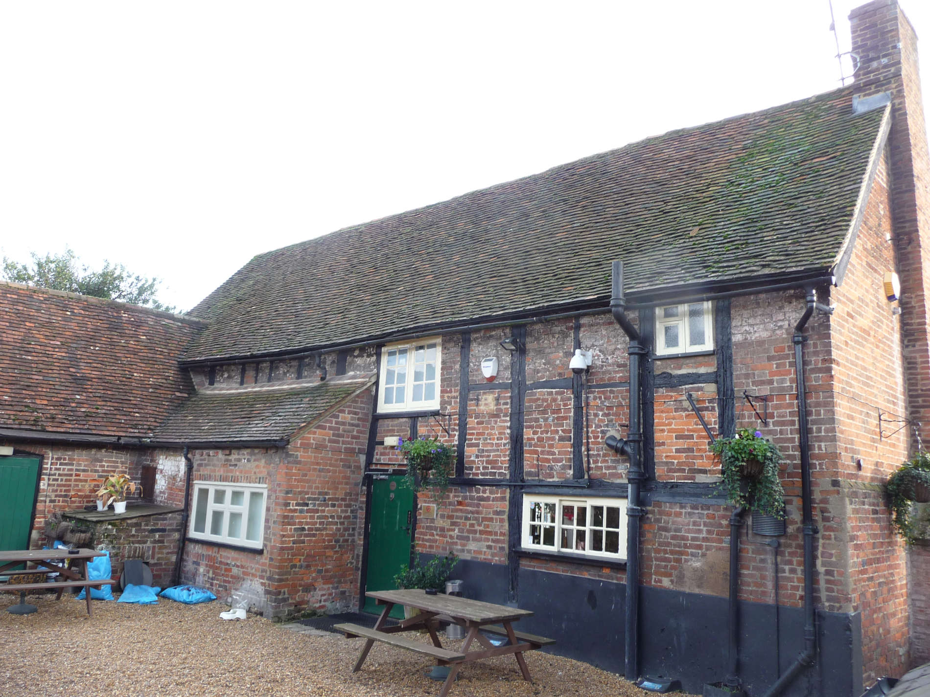
- Go round the back. Can you find the pump?
- Can you imagine what it must have been like not to have running water from a tap?
- Can you see the wooden beams of the pub?
- Can you see the building shown below? It is the Old School House.
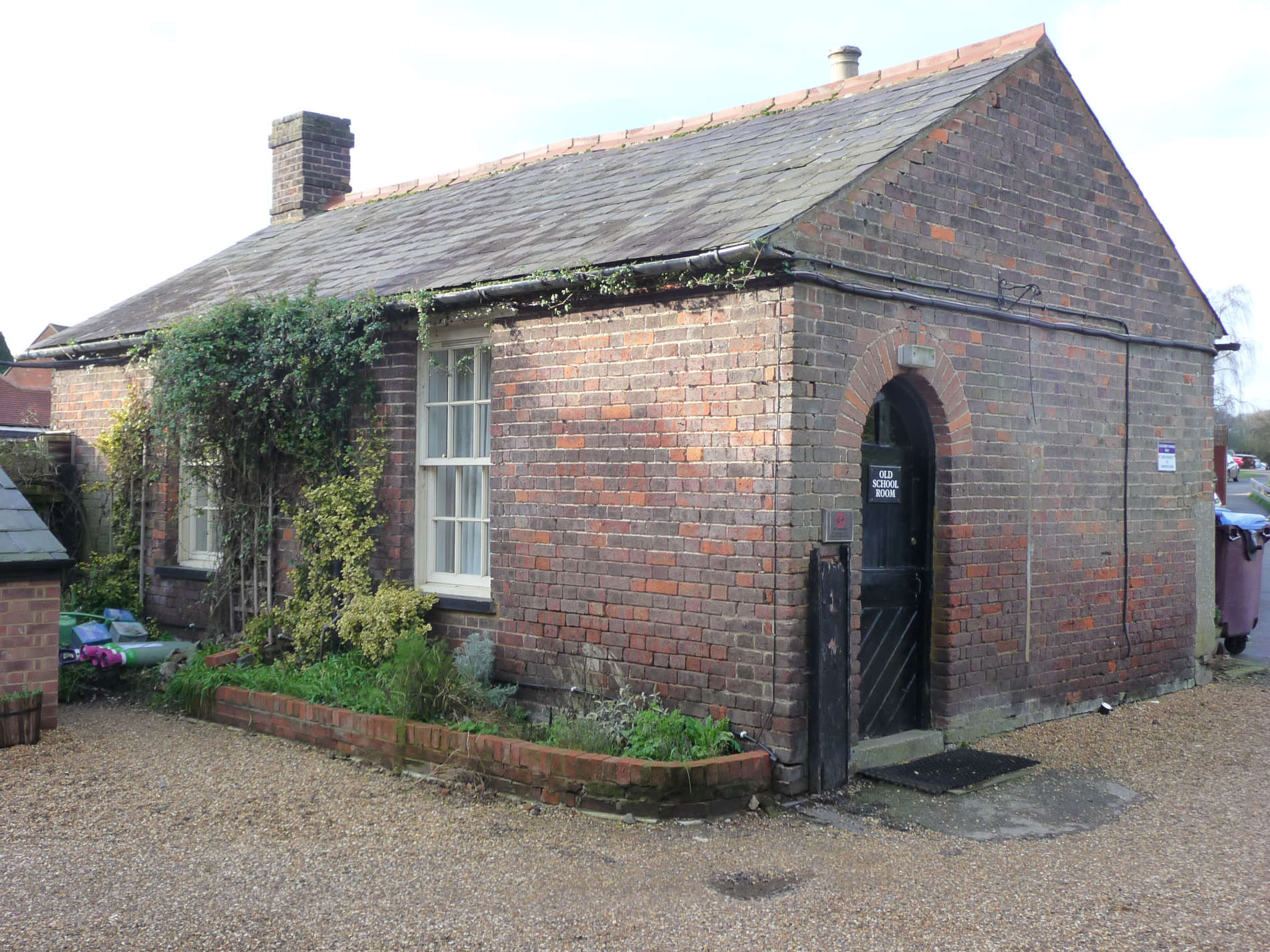
Imagine going to this school. Children from the work house went here. How many children do you think could get into the building?
Go back to the front of the pub and look back along the way you have walked. Take a look at the old photo below taken in the 1920’s
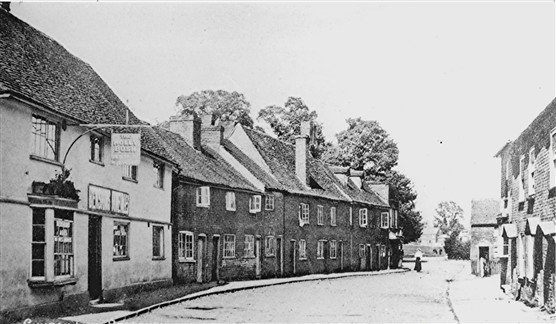
Can you see the houses right next door to The Hollybush? Look down the road. What is there now?
Now look on the other side of the road at this building
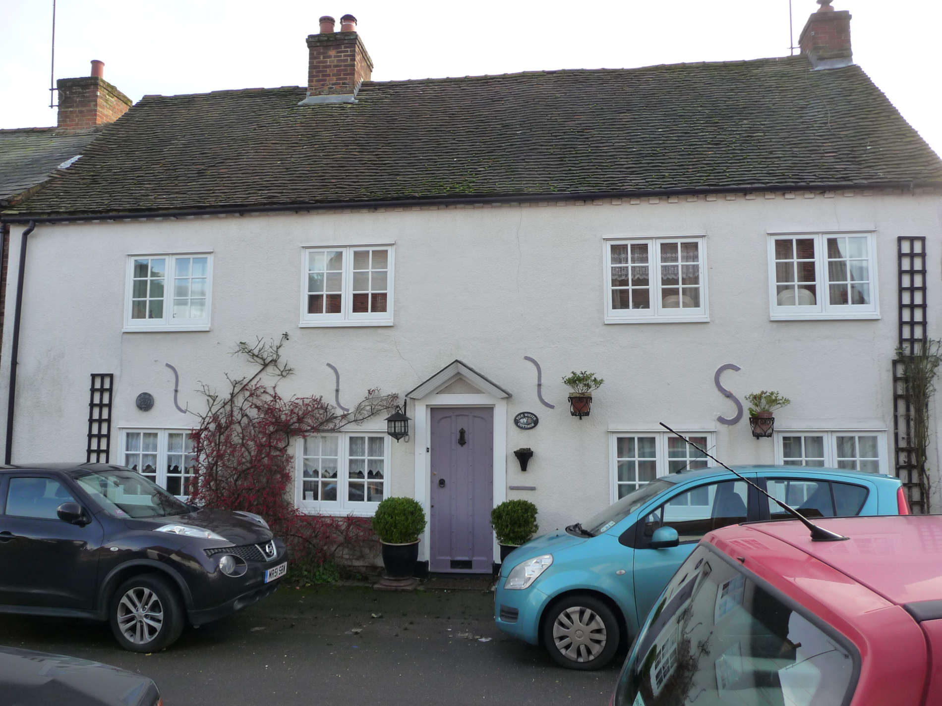
This used to be a terrace of individual homes. What do you think those S shaped signs are on the wall?
Now look next door.
This is the Old Workhouse
Here it is again in the 1920’s
What was a workhouse?
There was an Act of Parliament in 1783 that made each parish (Redbourn is a parish) look after its poor. Men who could not find enough work to earn money were given jobs in the village. Old people with no family would live in the workhouse along with women and children who had no income. About 20-30 people lived there. This is what they ate each day.
- Breakfast – Broth/Gruel
- Midday – Cold meat/cheese, bread and beer
- Supper – Bread, cheese and beer
This workhouse closed in 1834 and the inmates moved to cottages/huts in the village. Find the writing on the wall of the building.
- When was the workhouse re-built? It was originally built as a church house in 1486.
- What are the names of the Church Wardens?
- What is a Church Warden?
- What are the names of the Overseers?
- What is an Overseer?
Look at the poster below
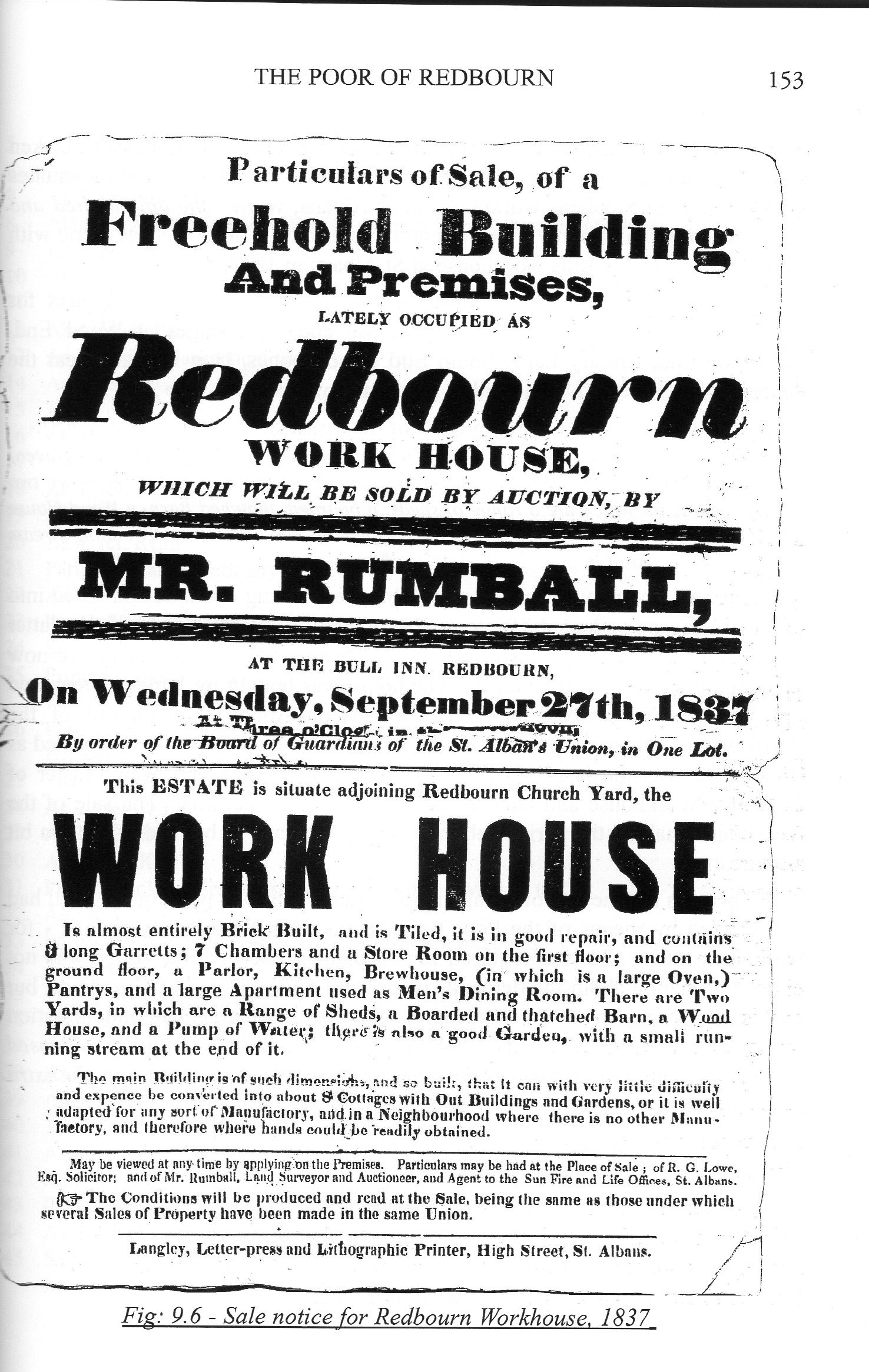
- When was the workhouse sold?
- Read the description of it. What surprises you?
Now walk towards the Church. Just before the gate into the church yard, turn right and take a look at this building.
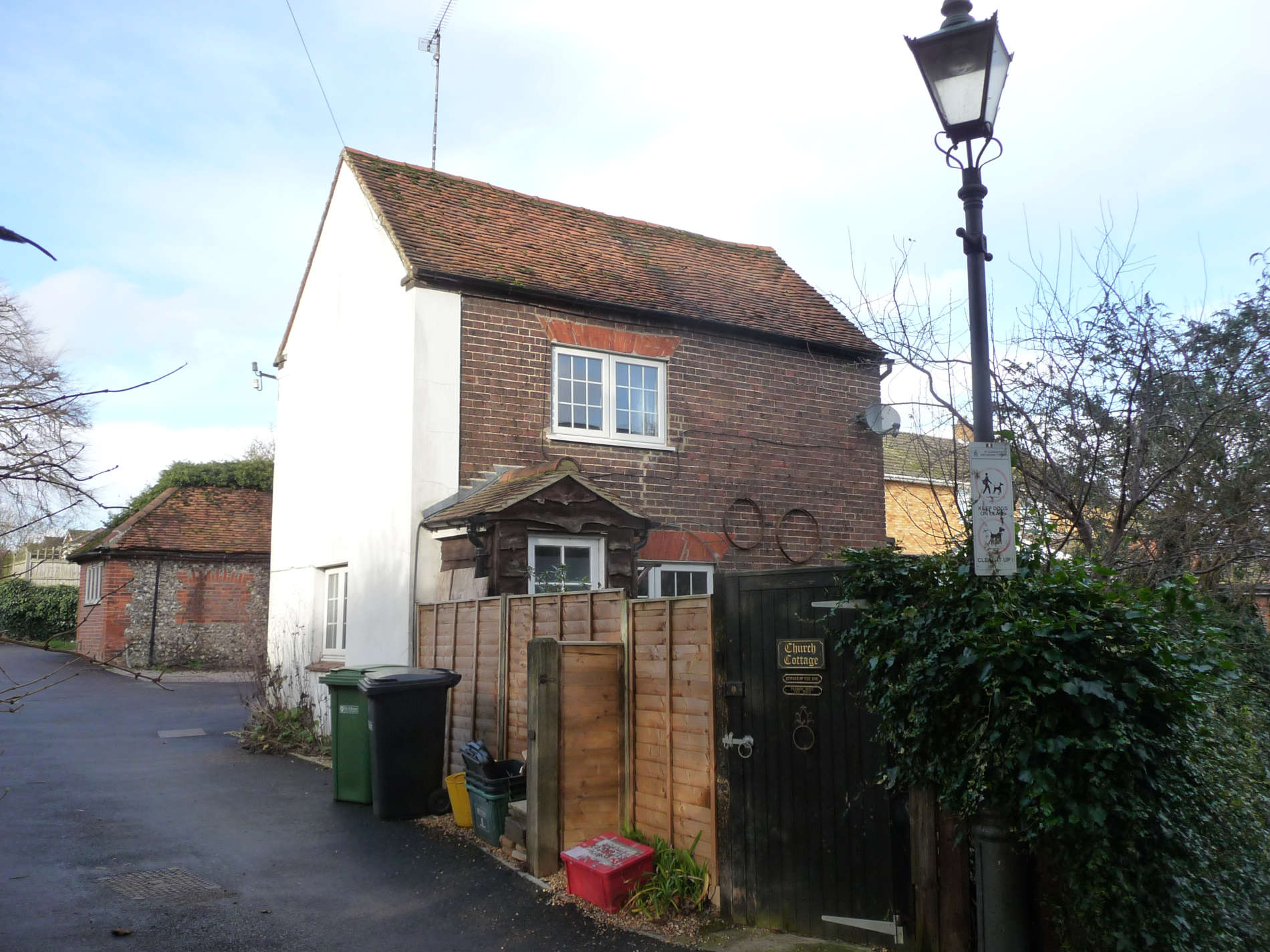
This little house is about 200 years old and was probably lived in by the workhouse school master
Walk a little and you will see a building that was once the church hall.
- Where is the church hall now?
- Have you ever been inside the new church hall?
Now turn around and walk back to the gate of the church gardens and take a look at the church.
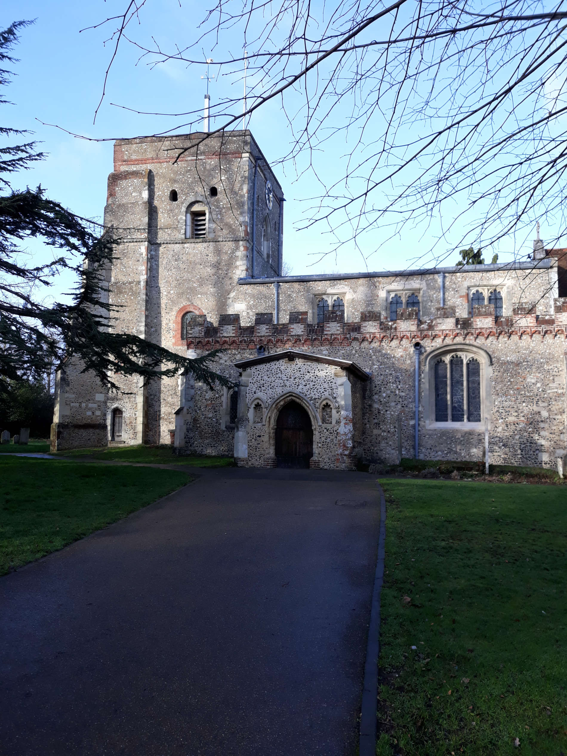
- What part of the church do you think is the oldest?
- Can you find the orange tiles in the wall? These were manufactured before the church was build. Who do you think made them and where might they have been originally?
- Can you see the new church hall?
- If you are able to go into the church, look for the rounded arches. these are the oldest.
- The porch is old too. Bodies in coffins were rested here before the funeral service.
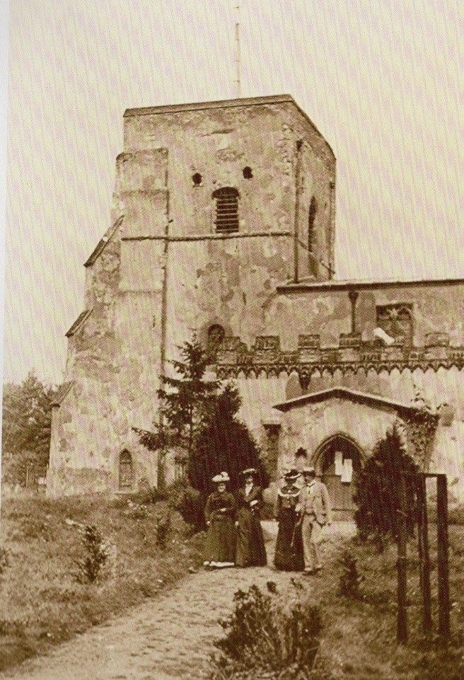
- Looking at Photo no.2, you can see that the church has not changed much.
- Can you see the different fashions worn by people in 1901
Now leave the church yard by the main gate opposite the church porch. As you get to the main Hemel Hempstead Road, look for this building.
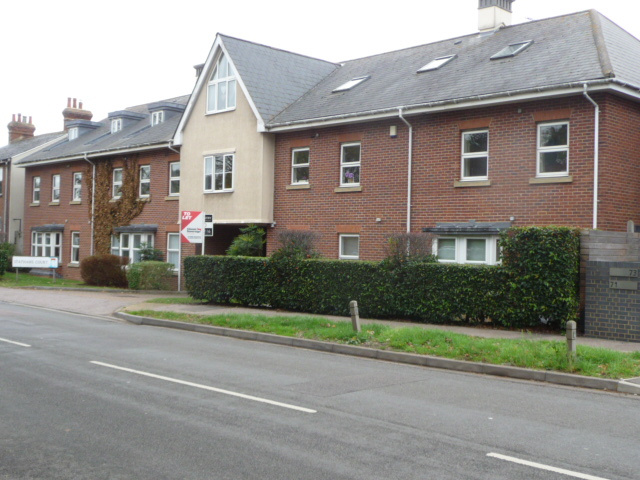
This has been build on the site of a garage and a shop.
What did this shop sell?
Now look at this photo taken from an aeroplane in the 1950’s. It shows the whole are now occupied by the flats and houses.
- Can you work out where everything was?
- Can you see what is running along the back of the garage just in front of the field? What is it now?
Now turn and walk towards the M1 motorway. Can you see these homes on the right?
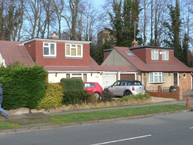
These have been built on the site of old pub called “The Waggon and Horses” It was closed and became a private house and was demolished later and the homes were built.
Walk under the M1 motorway. As you go through the bridge there is another opening to the left of the road for the public footpath.
- What is the name given to this footpath?
- Do you know what was there before the footpath?
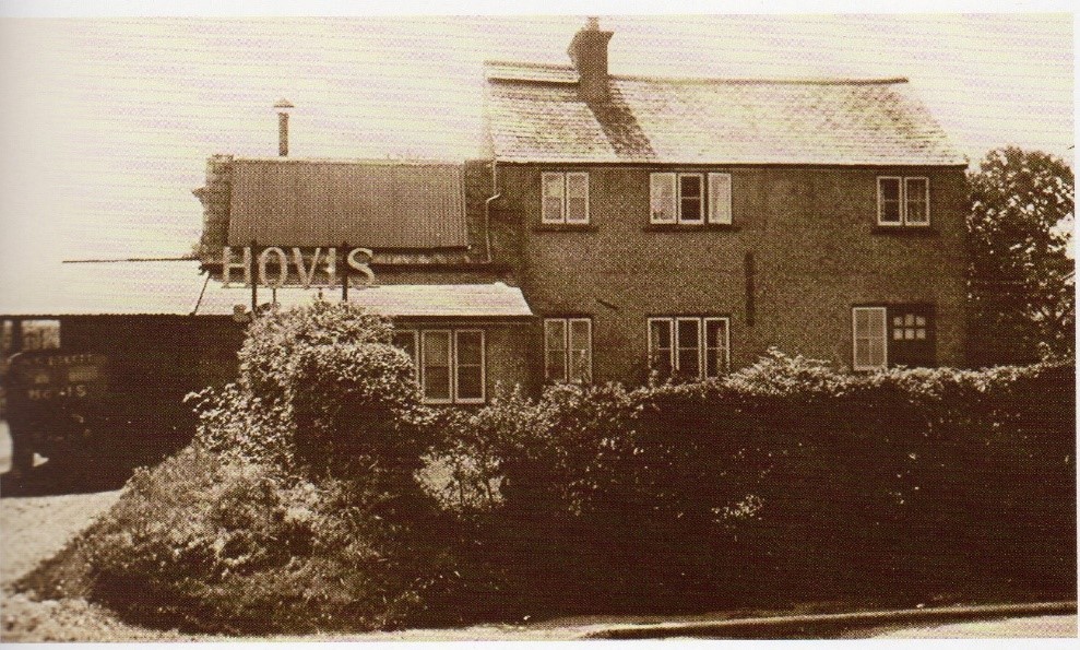
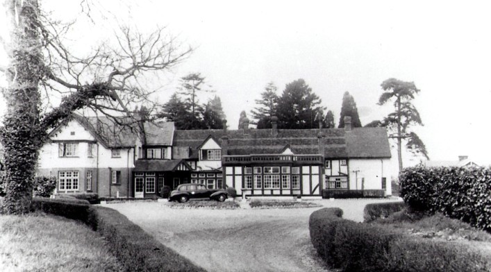
Walk until you reach the driveway for the Aubrey Park Hotel and walk up the driveway towards the hotel.
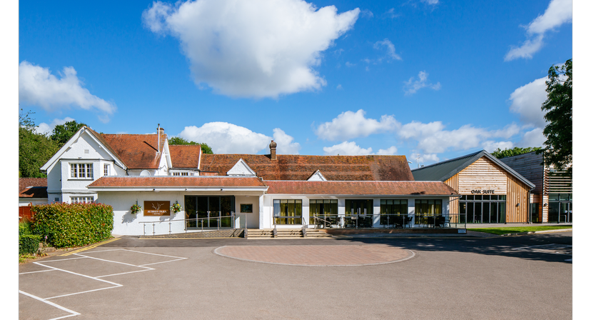
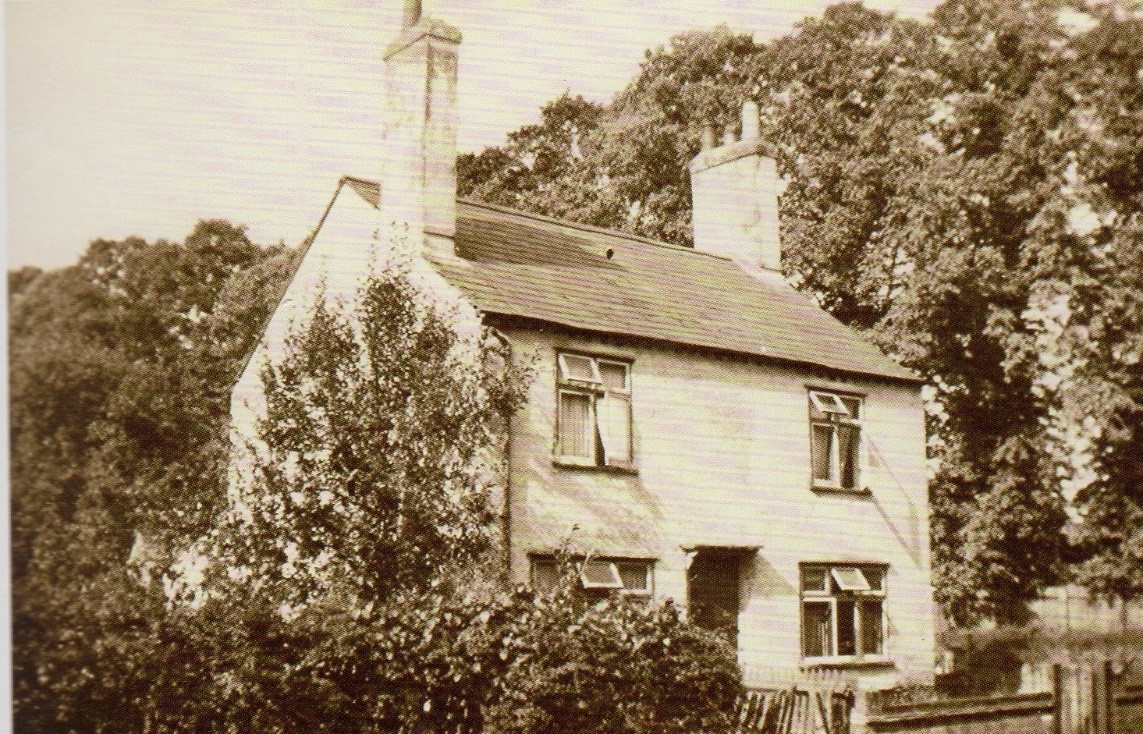
This used to be Foster’s Farm. In the picture below you can see the old farm building to the right of the parked car
As you approach the hotel, you will see a footpath to the right. This leads to Aubreys Fort
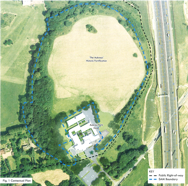
Foot path is the dotted line
You should be able to walk around the fort and run up and down the ditches. You might even be able to find the entrances if they are not too overgrown.
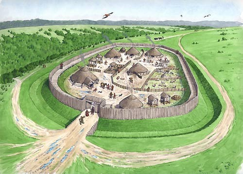
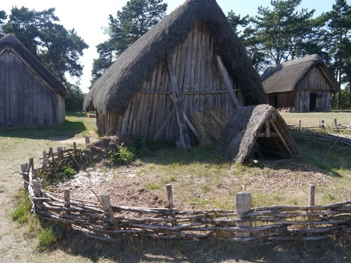
This where the original people of Redbourn lived in the Iron Age, around 4,000 B.C.E. That is over 6,000 years ago.
Have you had fun? Now make your way back past the hotel to the main road and turn right back under the motorway. Turn left into the road that leads to the church. As you do so, look for the footpath on the right. Walk up it to meet the Nicky Line where you turn left.Walk about 500 metres and turn left down a path that takes you back between the houses to the Common.
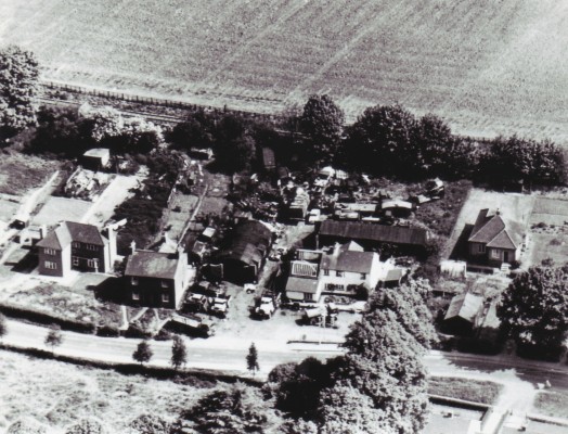
Take a look at this photo taken from the air in 1948 showing where you have been walking.
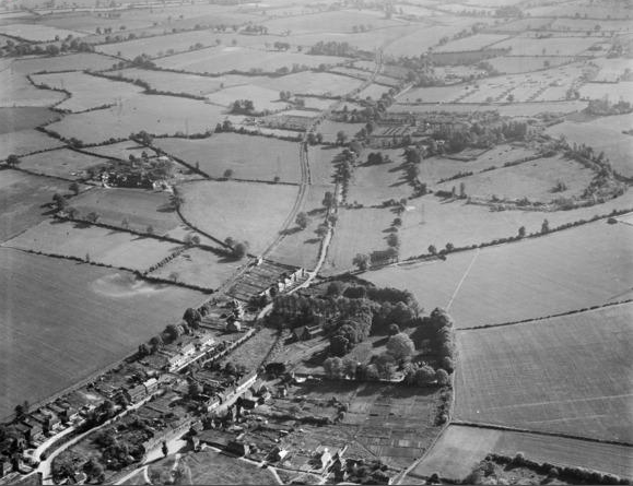
- Can you see the village in the bottom left of the photo?
- What do you think that oval of trees marks out top right?
- Can you see something running close to the road all the way up the photo? What do you think it is?
- What can’t you see in the photo that exists today and was opened in 1959?
You have now finished the walk. Why not try another?