Heritage Walk No.5 For Kids
This is a shortened version of the full history Heritage Walk No.5. The walk features the many inns that existed in Redbourn.
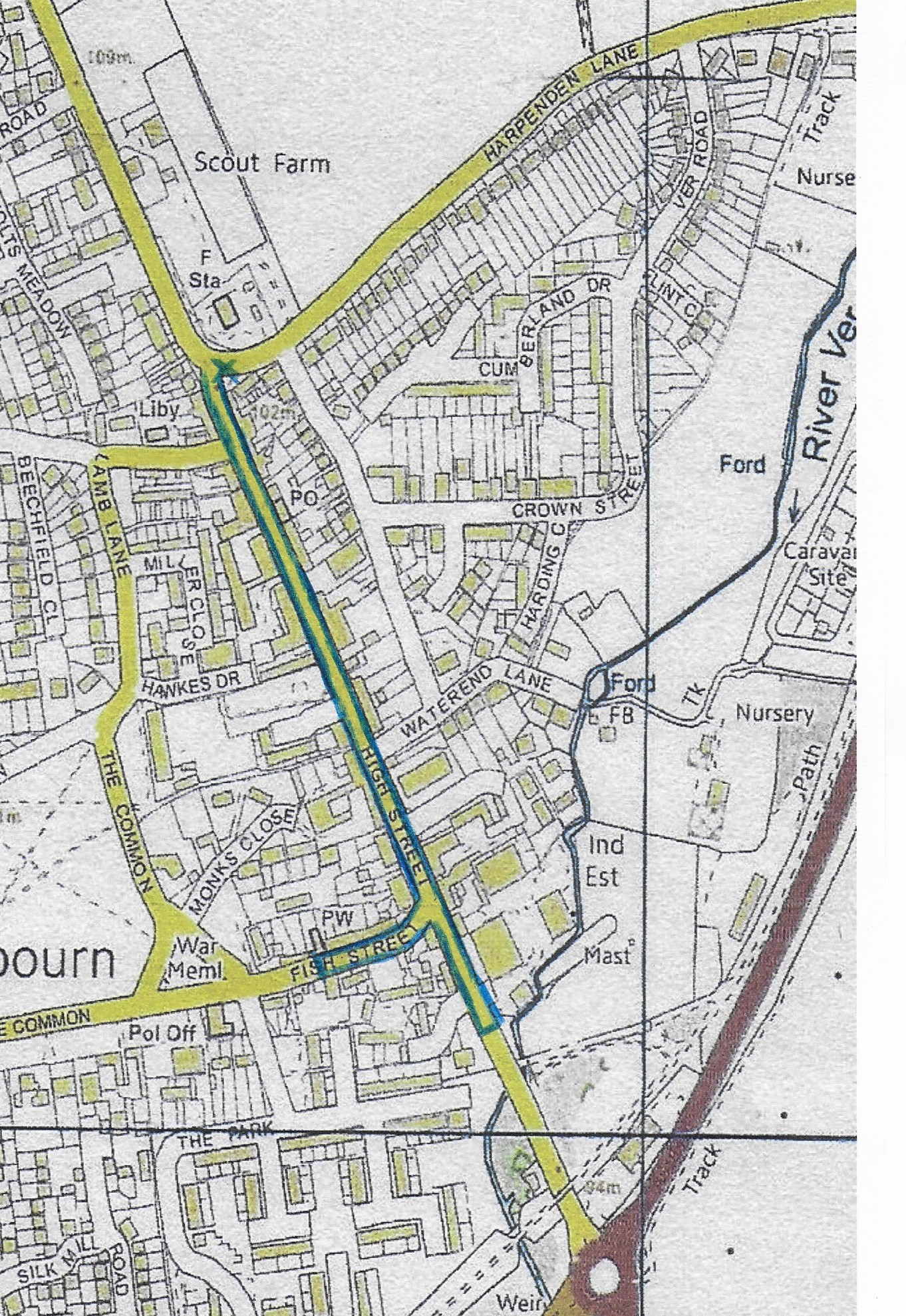
Start on the corner of Harpenden Lane and the High Street.
Stand at the side of the road and look up and down the High Street/Dunstable Road.
- What do you notice about the road?
- Do you know why the road is like it is? (Roman Road – Watling Street)
The older village centre is Church End (the end of the Common near to the M1 motorway). Most of the buildings you will learn about on this walk are there for 2 reasons.
- Watling Street for most of history, was the main route out of London.
- St Albans Abbey, with its shrine of St Alban was about 4 miles (7 kms) south of Redbourn along this main route.
Inns
The map below shows you all the inns that have existed along the High Street. How many are there?
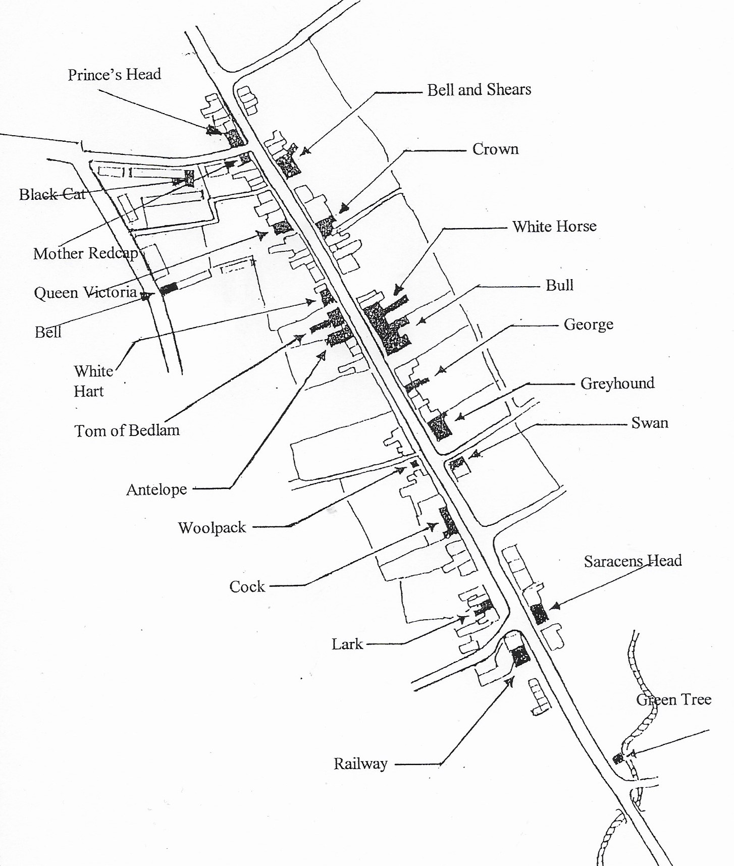
They did not all exist at the same time. Some have disappeared and others are still there but used for different things.
- Look at the names. Which ones do you like?
- Are there any strange/unusual names?
- Only one shown on the map is still a pub. Do you know which one it is? You will find out later.
- Do you know why were there so many?
(1. Pilgrims going to St Alban’s shrine. 2. Coaches on the north/south route)
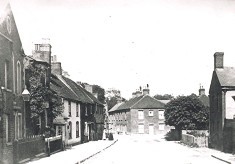
We are going to walk down the High Street. 100 years ago, you would have seen this. Can you see the children on the right? And the dog in the road!!
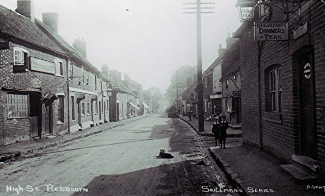
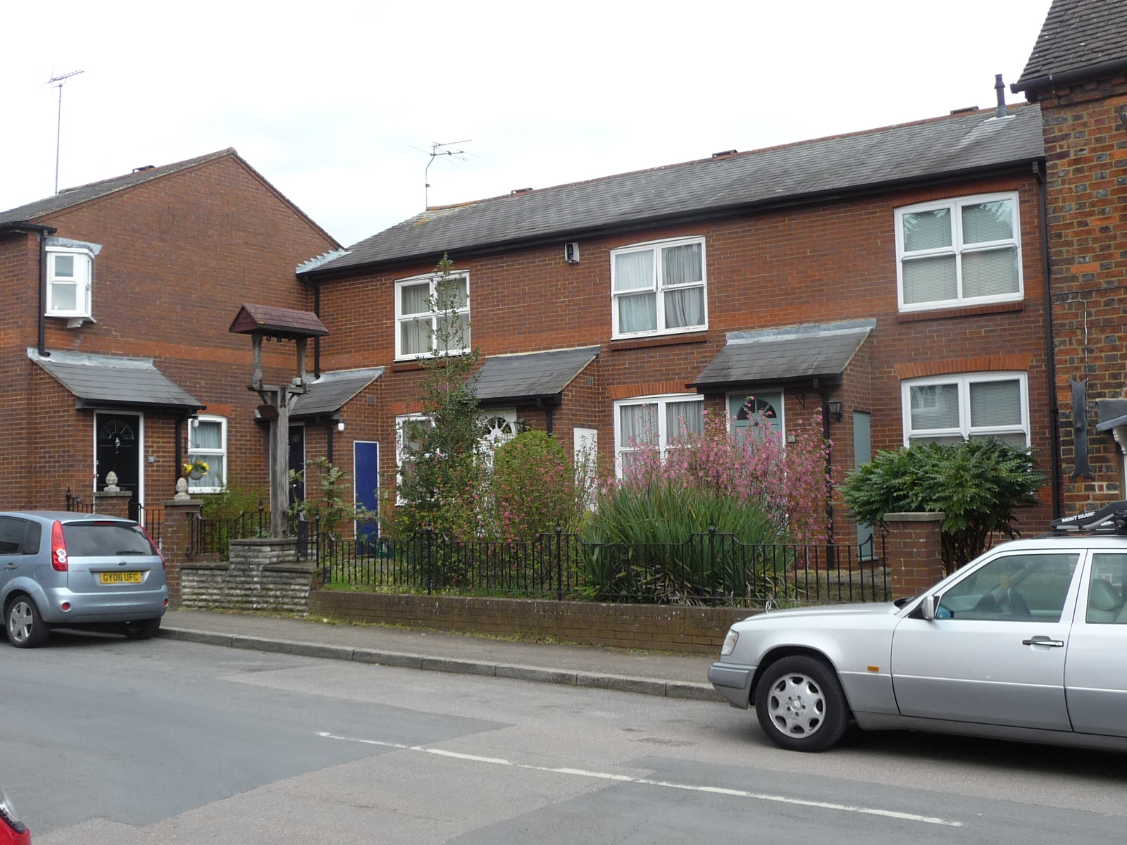
Continue walking and look to your left. We will look at the old inns but will also look at other buildings with a story to tell. Can you see these houses?
In the photo the clock has been removed for maintenance but can you spot it today? Look to the bottom left of the next photo and you will see a clue as to what was once on this site.
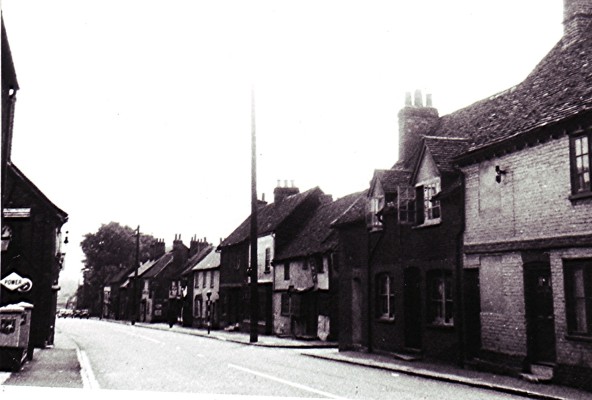
Before that, it was a blacksmiths. Further down the road you will see our first inn.
Using the map above, can you work out which one this is?
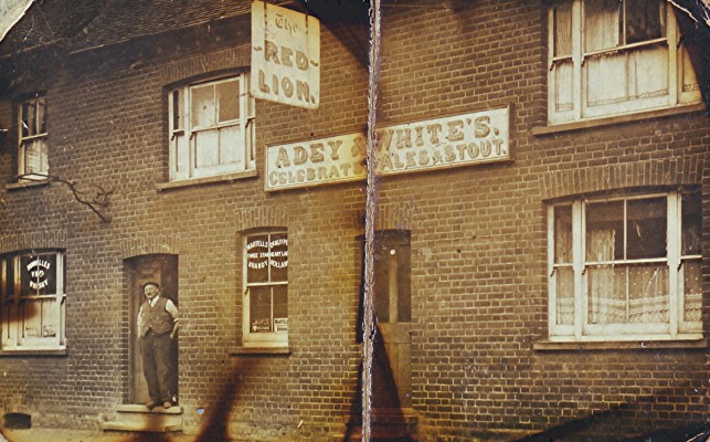
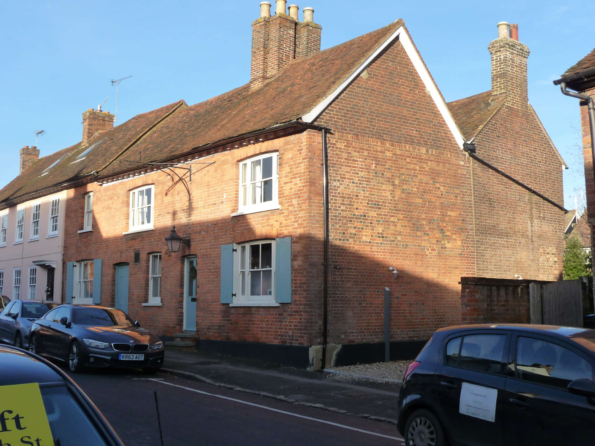
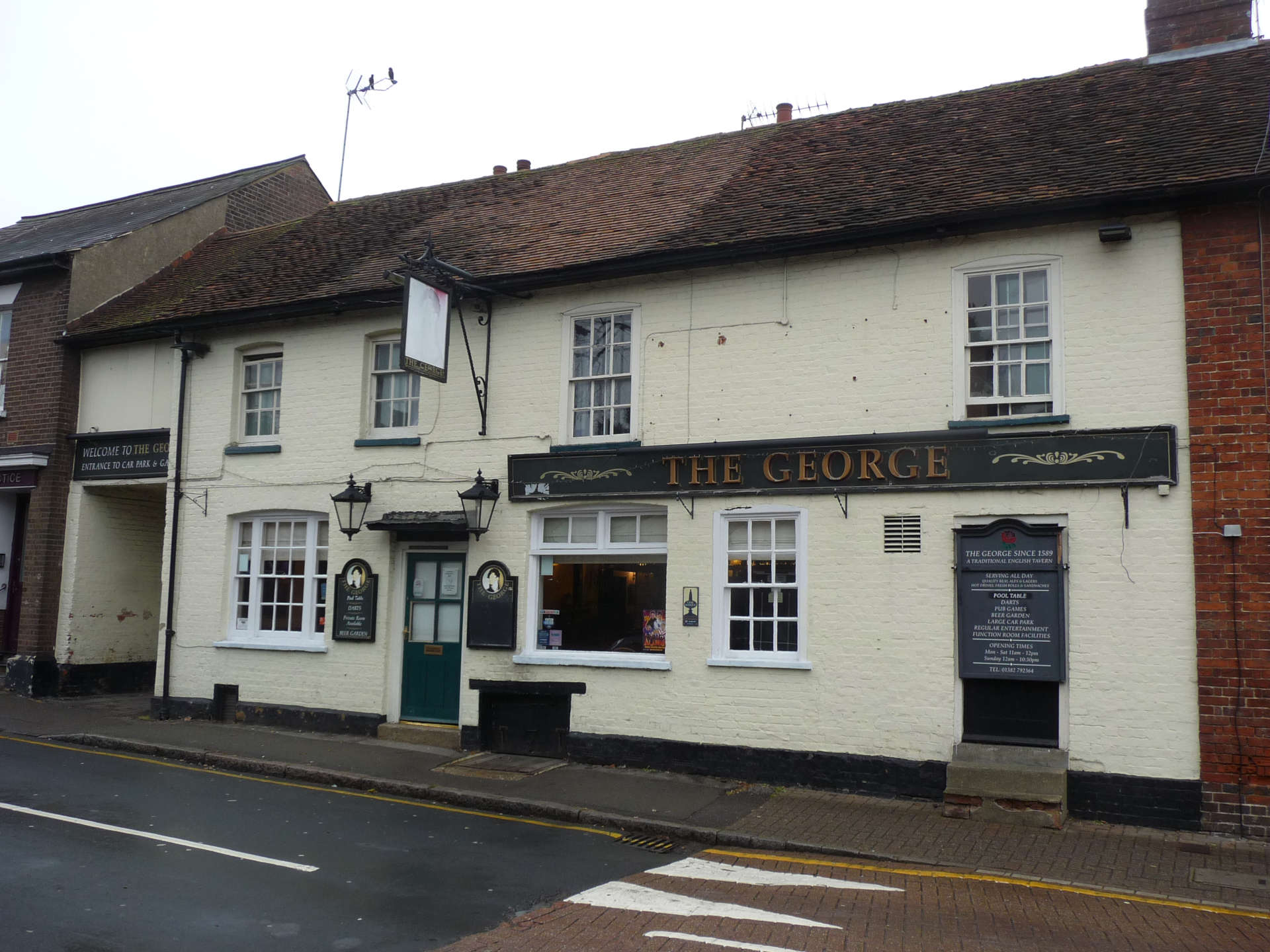
The “Bell and Shears”, once “The Red Lion” is over 450 years old. Continue walking down the High Street until you see the Old Post Office.
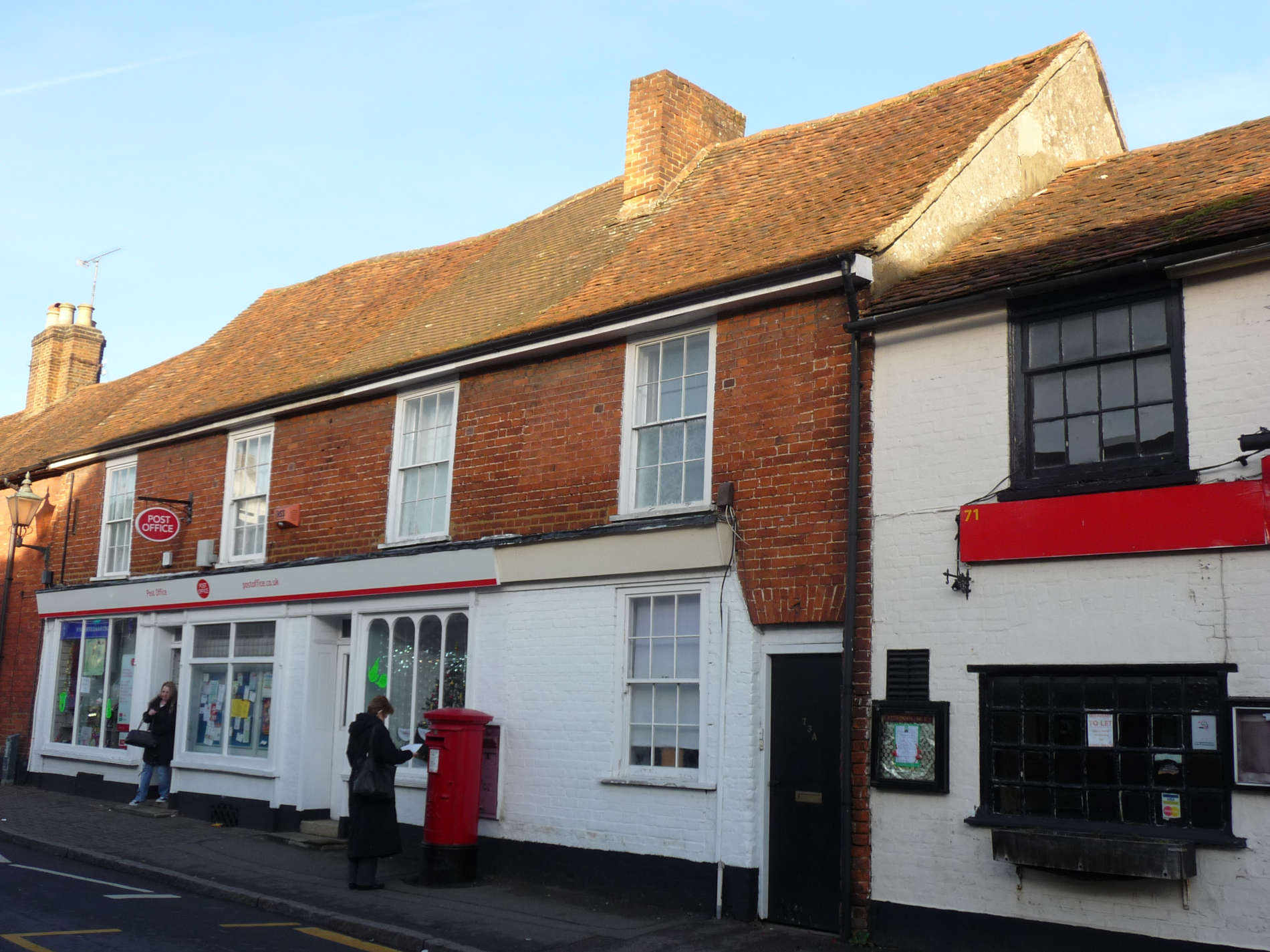
Look at photo no.2.
- The Post Office shared the building with a shop. What was it called? What did it sell?
- What is missing outside the Post Office that can be seen in photo no.1?
- Can you see the sign that says Post Office?
This building is over 400 years old. If you go round the back you will see two unusual window surrounds that give a clue as to the age of the buiding.
Our next building is the 2nd inn.
Look at the map again.
- Which pub was this?
- What do we know it as now?
- Why does it have a large archway to the side? (For coaches and horses)
Looking at photo no.4, do you notice anything about the windows? How many are there and how many there might have been?
If you had walked through the archway 200 years ago, what buildings do you think you would have found behind the inn? (Stables, barns, workrooms)
This building is over 400 years old. Look at the beams in the archway. It closed as a pub in 1910. It became a home, and then a tea-room (The Copper Kettle) until 1967, then The Country House restaurant until 1991. After that it was an Italian restaurant. Perhaps someone you know will remember these changes.
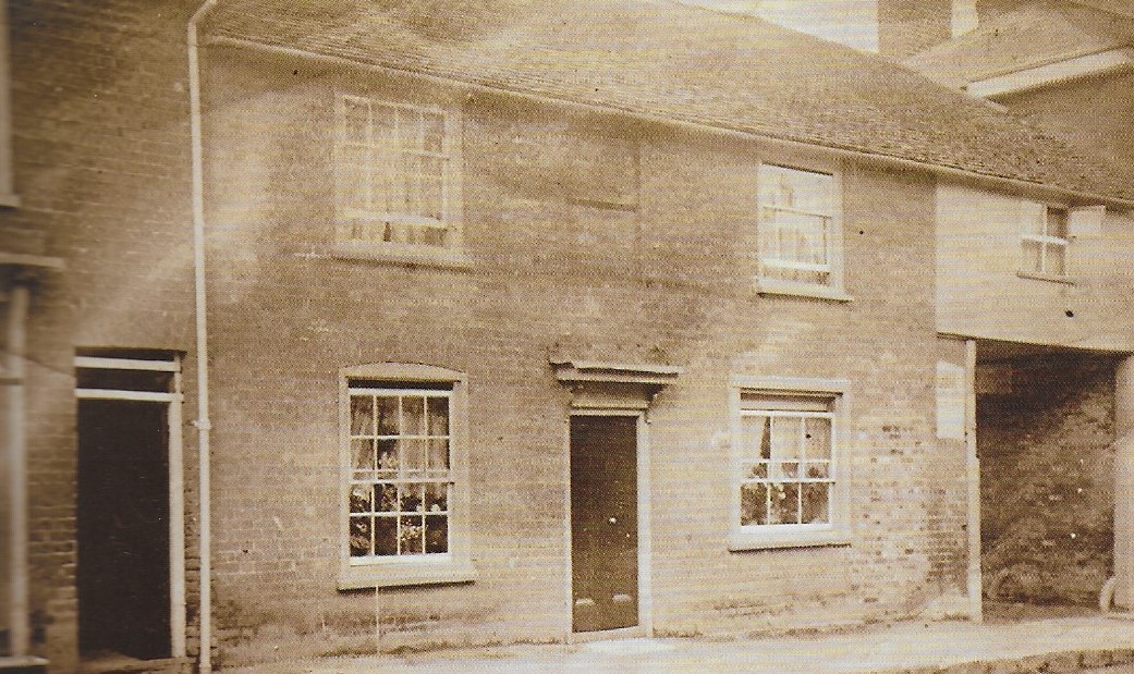
Carry on walking until you see this building.
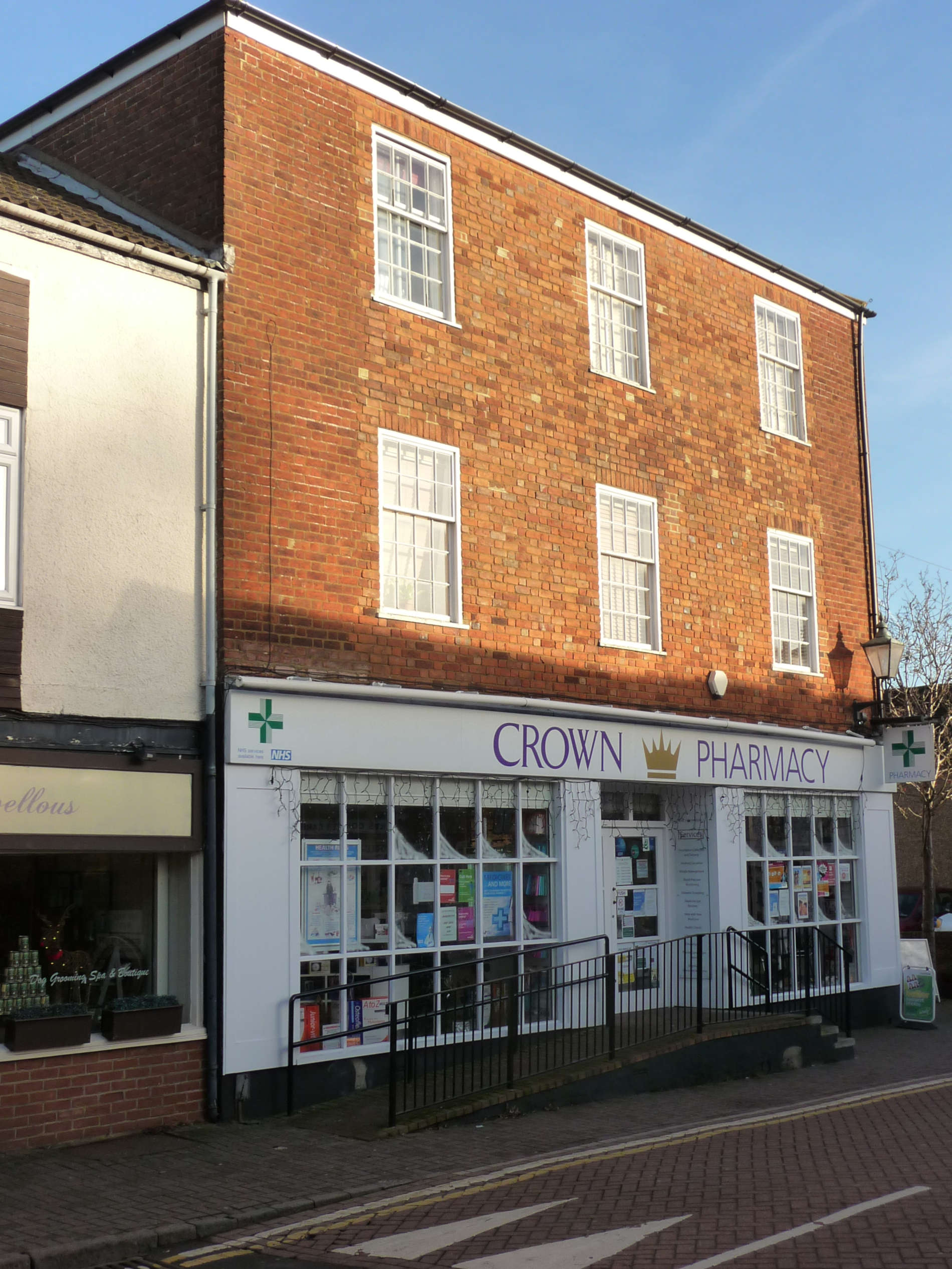
It is a pharmacy now but look at photo no.2 to see what it used to be.
This house might have had bedrooms rented to the Bull inn for coaching passengers.
You are now at the car park in front of the Village Hall.
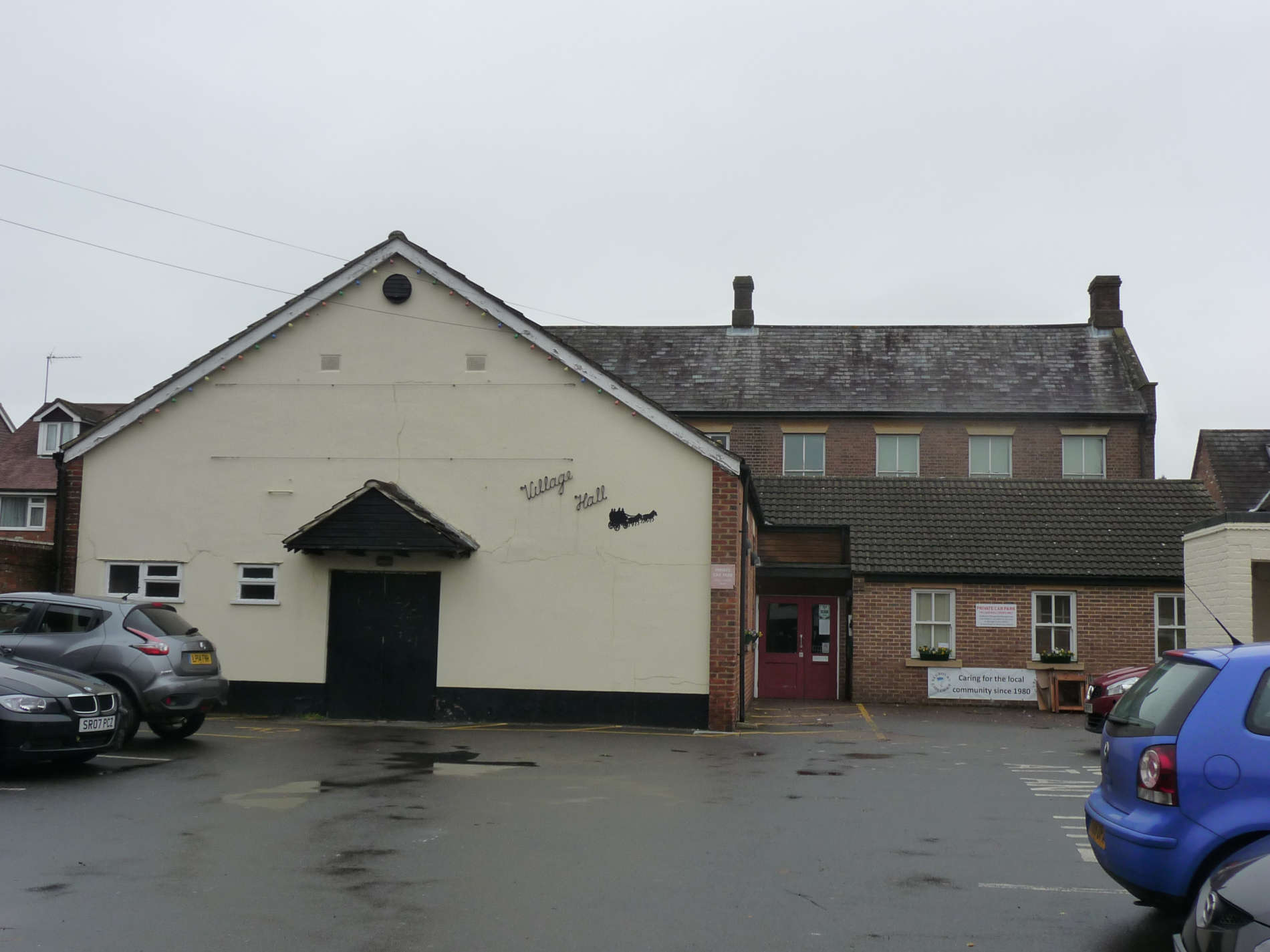
Have you been inside this building? There is a car park in front of it but look at photo no.2 below. Where is the Village Hall?
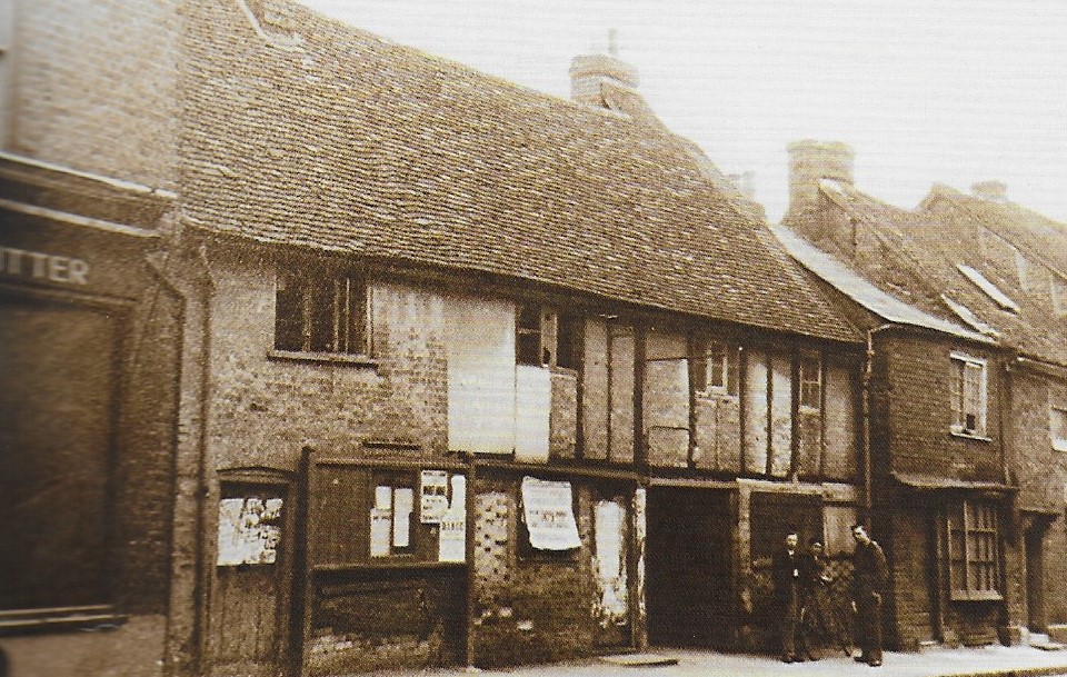
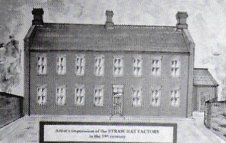
Answer: Behind these cottages that were amongst the oldest in the village – possibly 500 years old when they were knocked down in 1948. Look carefully at photo no.2. What can you see in the middle where the men are standing? The opening led to the Village Hall but then it was a hat factory and looked like this (photo no.3) Hat? Straw hats – made with lengths of straw plaits, many made in the villagers’ houses.
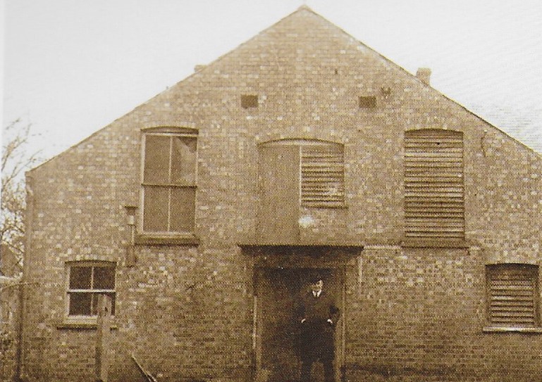
A new extension (see photo no.4) was added to the original building and used as a warehouse and store.
Take a closer look at the Village Hall today. You should be able to see where the old building (built in 1861) is now.
After the factory closed, the village bought the site and the hall was used as a cinema for silent films with a piano and later it had a projection room. It stopped showing films in 1958. By this time most people had bought a what?
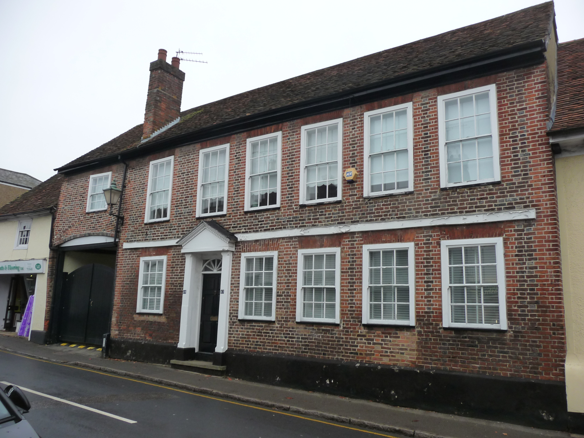
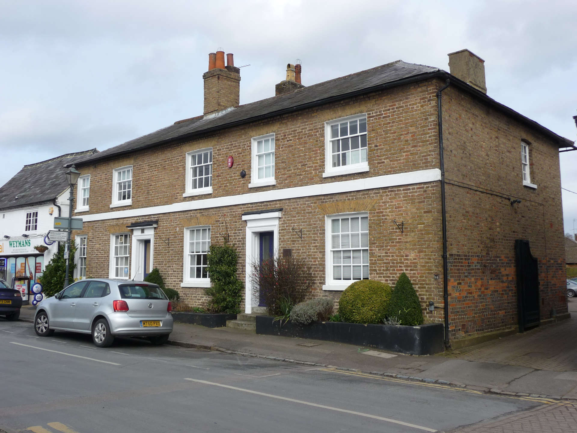
This is the third inn. Look at the map again.
- What was it called?
- What feature suggests that it was once a coaching inn?
The house is over 400 years old. Like the previous inns it had a big yard and stables at the back. By the 1870’s people started using the railways and gradually coaches stopped running. This building closed as an inn in 1881.
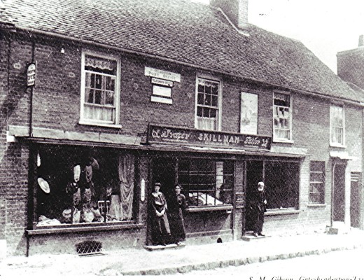
Look next door and you will see our 4th inn which is now closed and will become a new Coop mini-supermarket.
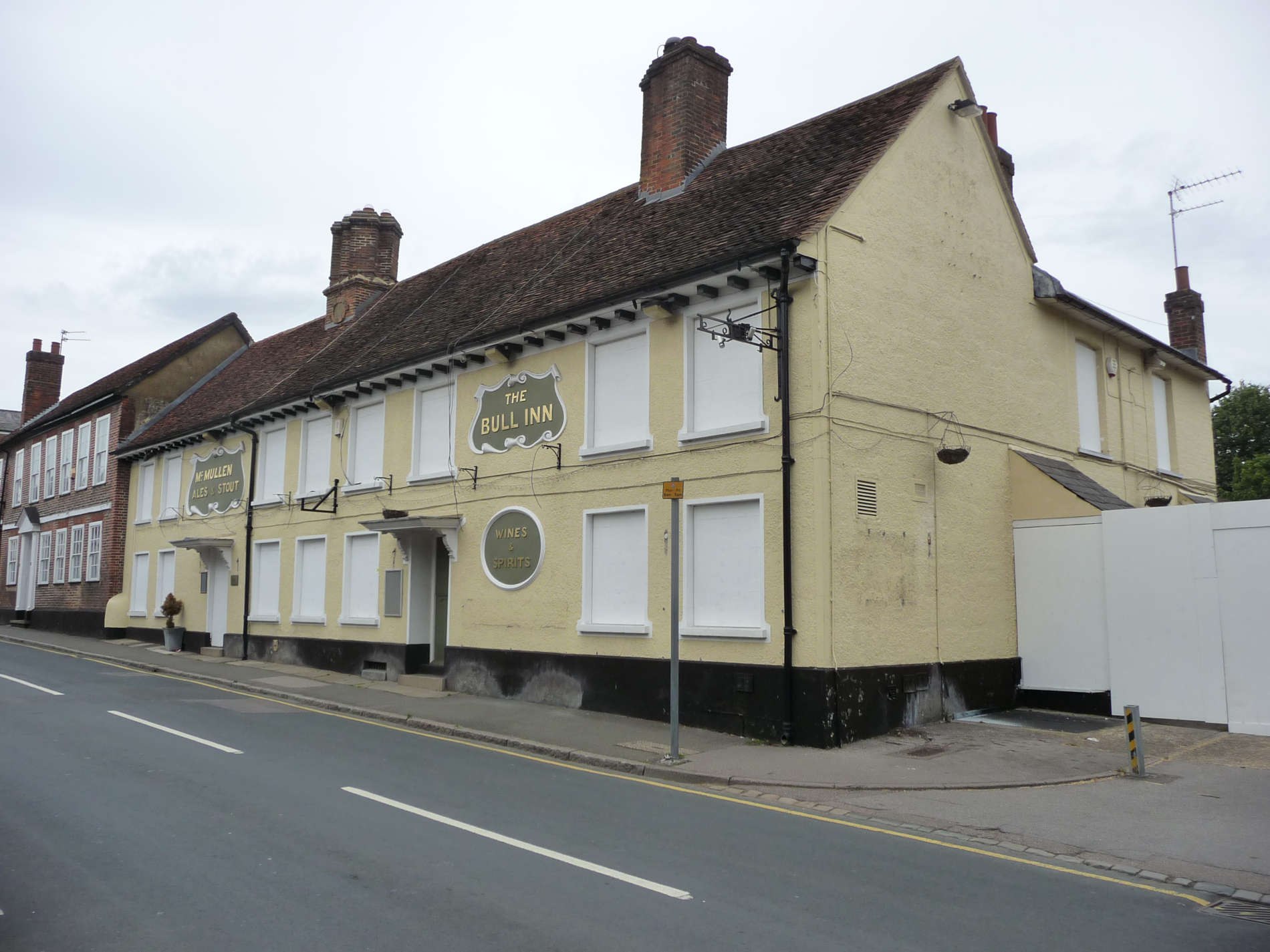
- What was its name? Look back at the map,
- Look at photo no.2. Can you see the old sign? What is written underneath?
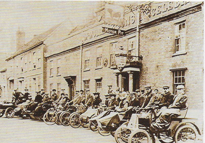
This photo celebrates the opening of the pub under a new brewery and they held a motor rally. (rather like the Classics on the Common!)
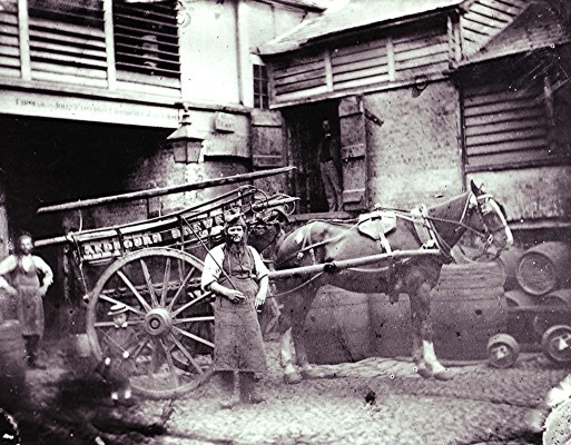
Photo no.3 shows the back yard of the Bull and gives you an idea of what it was like. The building is over 500 years old. The Bull was the main stopping off point for coaches passing through Redbourn – a posting house. It had 13 bedrooms, a large dining room, bars, cellars and stabling for 50 horses.
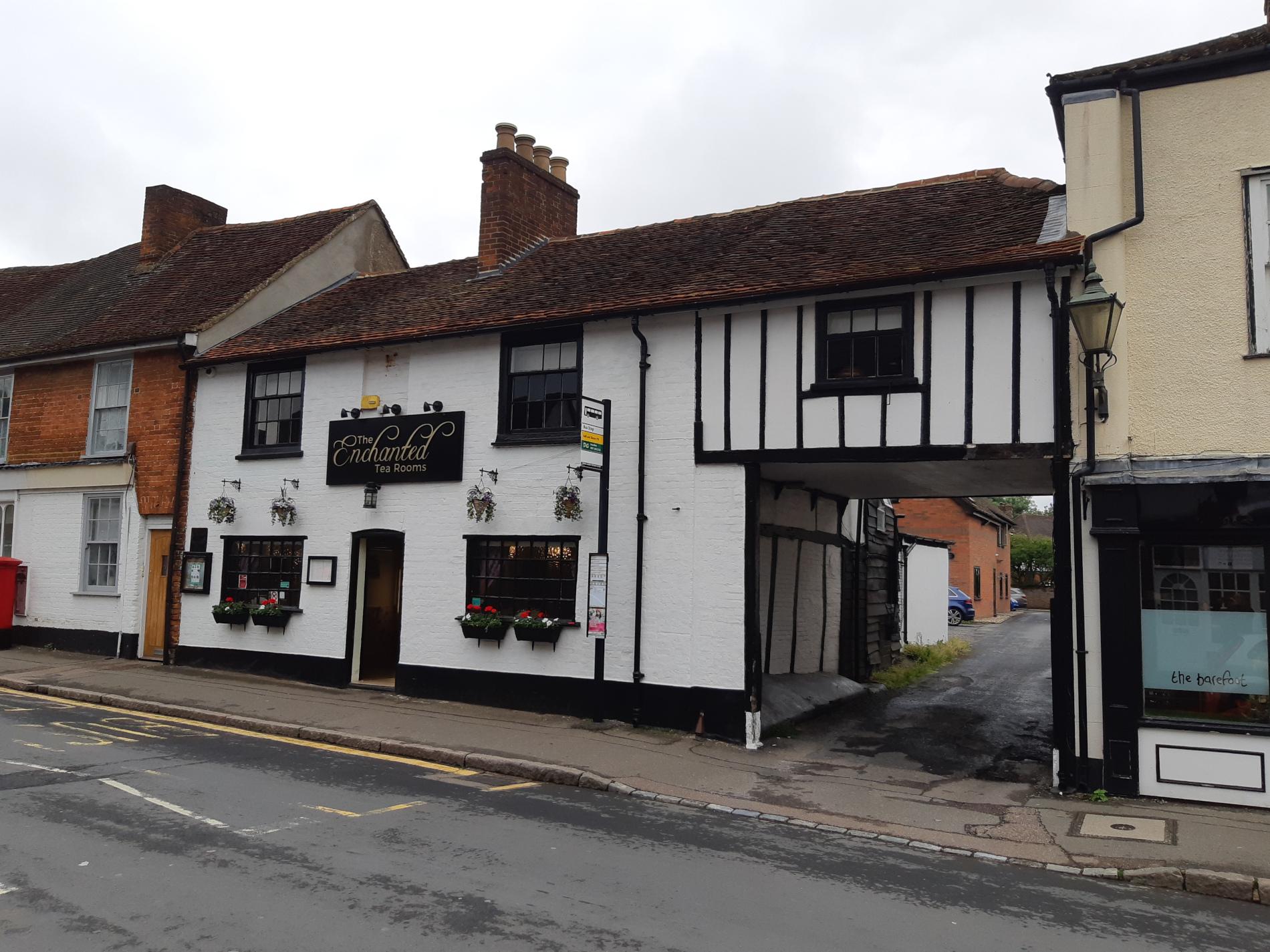
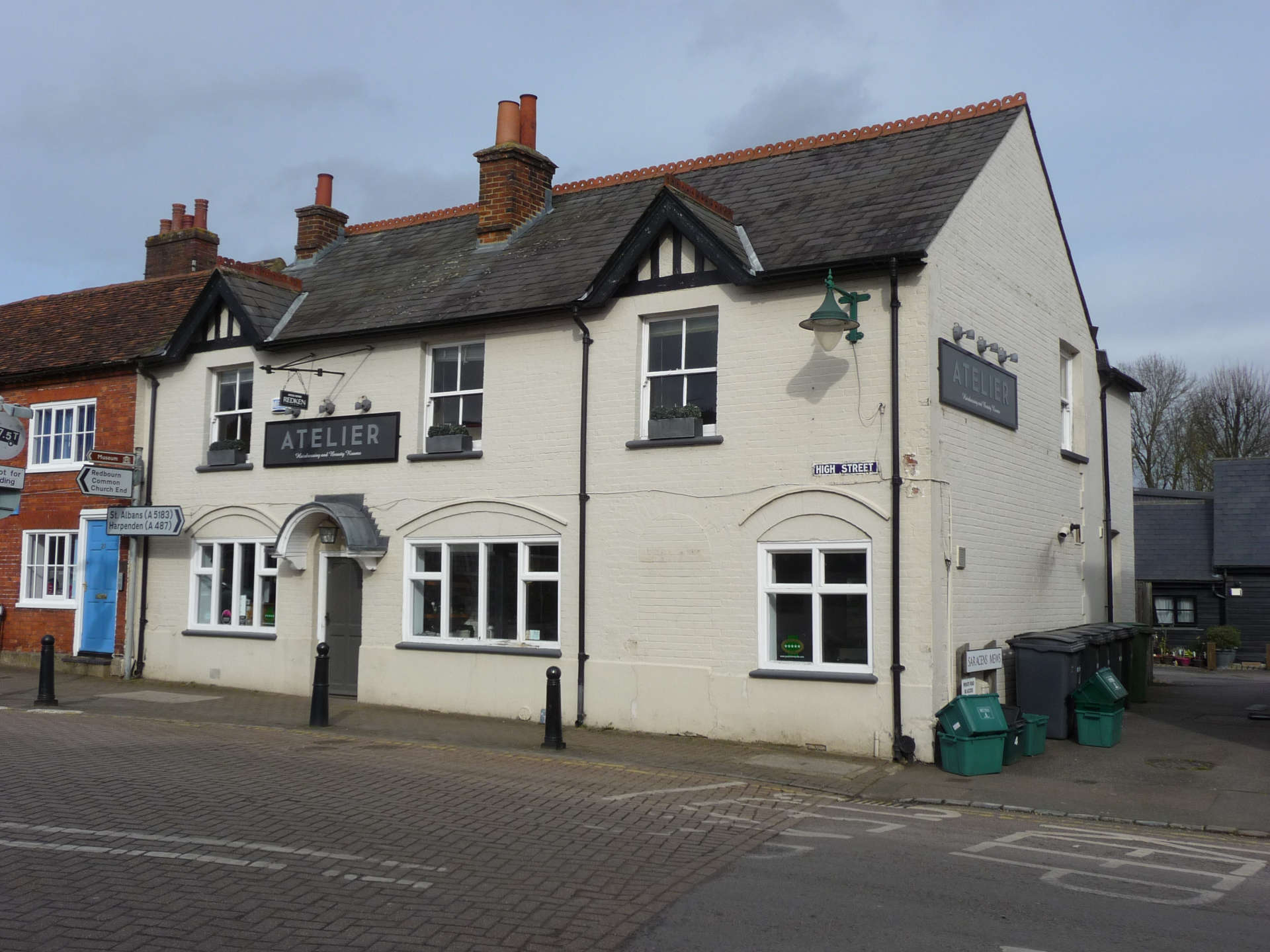
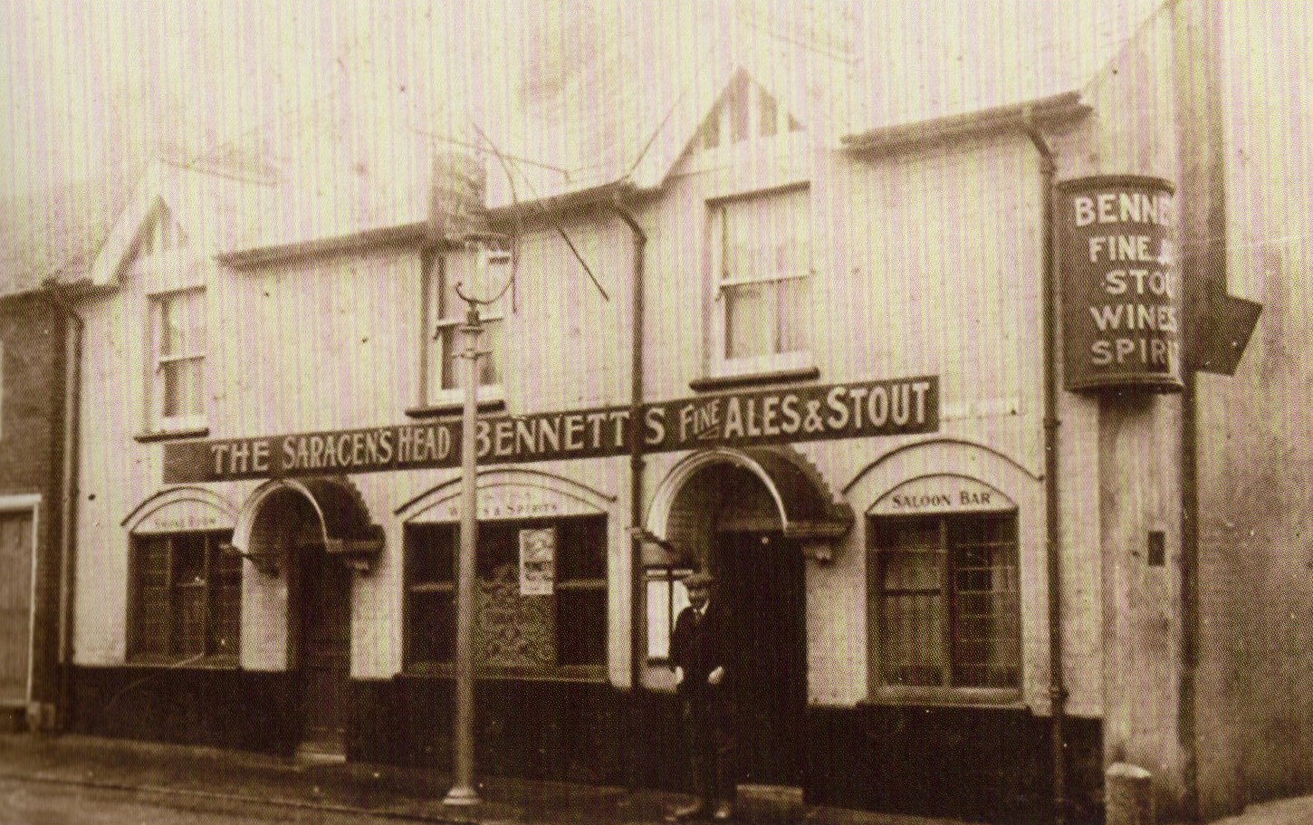
Carry on walking until you spot this inn. Our 5th one and easy to spot because it is still a pub. It is Nos. 35 and 37 High Street.
- What’s the name?
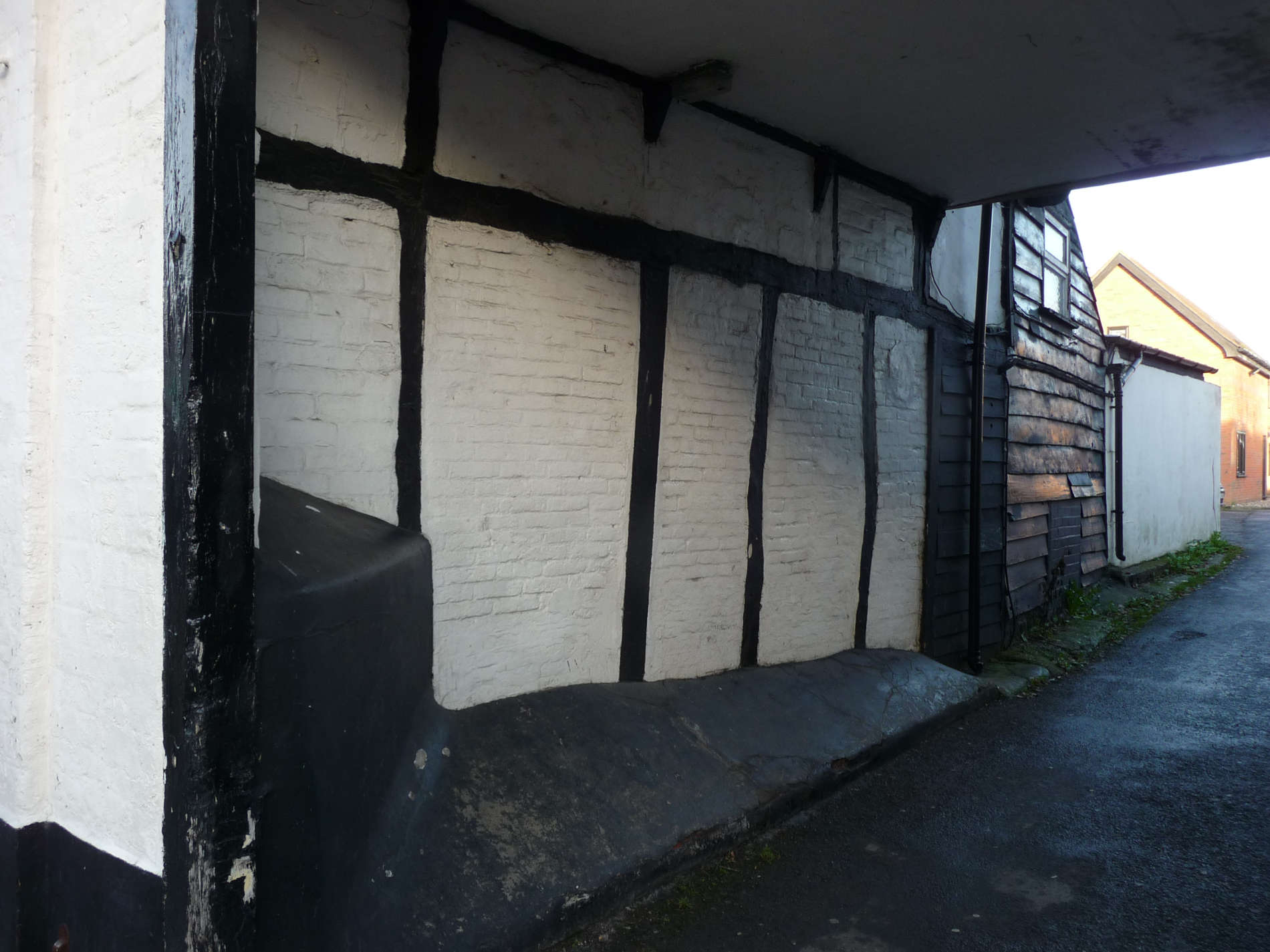
- Can you spot the archway?
- This building was once two separate houses. Can you see the join?
It has been one building for over 200 years
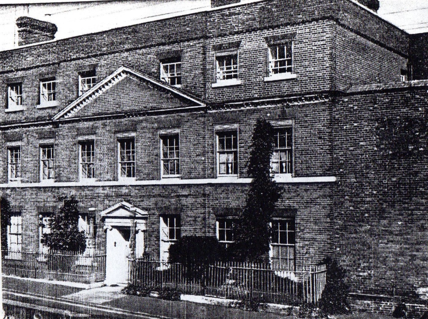
Walk a little further and you will see the The Red House
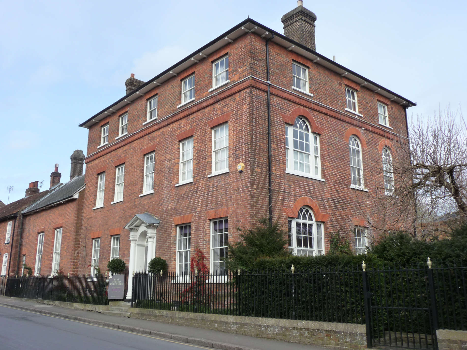
This is one of the grandest houses in the High Street. Very rich people had it built. Count the windows. How many are there? But it is shown on the map below as an inn – our 6th. what was its name?
The Greyhound inn was knocked down when the grand house was built 200 years ago. To the right of the house you can see what was once a stable block with a carriage entrance. The extension on the left was once a picture gallery.
Look at this building on the corner of Waterend Lane
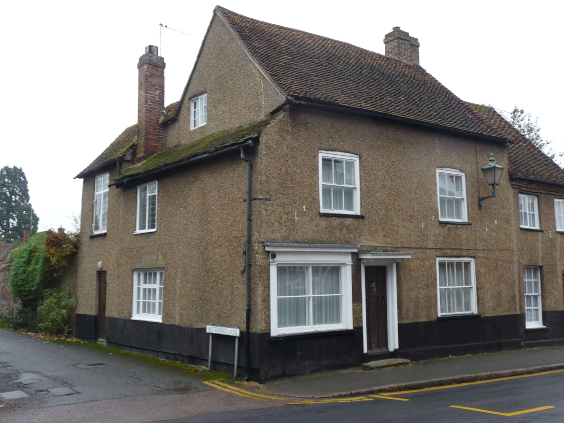
This building is amongst the oldest in the village – over 500 years old. It is the 7th inn shown on the map. What was its name? Look at the map.
It has been a house for 250 years.
The next building we will investigate is no longer on the High Street.
Looking at this building today, it is amazing that it occupies the site of the building in photo no.2.
Such a big house used to stand here and its garden stretched all the way down to the River Ver. The grand house was built around 1700 by the Carpenter family on the site of an earlier house and barn.
Here’s a very special piece of information. George Carpenter was the great great great grandfather of our present Queen Elizabeth II. (for the whole story, go to the main Heritage site on redbournvillage.org.uk).
During World War II (1939-1945) there were families from Plymouth living in the house. They had been bombed out of the homes (ask an older person for an explanation of this). The building was very run down in the 1960’s and was demolished. One part still survives. Next time you are passing the museum on the Common, look in the garden.
If you have done Heritage Walk No.3, you will know about the Samson Family and watercress. They lived here at Ver House.
Continue the walk and look out for this building.
This is our 8th inn. What was its name? Try looking at the road name plate next to the building for a clue. See if you are right by looking at the map below.
It was probably named for The Crusades (Google them!) It is the oldest recorded inn in the village – 1530 – nearly 500 years old!
Can you smell anything as you stand outside the building? About 200 years ago you would have smelled awful smells coming from a tannery behind the inn. The inn closed in 2002.
Now walk to the the Industrial Estate
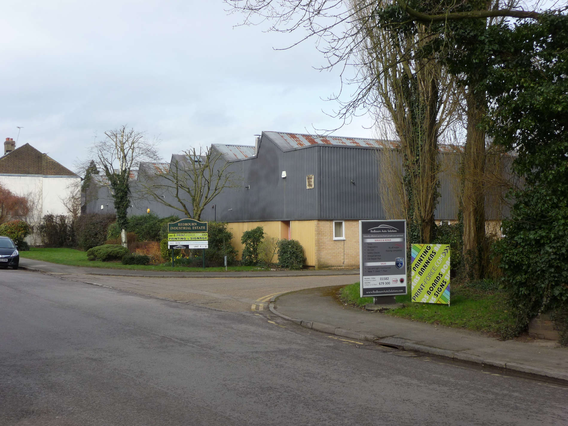
- Do the buildings look new or old?
- If you think the buildings are new, have you thought what might have been there before?
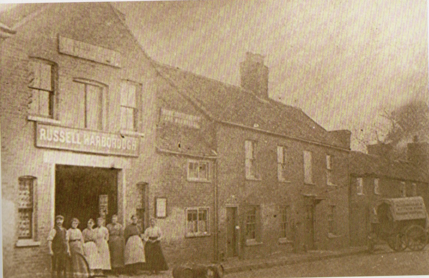
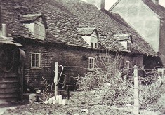
The photo above shows what once stood here.
A man named Russell Harborough ran a jam factory in the 1800’s. Jam and sweets were made in the factory using fruit grown in the fields around Redbourn.
- Can you see the workers in photo no.2 standing outside the factory?
- Can you think of any fruits that would have made tasty jam?
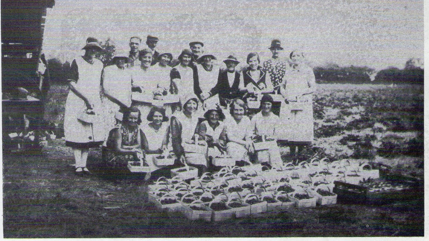
These workers are in the fields around Redbourn. What have they been doing?
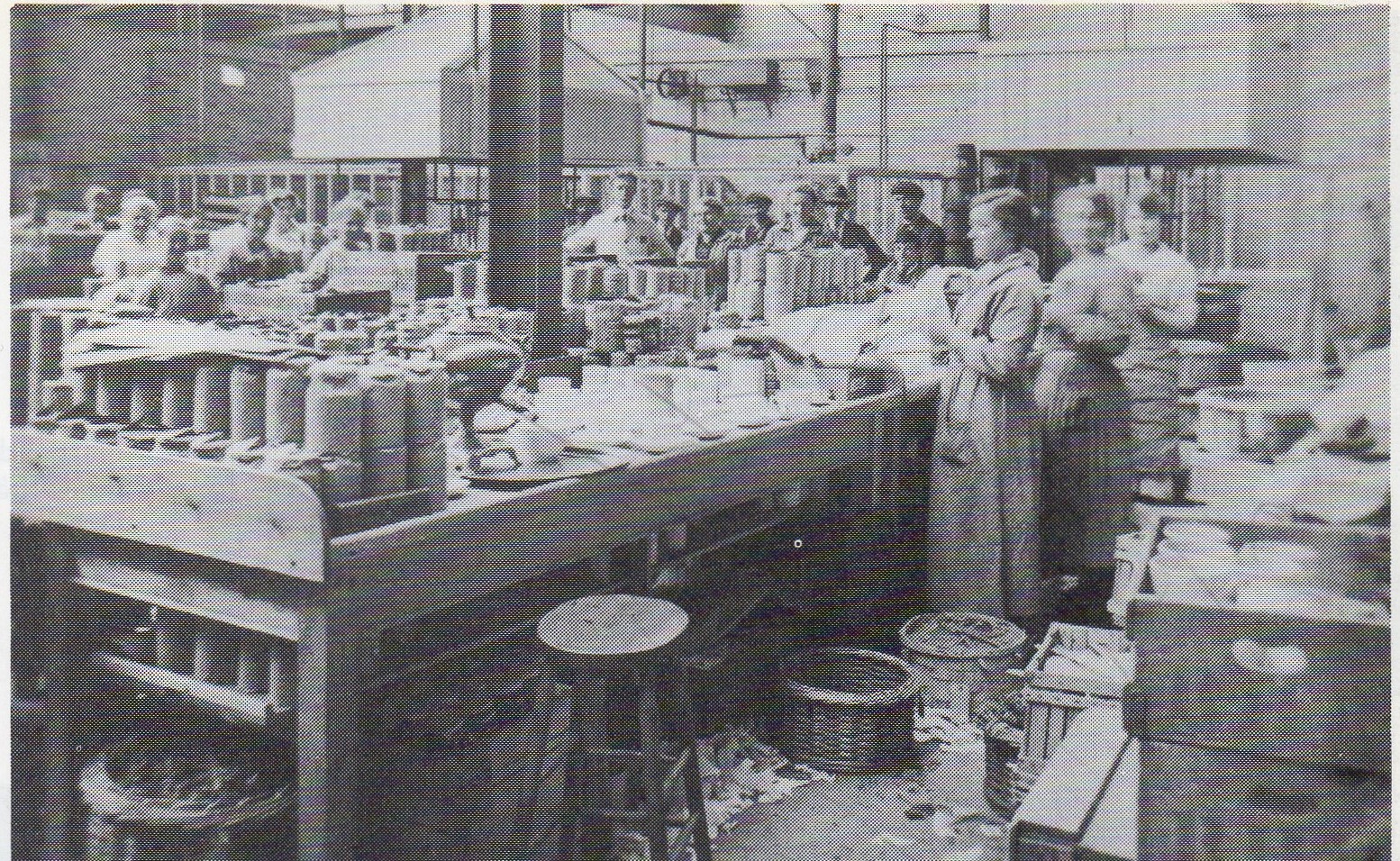
What do you think the workers in photo no.4 are doing?
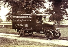
What do you think this van is doing?
Now find where the High Street crosses the river. Here amongst the trees was inn no.9. What was is called? Look on the map again.
It was last in a row of cottages near the jam factory. It was on a little lane (Farey Lane) that ran up the the railway. The cottage was pulled down in 1910.
So on this side of the High Street, there were NINE inns!
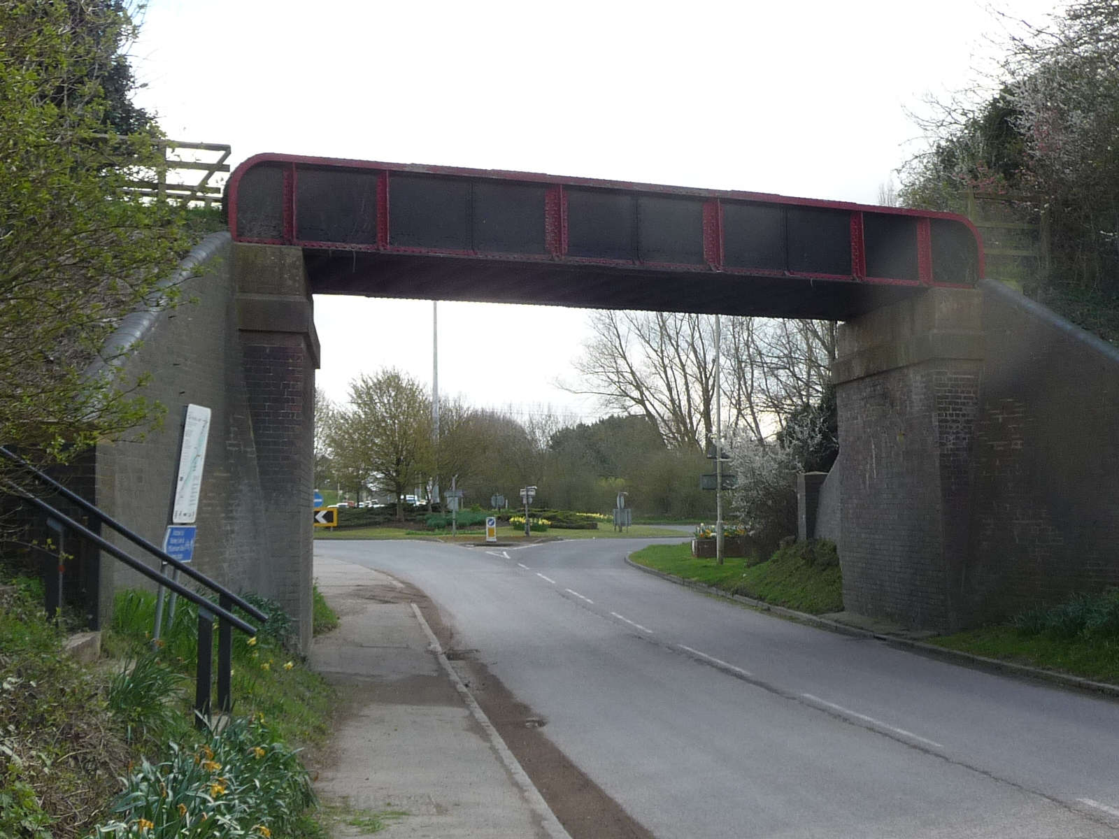
Look ahead of you at the old railway bridge. It is the only railway structure in Redbourn remaining.
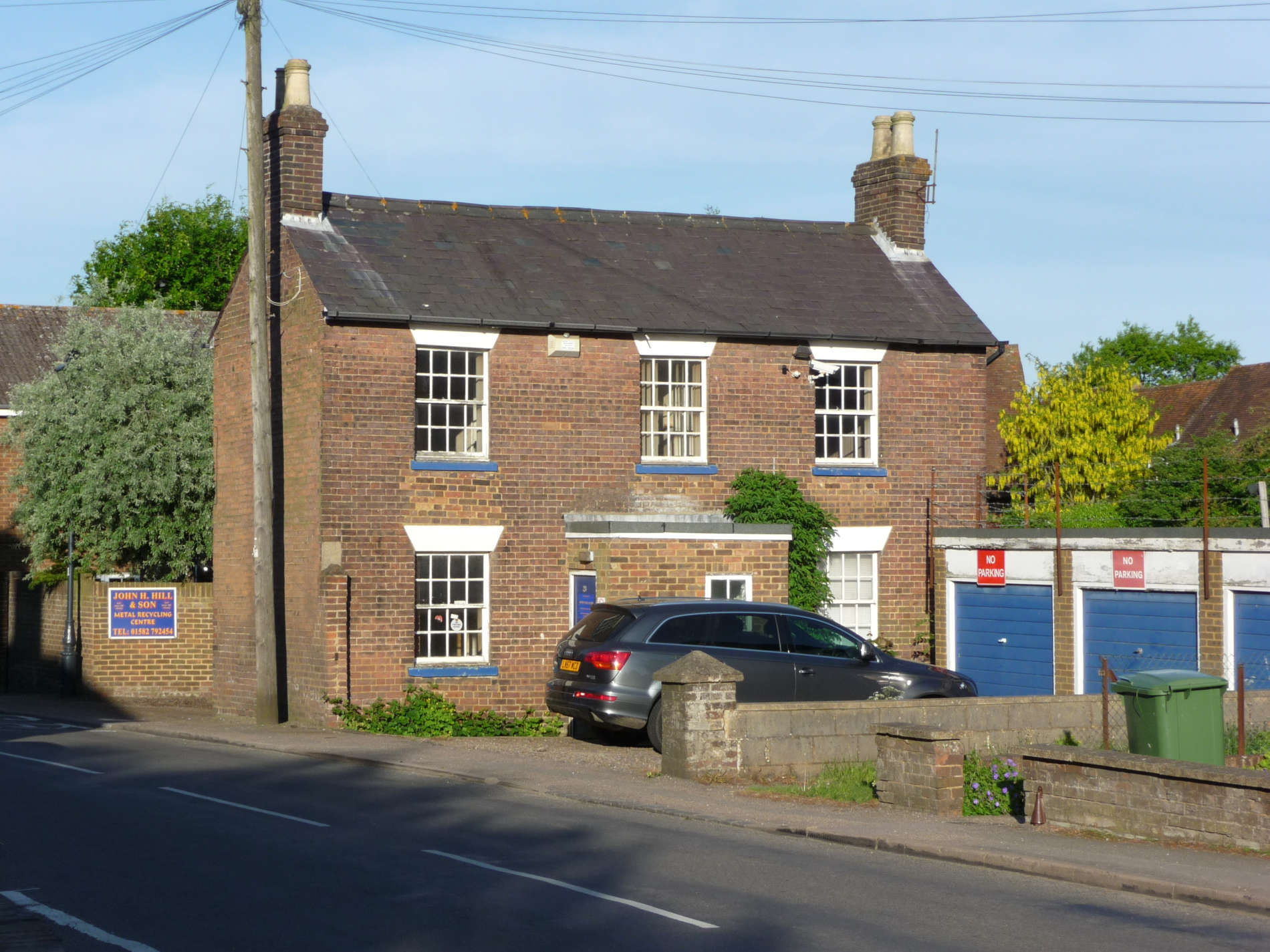
Now cross the road and start to walk back the way you came. To your left you will see Fish Street Farm.
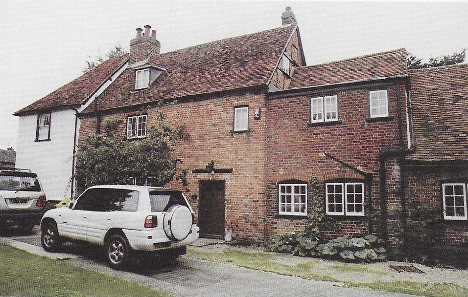
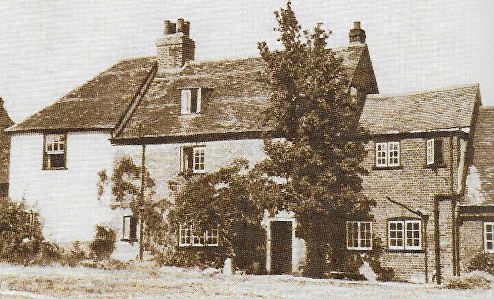
Looking into Fish Street Farm 100 years ago, you would have seen a farmyard with barns and a milking parlour. Imagine the chickens, cows and the smell of the farmyard.
At the same spot 800 years ago, you might have been looking at church-like buildings – chapel, cloister, dormitory etc. This was Redbourn Priory, site of St James’ Chapel dedicated to St Amphibalus, the Roman who Alban tried to save. (for the full story visit the Redbourn Village website. select “Heritage” and then “The Park”)
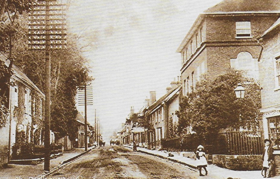
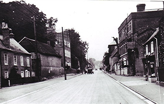
Take a look up the High Street
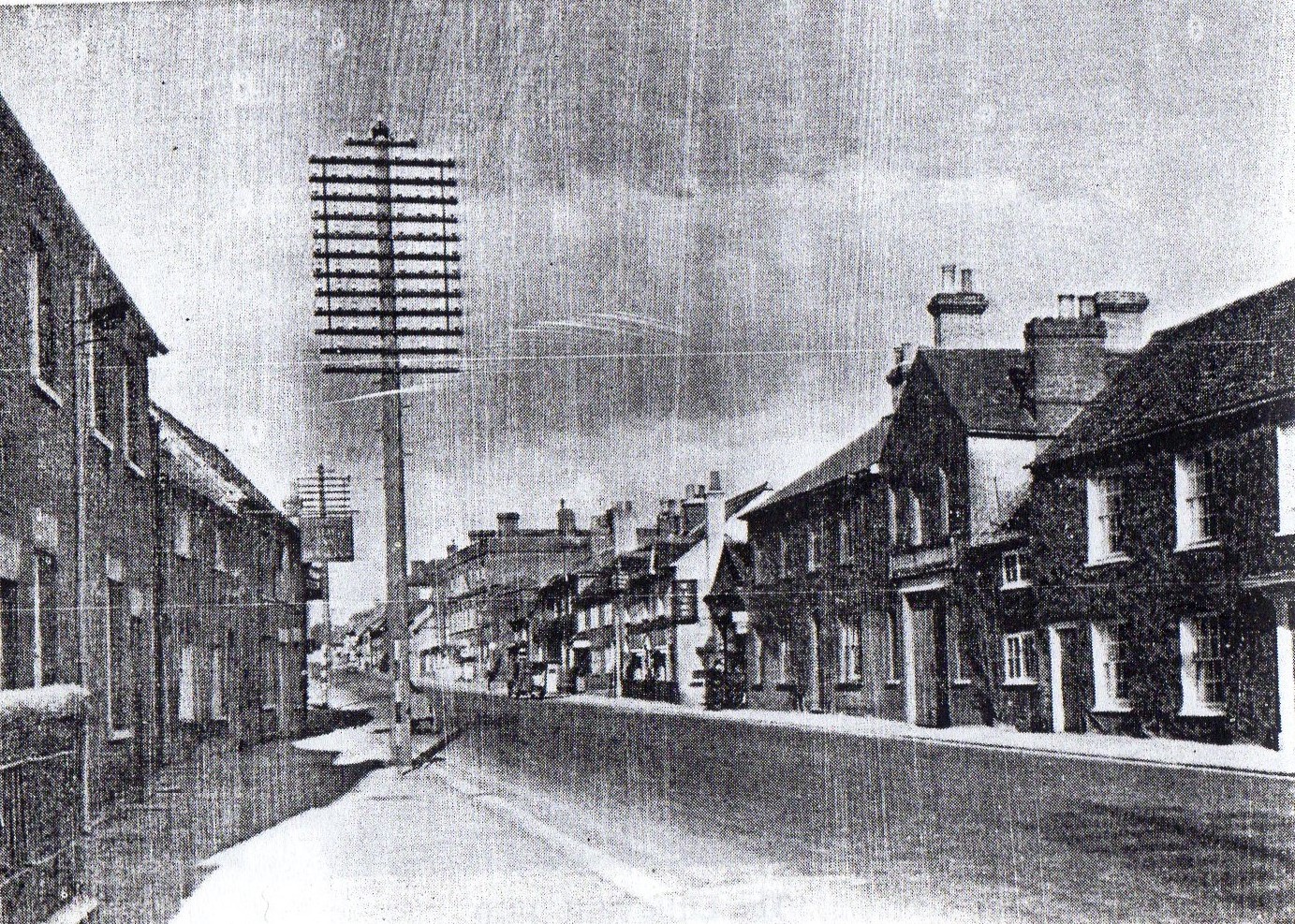
In 1900, it would have looked like this. What is the tall thing beside the road? Why don’t we see them today?
Find this building on the left. This is inn number 10.
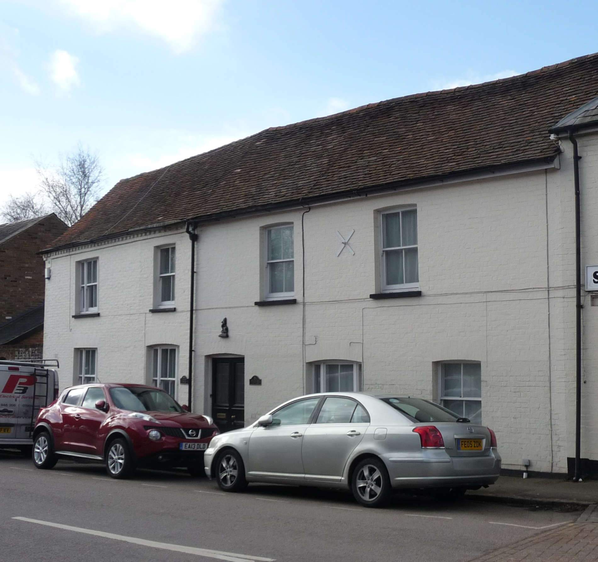
No.16, High Street is a very old building (over 400 years) and used to be a pub called The Lamb and then it changed its name to what? Look at the photo below.
Before walking back up the High Street, cross over Fish Street and turn left and walk a little way up the road. Look for Christ Church on the right.
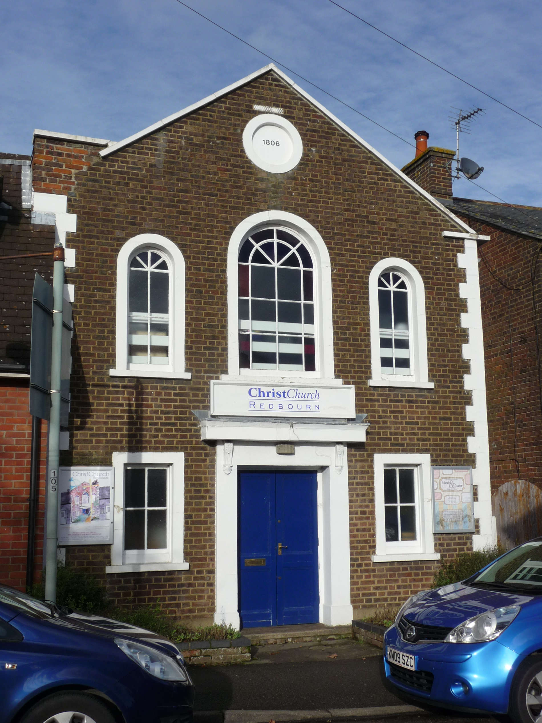
This an interesting buiding. It was once barn but converted to a meeting house in 1796. If you have already been inside or if you go in sometime you must be careful. One of the Preachers is buried under the altar – is it haunted?
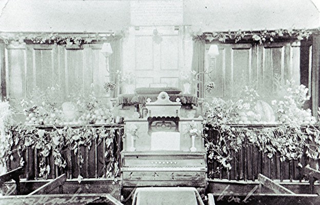
It was once the village library! Can you spot it in the next photo of Fish Street?
Now look at the building opposite.
The photo shows the building that was here in 2012. Can you find it now? Once, there were two gas holders on the site as it was the Redbourn Gas Works opened in 1861. The High Street was the first road to be lit in Redbourn.
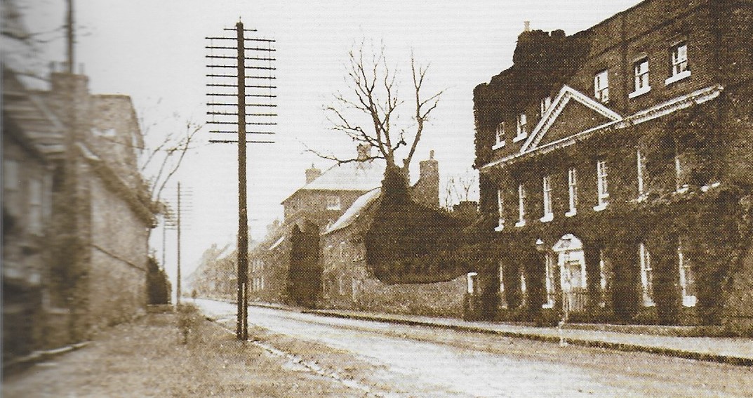
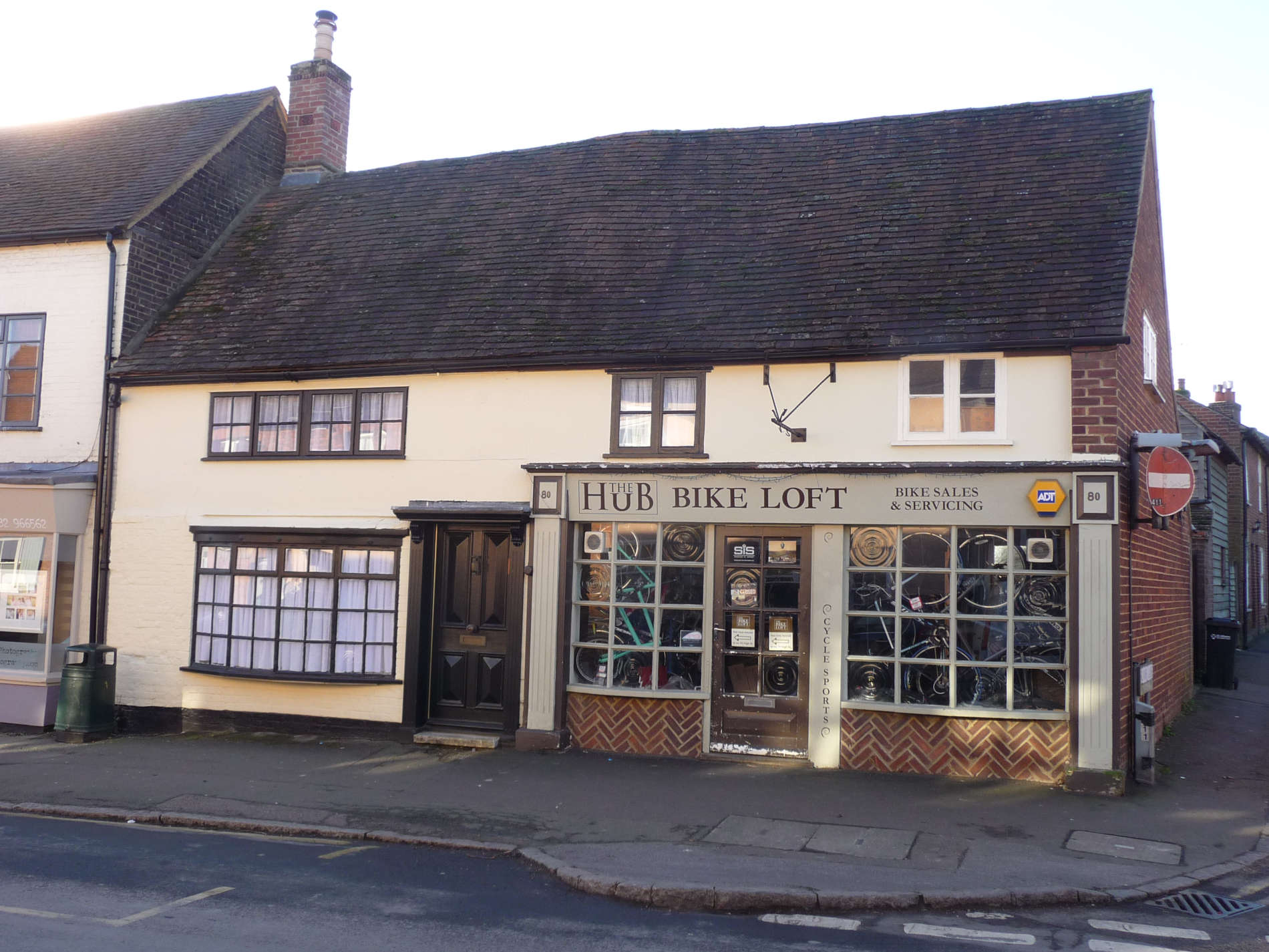
Now walk back towards the High Street and pause at the corner by “The Hub”.
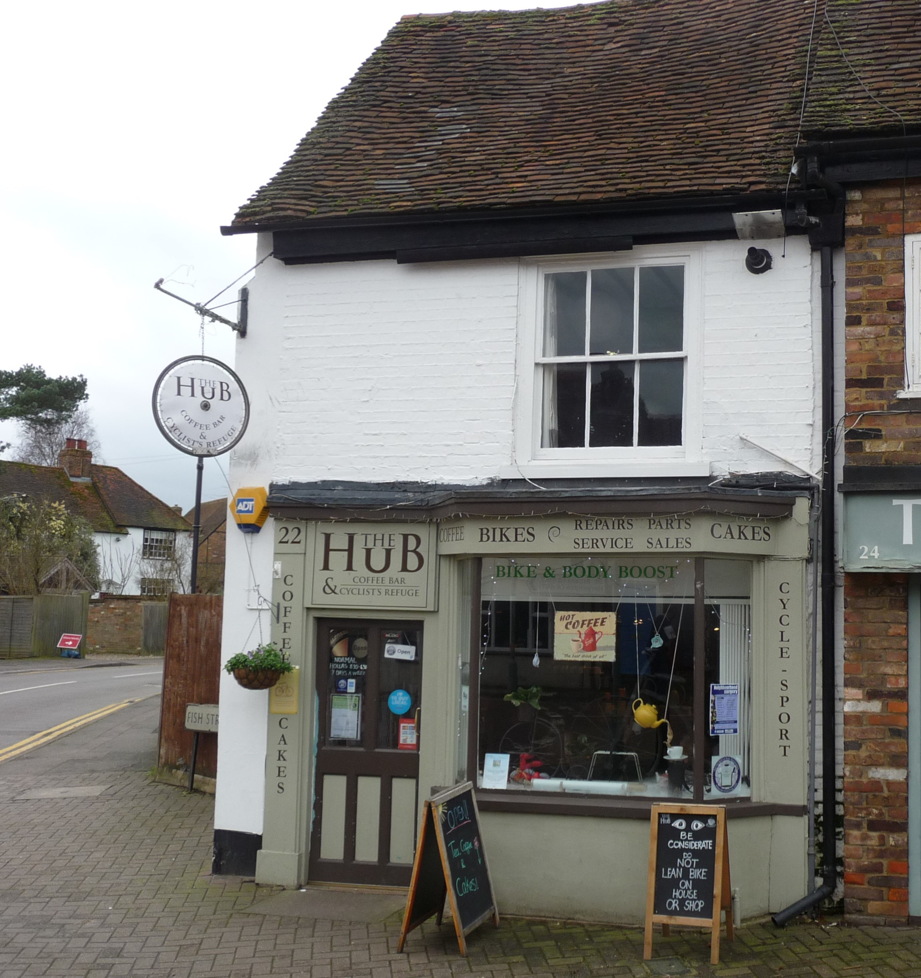
The Hub is now on the end of a row of shops but that was not always the case. Look at the next old photo. It shows the corner of Fish Street and the High Street in the early 1900’s.
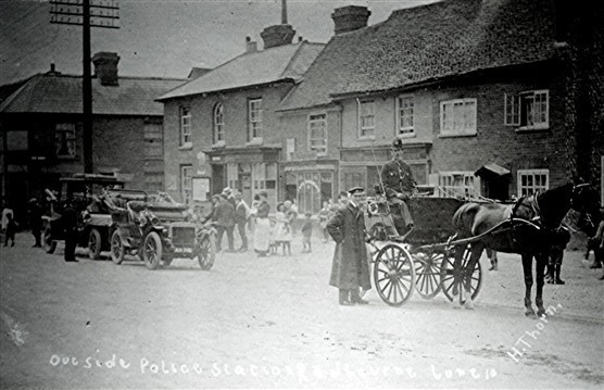
There is a big building on the end of the row. What was it? A clue can be seen by looking at the man sitting in the horse-drawn cart. It was knocked down in 1945 so Fish Street could be widened.
Where is the Police Office now?
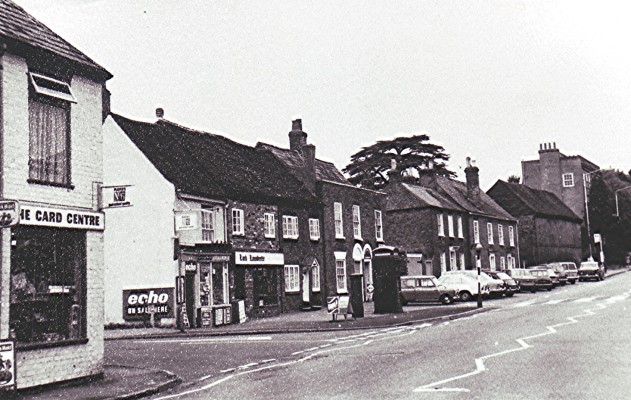
The Hub used to be a sweet shop “S.Webb” It is shown in the photo below that was taken in 1974.
Next to the hub was our inn no.11. It was called “The Lark”. It was not so much of a coaching inn but more a beer house for the locals. It closed in 1904. Since then, it has been a fish shop, a furniture shop, a toy shop, a laundrette and an antique shop. What is it now?
Have you ever noticed that the pavement is very wide here and there is even plenty of space for parked cars. Can you think why that is? Here’s a clue – St Albans has one every Wednesday and Saturday.
Yes, it is a market place. The market hall was where the Priory is now. It was King Charles I who granted the village the right to hold a weekly market on a Tuesday. (Yes, he got his head cut off later!)
Now walk up the High Street to our next inn – our 12th. Using the map can you work out what it was called?
This archway has never seen a coach. Look at photo no.2 below. See it on the left?
It was a barn and behind was the pub. The only picture of the Cock in that survives is below.
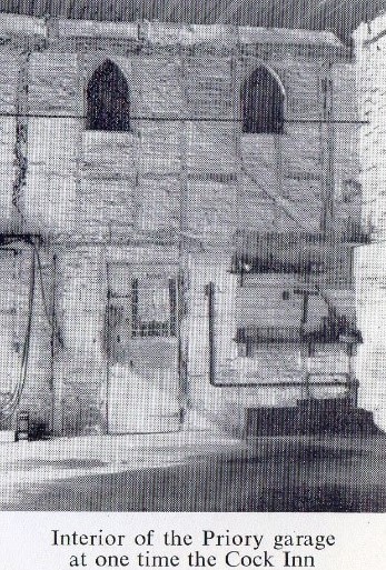
It was very big with “10 chambers”(bedrooms) and “5 parlours” (dining and living rooms). It was probably the biggest in the village. It later became the barn for Priory Farm and then a coach house later a garage for Priory House.
So where are all these buildings? All but Priory House (can you find that?) were pulled down in 1977. What a terrible loss – they would have been lovely. Even more sad – there are no pictures of them.
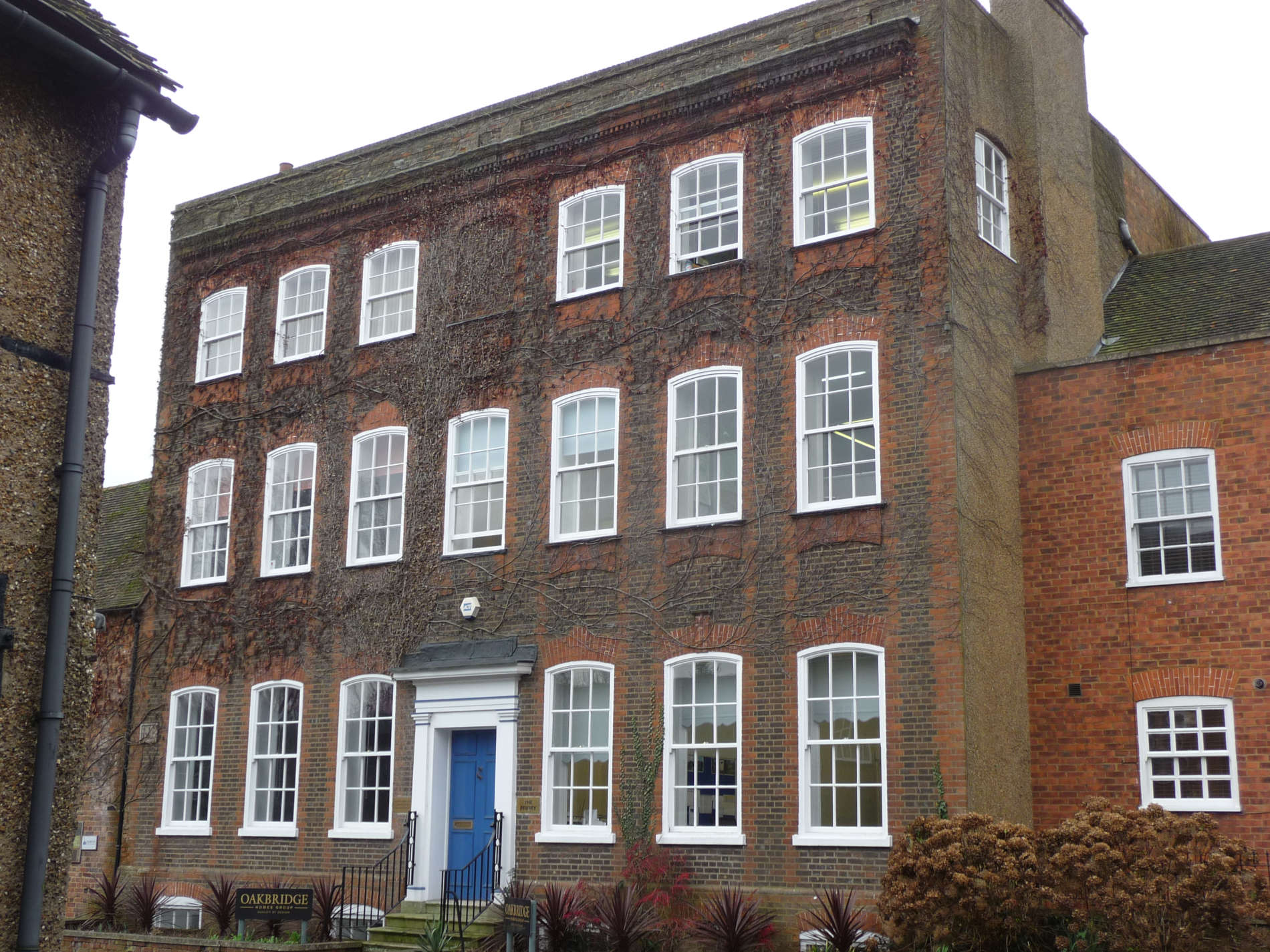
The Priory was a big house built 300 years ago. To build it, our 13th inn was knocked down. What was its name?
As it is called the Priory, some people think it was the site of the medieval St James’ Priory but who knows?
Continuing our walk we arrive at this building.
This used to be just one house about 300 years ago and lived in by the Stephens family (invented blue-black ink).
Part of the house was used as a school 200 years ago and more recently as “Dr. Totton’s house”. Look at the street sign next to the house. What does it say?
Walking on, you will arrive at this building.
This is our 14th inn. Look at the map to see what it was called.
Look up at the roof and compare it to the others nearby and you will notice something different. (look at the roof line). It is very old – over 500 years old. Look through the windows to see the wooden beams and see how small the rooms are. Through history, it has been a butcher’s shop, a saddlery and cycle shop and an antique shop.
Just a little further along you come to this building.
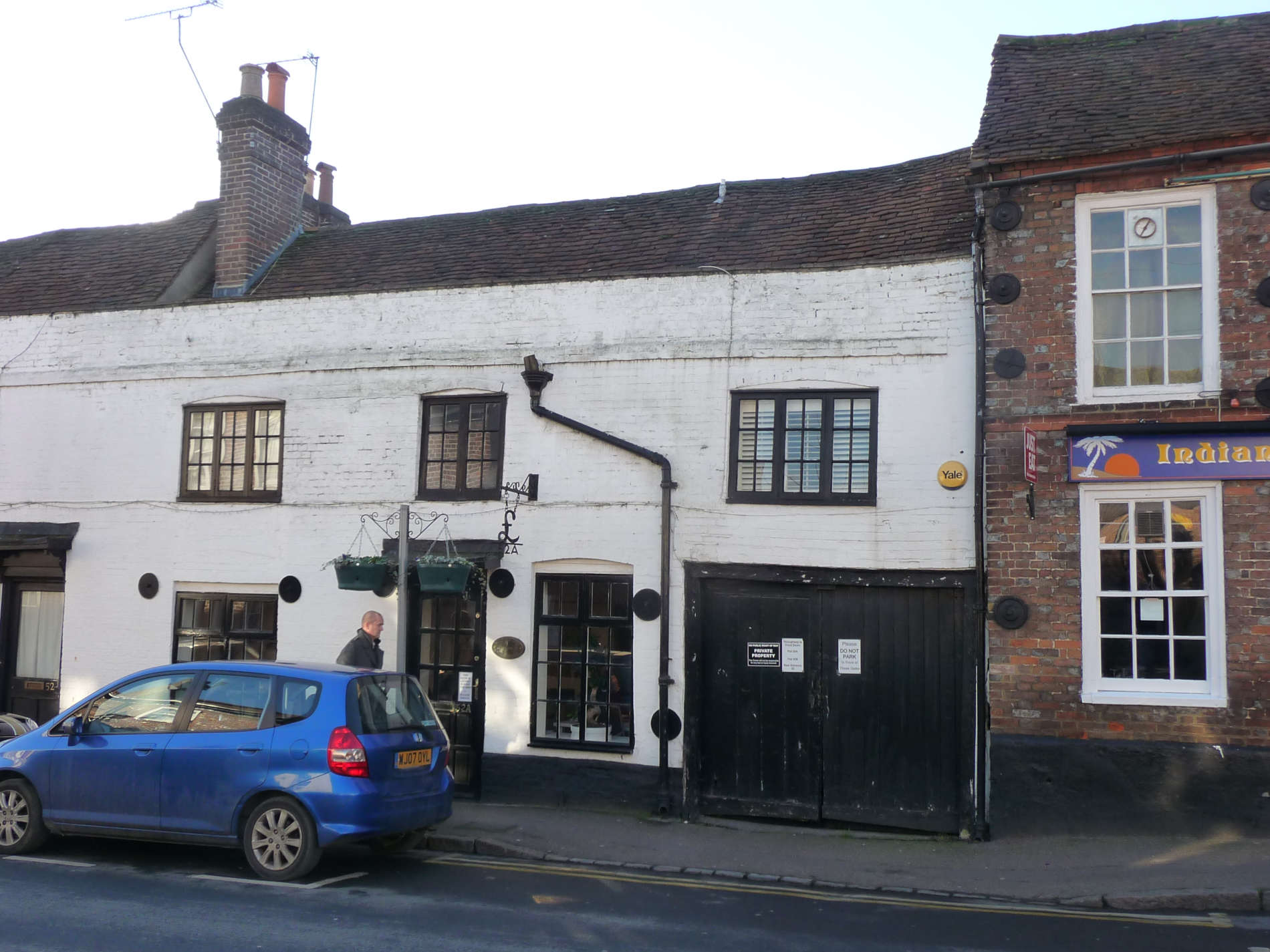
No prizes for guessing what this building used to be! It’s the 15th inn. You can see its name on the map above. Again, it’s very old (400 years +) and ran as an inn until 1933. After that it has been a greengrocer’s, shoe repairer and a betting shop.
Look at the building next door.
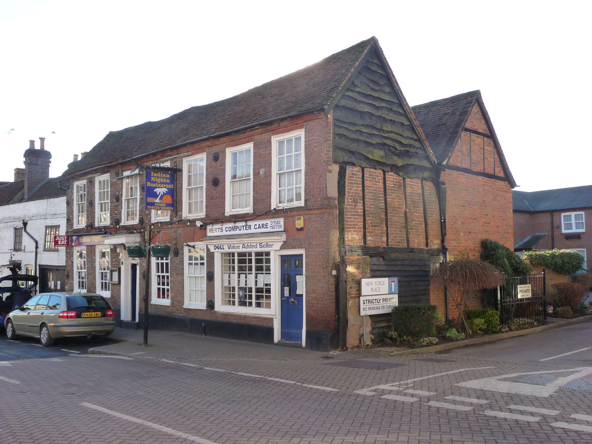
Can you work out how the two photos are linked? Clue: Look carefully at the end wall of the house today behind the street name signs. It was once inn no.16. Look at the map again. What was it called?
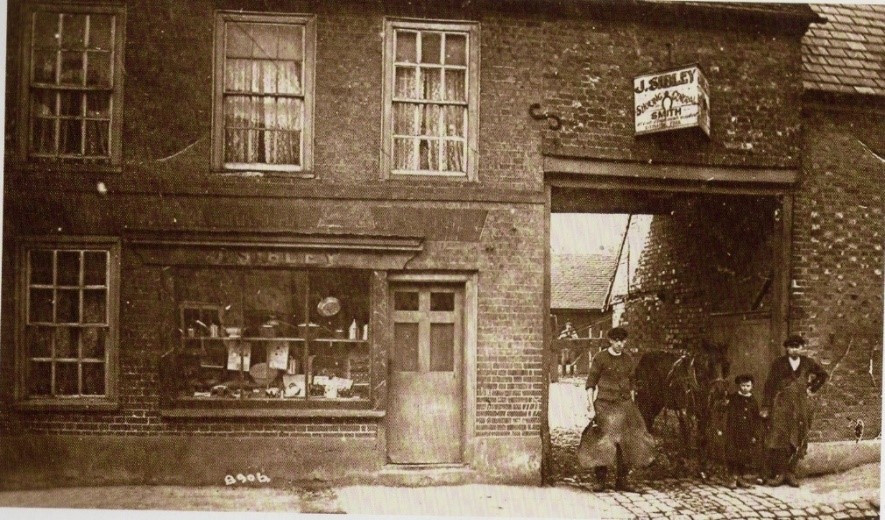
Look in photo no.2 at the notice over the throughway that two men and a boy are walking with a horse. What does the notice say? This was the site of a smithy but you might have guessed that because what is the name of the new sheltered accommodation just along the street?
Now walk up to the Co-op.
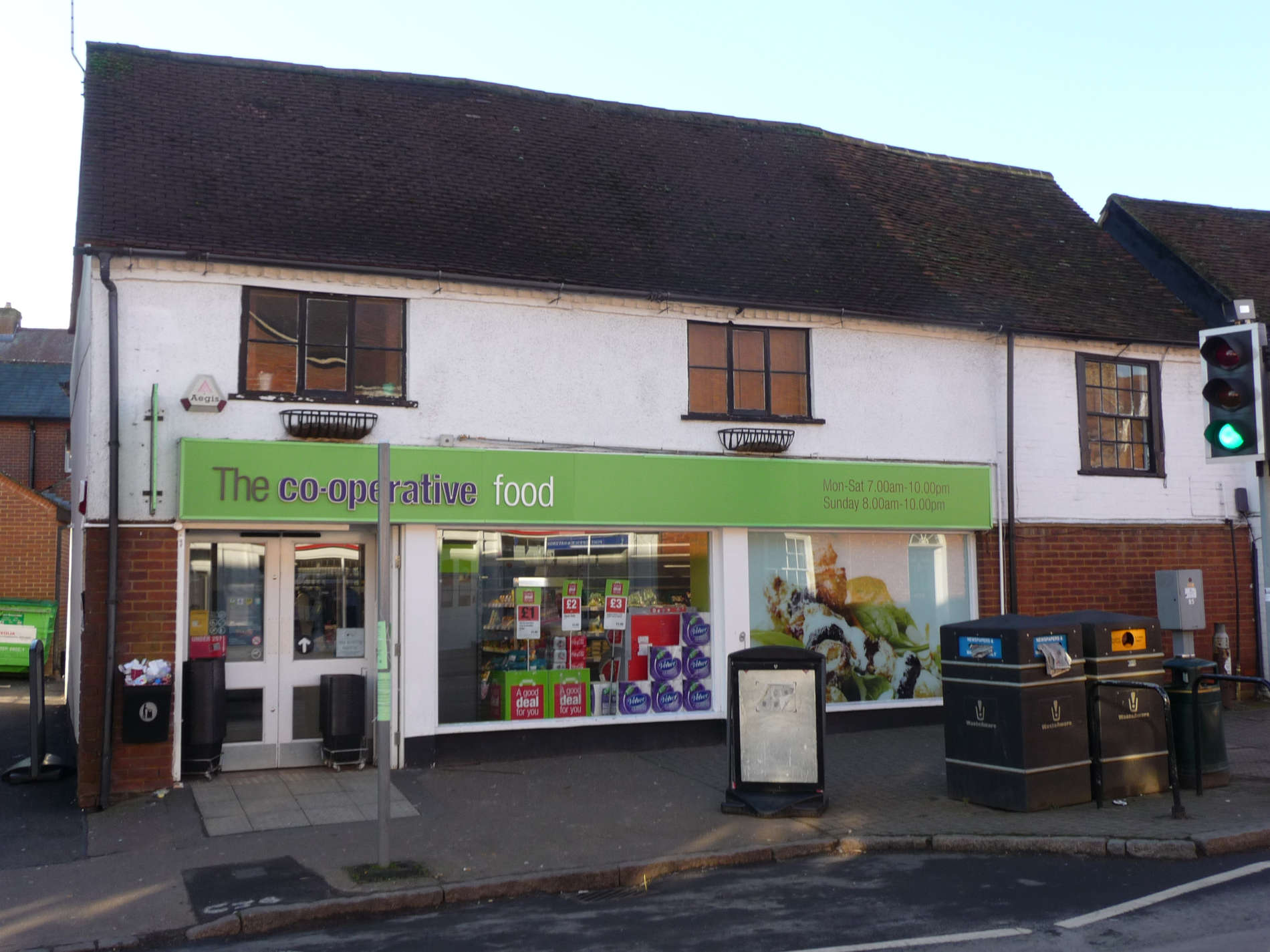
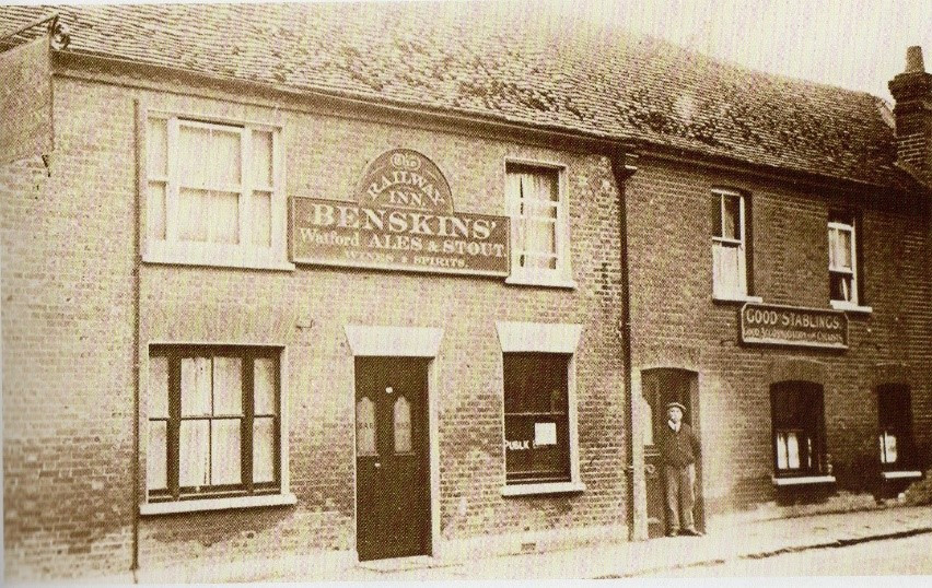
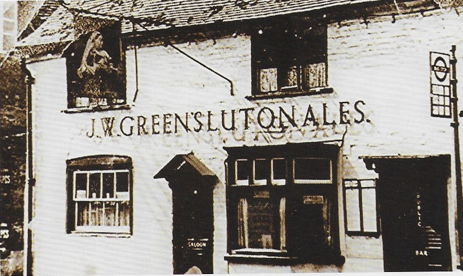
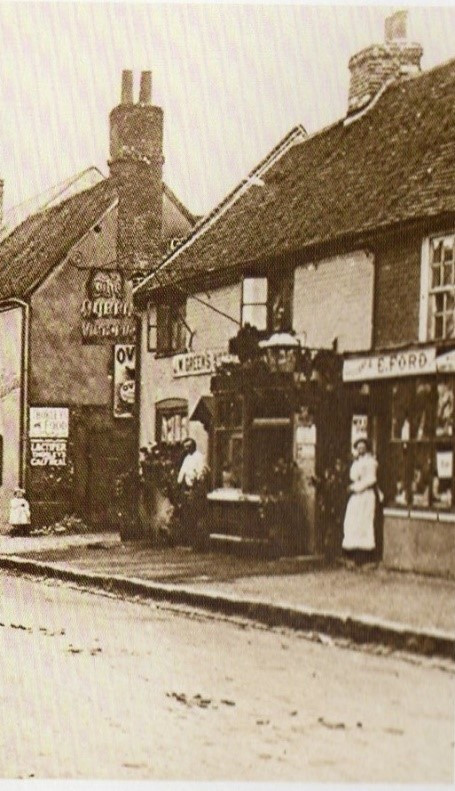
Known to us all as the Co-op but it was inn no.17. What was its name? Look at the sign hanging outside the inn in the photo below.
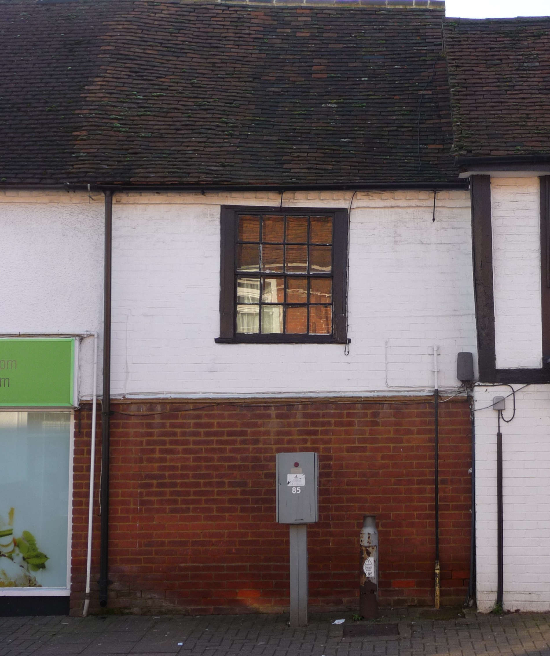
It closed in 1968. The building is 400 years old – you might have noticed how low the ceiling is when you have shopped there. The Co-op incorporates No. 66 next door.
Take a look at photo no. 4 below. It was a little grocer’s shop. What was its name?
Now keep walking until you reach the junction on the left.
This was our 18th inn. Its name incorporated a lady’s name. What was it called? Look at the map. Maybe the original owner brewed beer!
The building is over 500 years old. In that time it has also been a grocery shop, a barber, a fishmonger, a greengrocer, a bakery, a tearoom and now a store for the Hub cycle shop. And it has been done up!
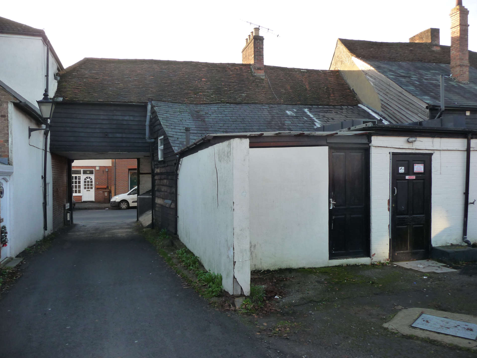
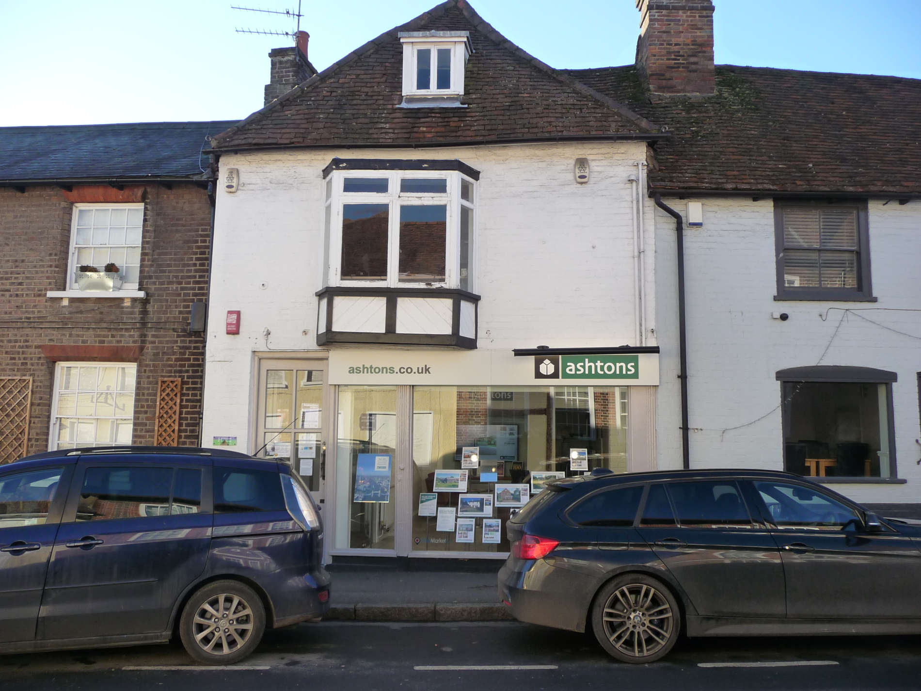
Cross over the road to stand outside our 19th inn. What was it called?
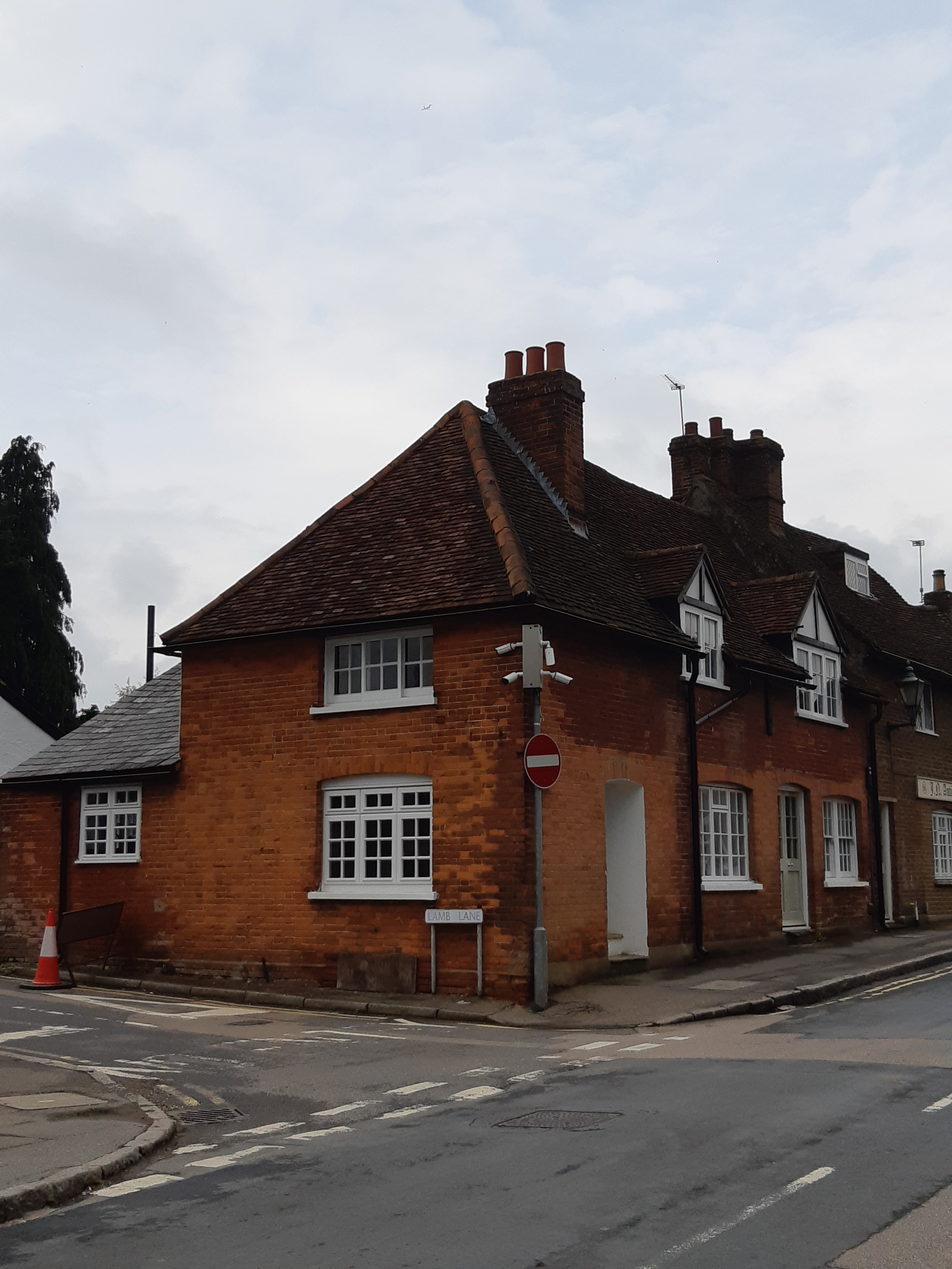
Photo no.2 is interesting because we can see around the back. The backs of all the buildings along the High Street are more interesting than the fronts – take a wander round some time and see!
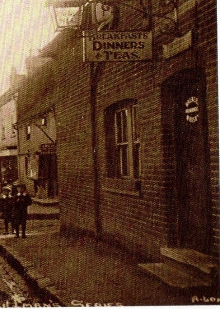
Photo no.3 shows the way into the inn. Can you find that door now? The house is over 400 years old and could have been at first a farm known as White Lamb.
What is the name of the road you have just crossed that runs alongside this building? It closed as an inn in 1914 and since then has been a greengrocer, a florist shop, an estate agent, a hairdressers and antique shop, a beauty salon and now homes.
So now we have reached the end of the walk – NINETEEN INNS, not all running at the same time, and many old houses. We are very lucky that the whole of High Street is a conservation area.
If you want to learn a more detailed history of all the buildings in the High Street, go to the full history version of Heritage Walk No.5 on the village website.