Heritage Walks No.3 (For Kids)
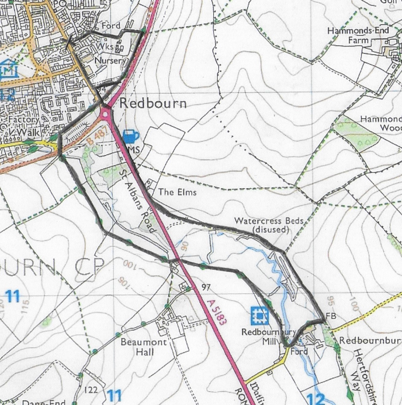
Start the walk on the High Street at Waterend Lane (marked with a cross on the map)
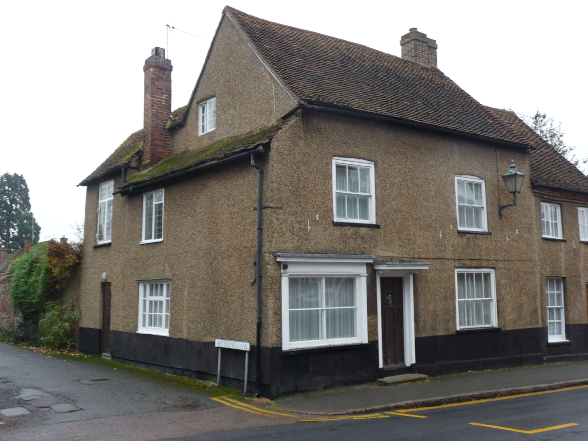
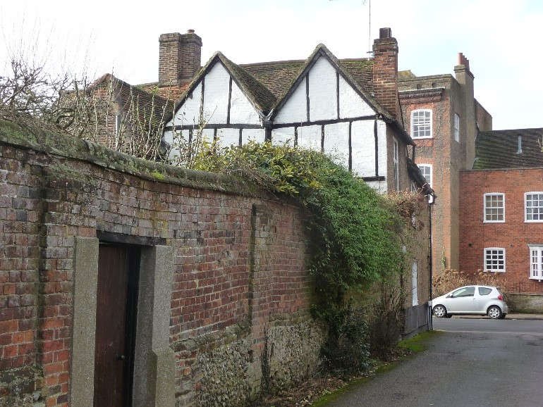
Start walking down Waterend Lane. Look at the wall on the right. This is very old and once surrounded Redbourn House which has now gone.
- Where do you think this lane leads to? The clue is in the name!
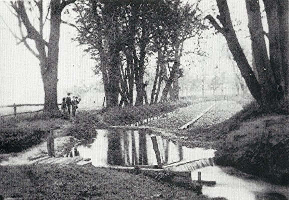
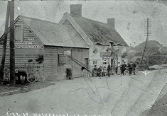
- What did the villagers used to do here? The clue is in photo no.2.
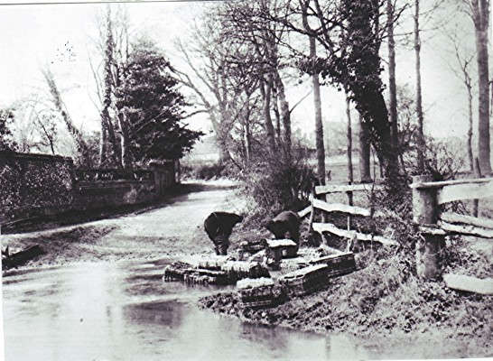
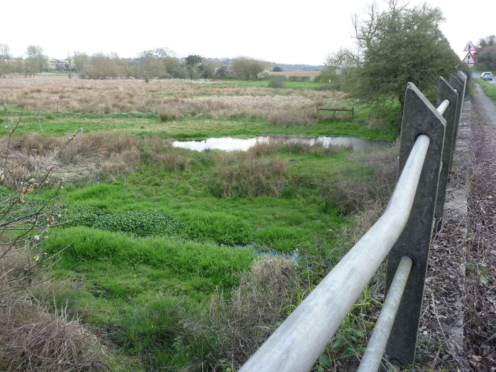
Can you find the spot where photo no.2 was taken in 1865? Look at photo no.3 below.
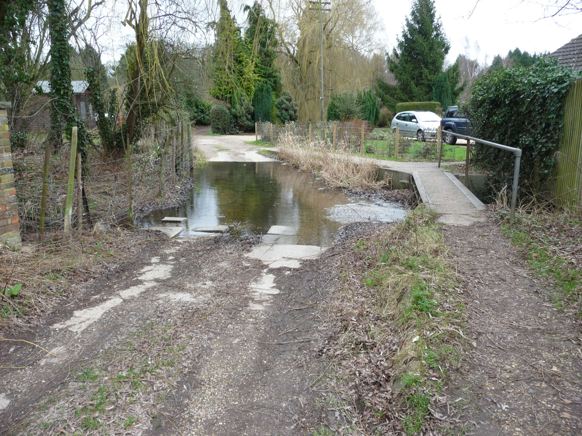
- Can you imagine standing where the children are standing in the next photo?
- Do you know the name of the river?
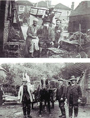
The Samson family ran the watercress beds and lived at Ver House (in the High Street). The cress was taken by horse drawn cart to Redbourn Station bound for London.
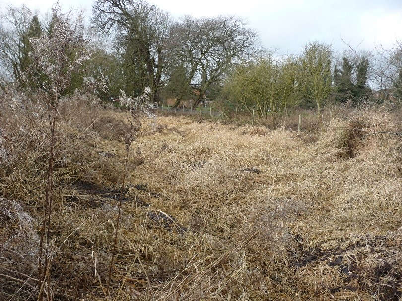
The watercress beds are overgrown now but you might be able to spot them.
Walk across the footbridge over the river and keep walking until you reach the Nickey Line footpath. Take care as you go down the old wooden steps. Turn right and walk along the footpath. This was once a railway line.
Who uses it now?
The railway line ran from Hemel Hempstead to Harpenden and was opened in 1877.
Have you been to the Millenium Park? This is the site of Redbourn Station.
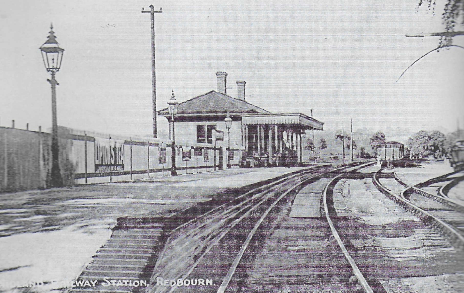
Look at the vehicle below. Is it a bus or a train?
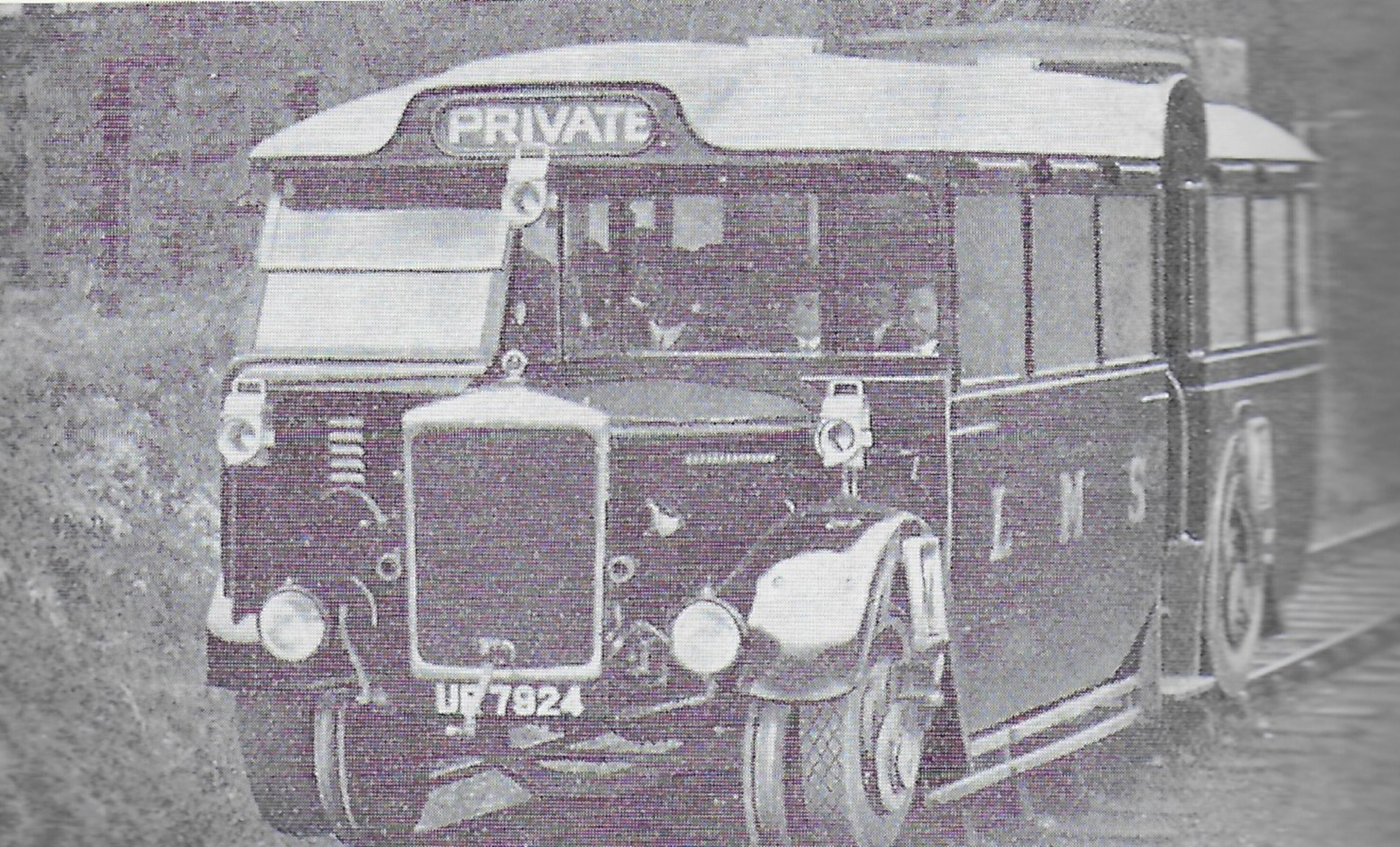
The line closed in 1982. How about another walk along the length of the Nickey Line? Perhaps ride your bike? It is 8 miles (14kms) long.
While you have been walking, you will have heard the noise of the by-pass. Because of accidents in the High Street, the by-pass was built and opened in 1984.
You will see a sign post to the High Street. Turn right here and walk down to the High Street where you should turn left. Walk under the old railway bridge towards the rounabout.
At the roundabout, cross over the by pass heading in the direction of the petrol station. Keep walking and you will see The Chequers pub on the right.
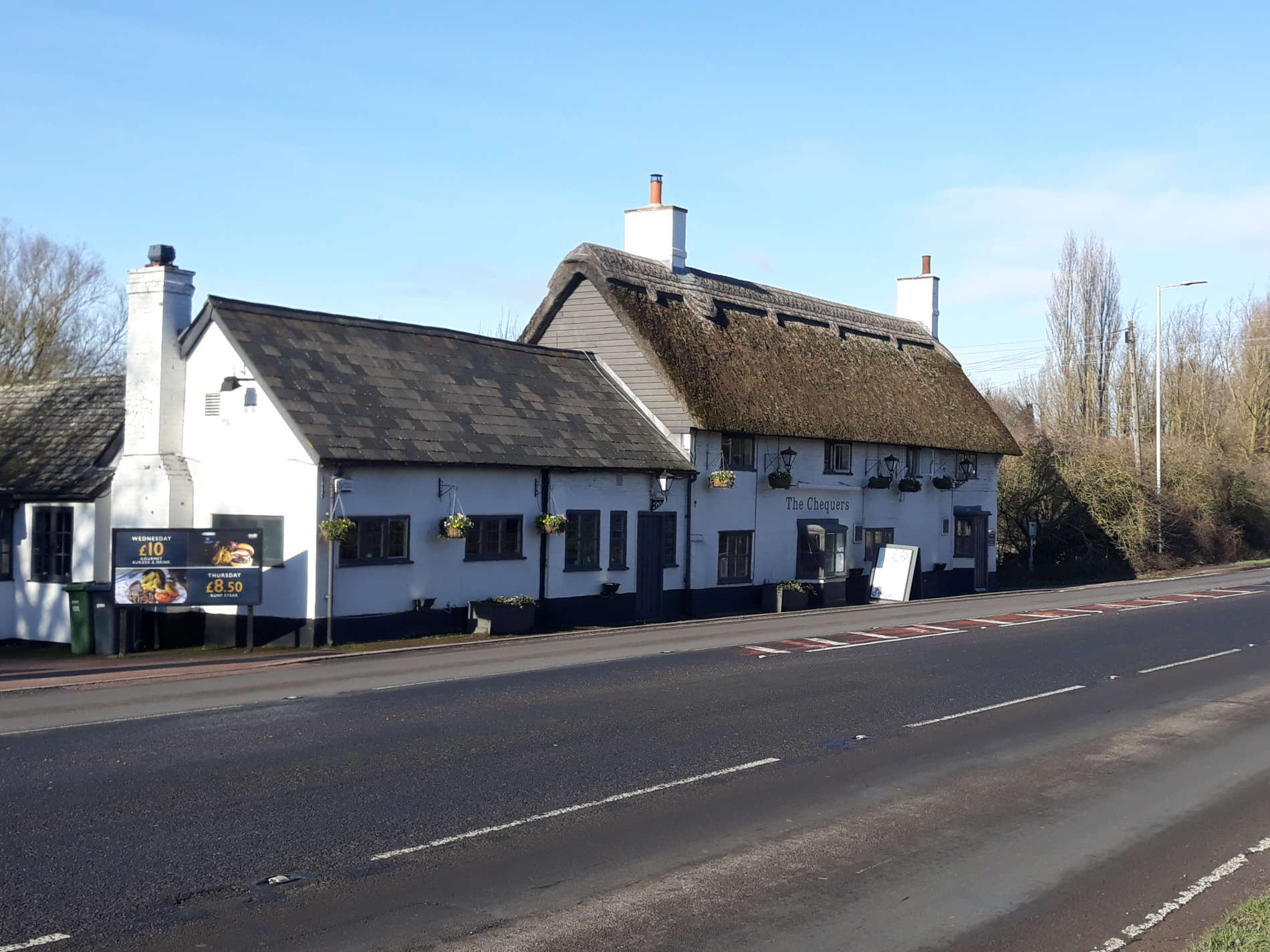
Which is the oldest part of the building? The clues are the roof and the inside. This part is about 450 years old.
If you look to the right hand side of the pub, there is a lane. Can you guess (or at another time find out) where it comes out? It was once the main road to Hemel Hempstead before the by-pass was built!
Continue walking down the road. Look out on the left for The Elms
The Elms – our own forgotten, unloved, and overgrown secret house over 200 years old. It once had lots of land and a big garden.
Across the road you will see The Runners.
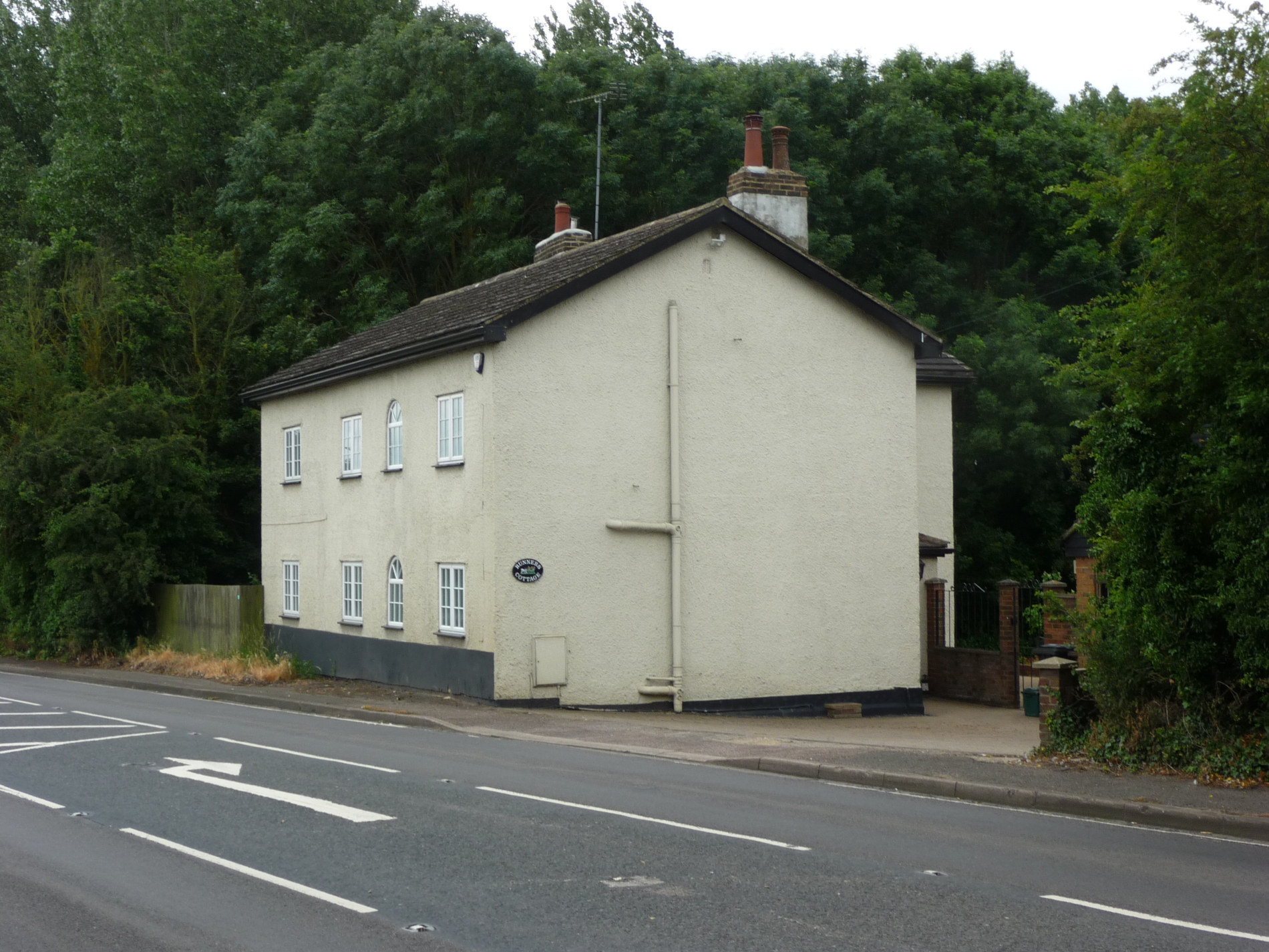
This was once a pub called “The Green Man” and then “The Running Horses” Why was the name changed? (think of coaches and horses).
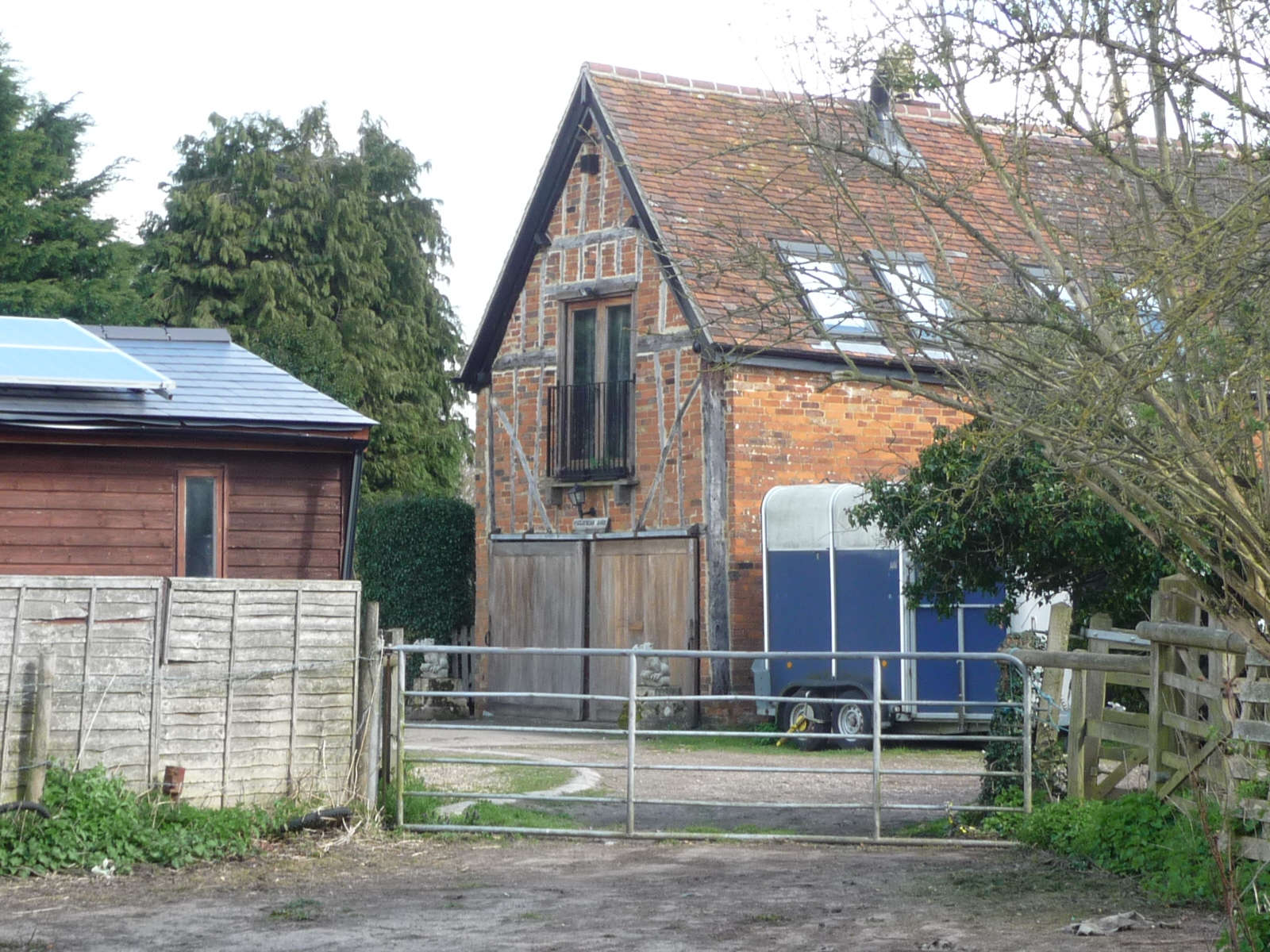
Walk past the Elms and climb over the stile on the left into the field. Walk through the field with the hedge on your left until you reach a “kissing” gate. Go through the gate and walk on with the wood to your right. Pass the gates to Redbourn Fisheries and on to the ford. Cross the River Ver to the right, using the bridge and the walk-way behind the barn. Keep walking and you will arrive at Redbournbury Mill.
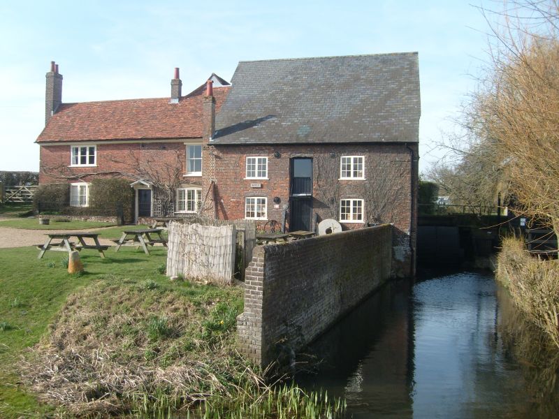
- Where does the miller work?
- Where does the miller live?
- What does he do in the building shown in photo no.2?
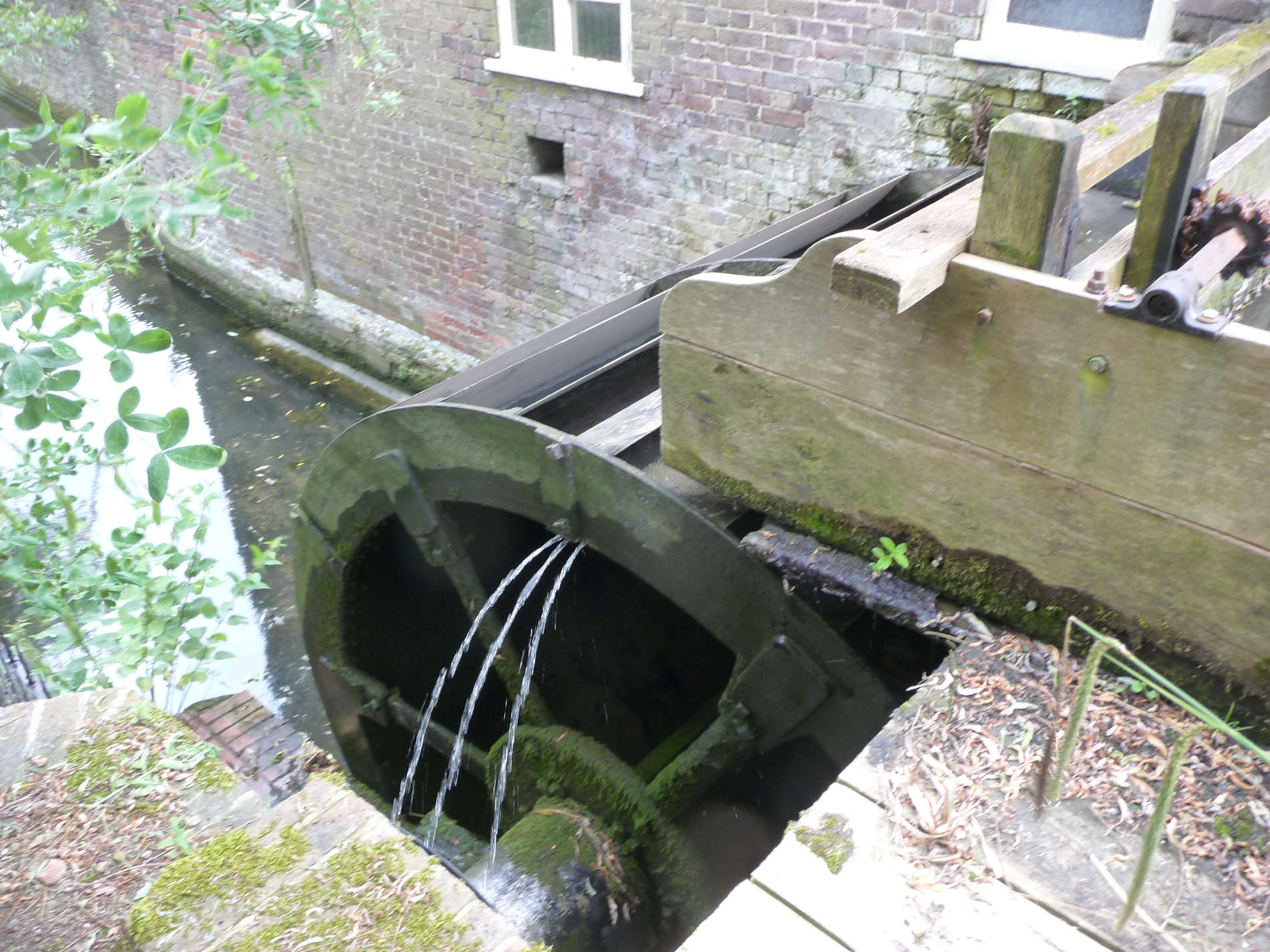
- Can you find the waterwheel?
Here is a photo of it from the back garden
There has been a mill here since before the time of the Norman Domesday Survey in 1086. It belonged to St Alban’s Abbey, and after the dissolution of the monasteries by Henry VIII it went to the Crown. It later came into the hands of the Earls of Verulam. They milled grain from their land and from the Abbey land.
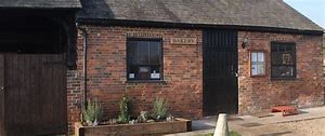
A visit to the mill is very interesting and the cakes from the bakery are declicious!
Now time to move on. Look to the left of the mill house and you will see a footpath running alongside the house. Walk along this path into the fields beyond. Keep walking until you reach the main St Albans Road.
Before you cross over the road, pause for a moment. You are standing close to where another mill once stood.
Dolittle Mill was also called Bettespool. Do you know where to find a road in the village with almost the same name?
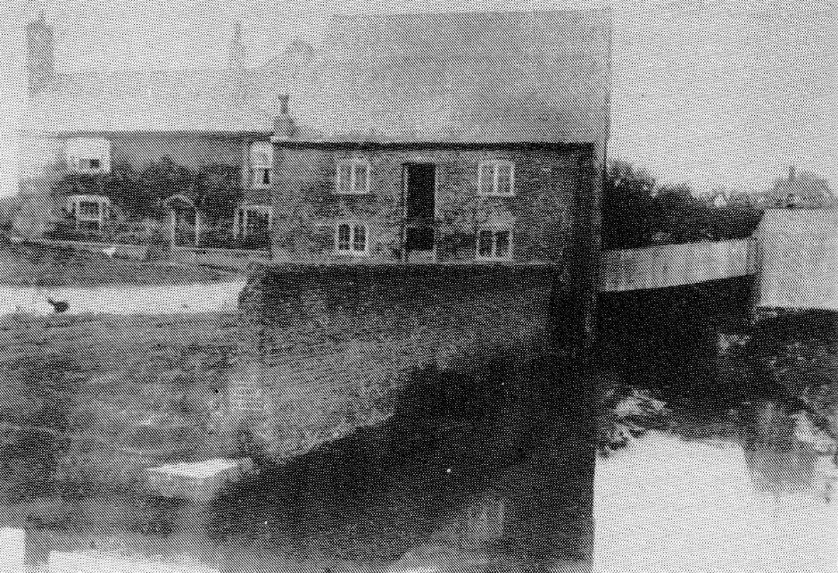
If you look carefully from the bridge shown in photo no.1 you can see lots of lumps and bumps in the field and little streams of water (if it is not a hot summer!) Now look at photo no.2 below.
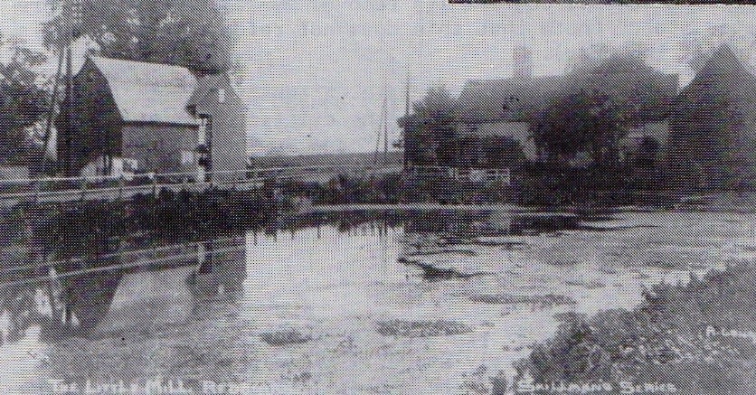
The mill (on the left) is where you are standing on the bridge and on the opposite side is the mill house.
Look over the road. Can you see the mill house that is shown in the old photo?
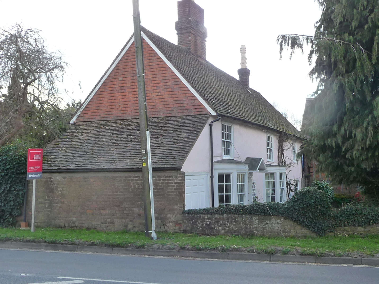
The mill was mentioned in the Domesday Book. As you can see, the mill has gone but the house which is around 300 years old and the barn, are still there. Carefully cross the main road and head for the mill house.
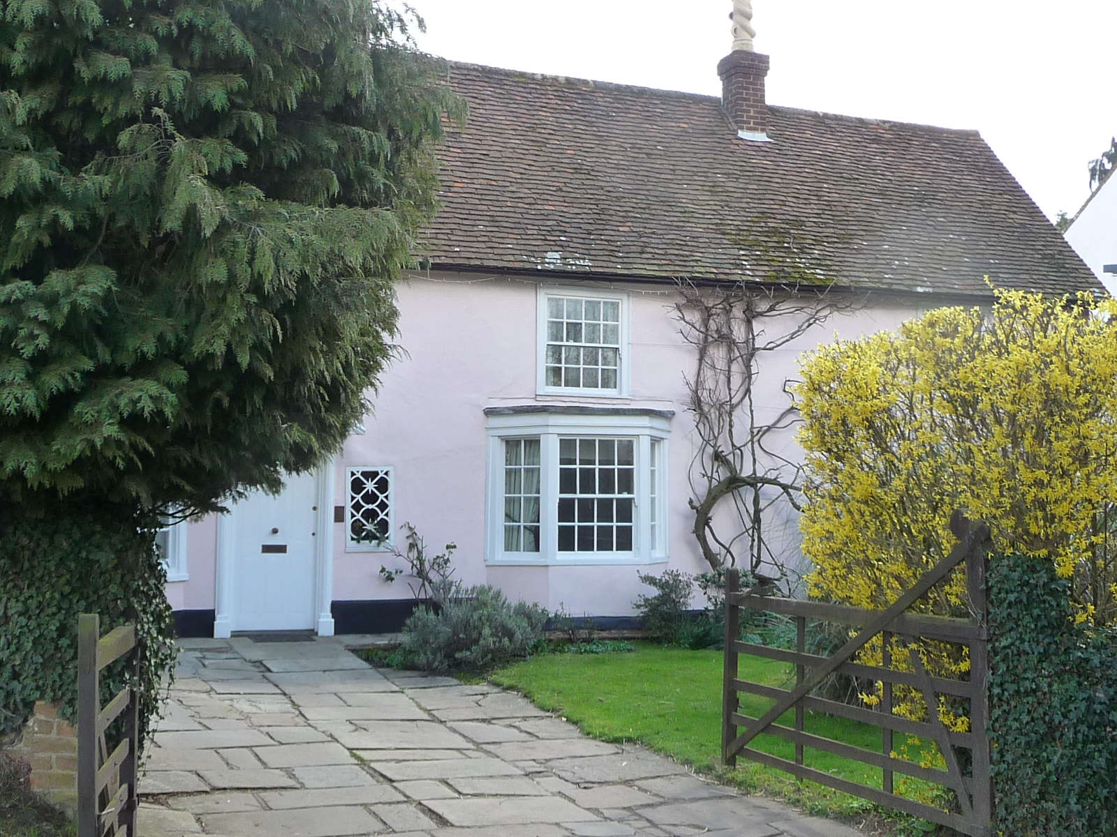
Like Redbournbury Mill, Dolittle was owned by the Abbey, Henry VIII and the Earls of Verulam. It milled grain from Redbourn village. Later it became a paper mill. In the 1950’s it was pulled down so the road could be widened but the house survived. Walk past the house and the barn, and take the the footpath that forks to the right in front of the barn.
Walk along the path and keep walking straight in the same direction until you meet the by-pass. Cross over and take the narrow footpath that leads up to the Nickey Line footpath. Turn right and head back towards the village. Cross the old railway bridge.
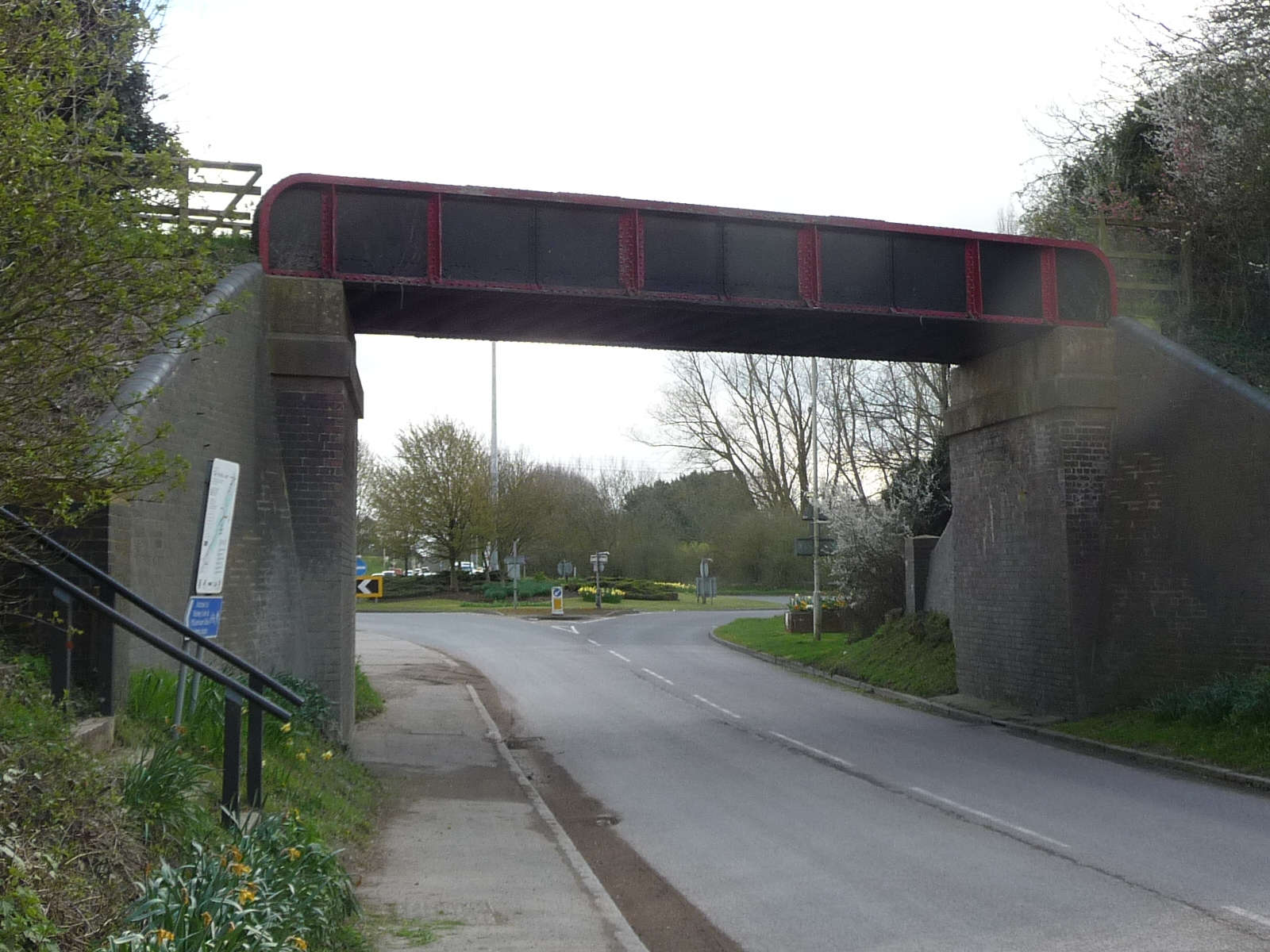
After crossing the bridge, turn left and walk down to the High Street. Turn right and start walking back up the High Street. Take a look at the industrial estate on the right.
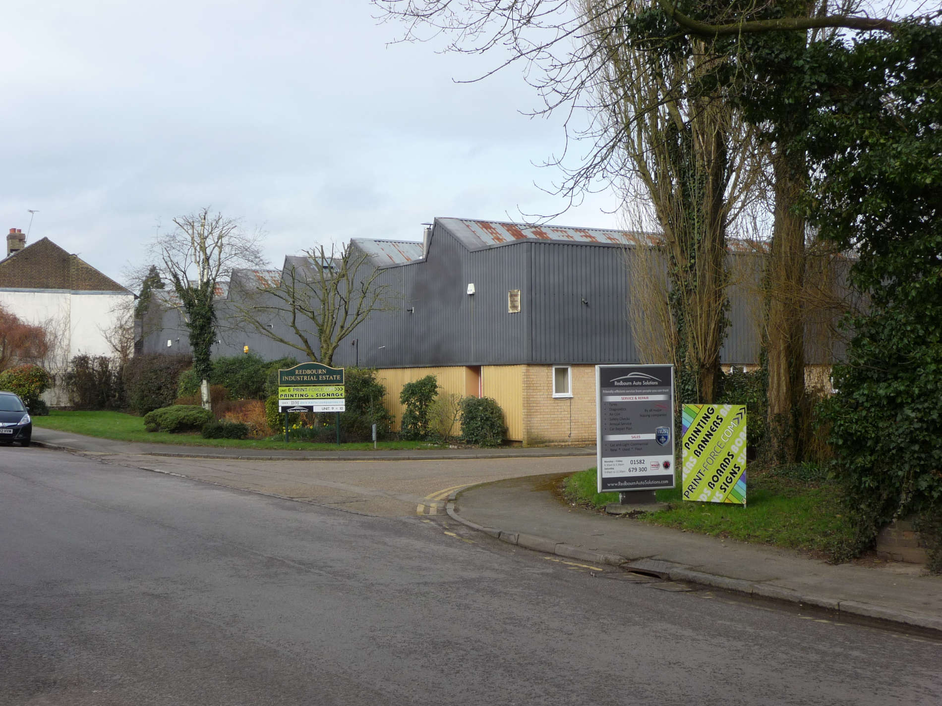
- Do the buildings look new or old?
- If you think the buildings are new, have you thought what might have been there before?
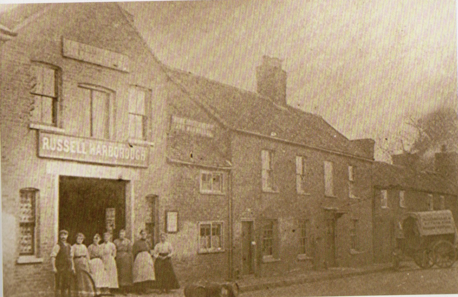
The photo above shows what once stood here.
A man named Russell Harborough ran a jam factory in the 1800’s. Jam and sweets were made in the factory using fruit grown in the fields around Redbourn.
- Can you see the workers in photo no.2 standing outside the factory?
- Can you think of any fruits that would have made tasty jam?
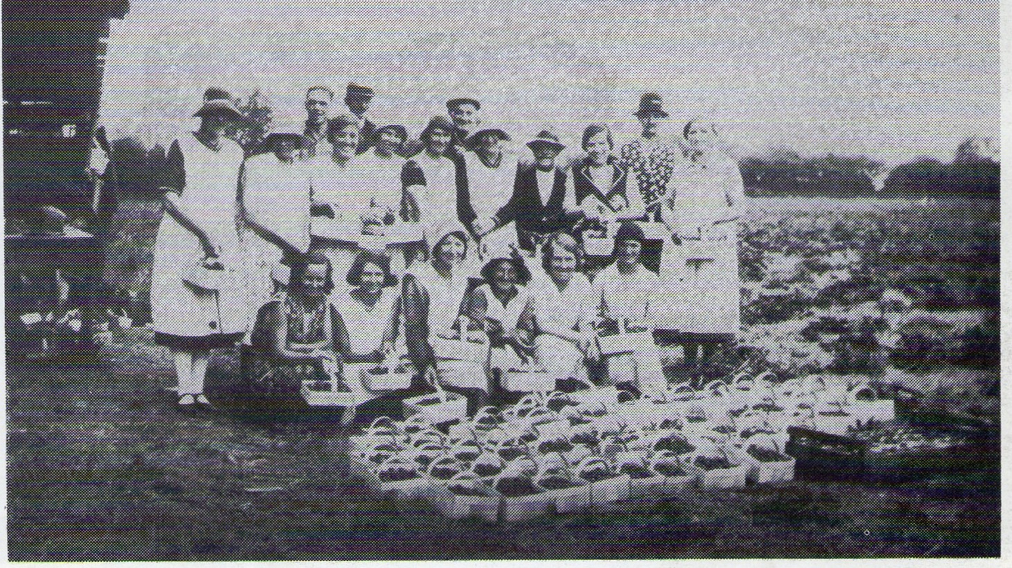
These workers are in the fields around Redbourn. What have they been doing?
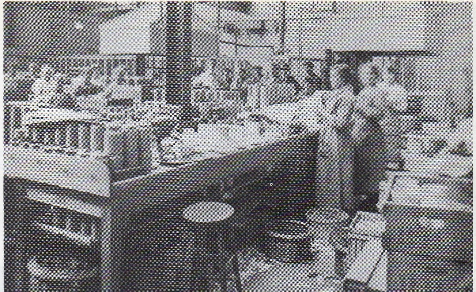
What do you think the workers in photo no.4 are doing?
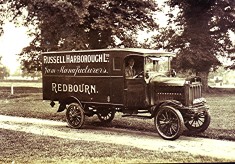
What do you think this van is doing?
Look at the other side of the road.
Looking from the High Street into Fish Street Farm 100 years ago, you would have seen a farmyard with barns and a milking parlour. Imagine the chickens, cows and the smell of the farmyard..
If you looked across the road at the same spot 800 years ago you might have been looking at church-like buildings – chapel, cloister, dormitory etc. This was Redbourn Priory, site of St James’ Chapel dedicated to St Amphibalus, the Roman who Alban tried to save. (for the full story visit the Redbourn Village website. select “Heritage” and then “The Park”)
Take a look up the High Street. The following photo’s have been taken from almost the same place. One is very new and the other is taken around 1900.
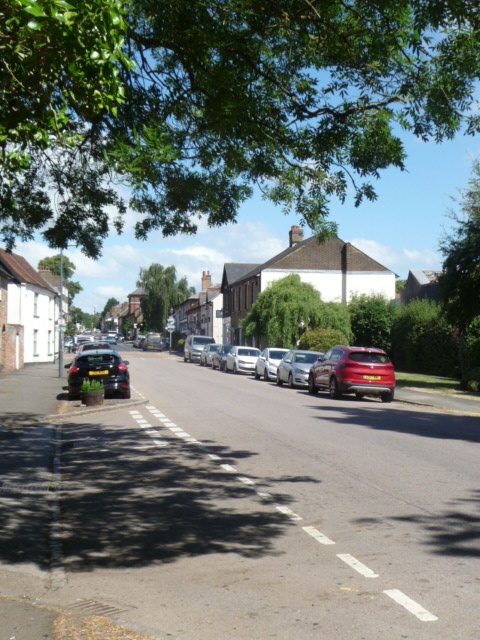
- Can you spot the differences?
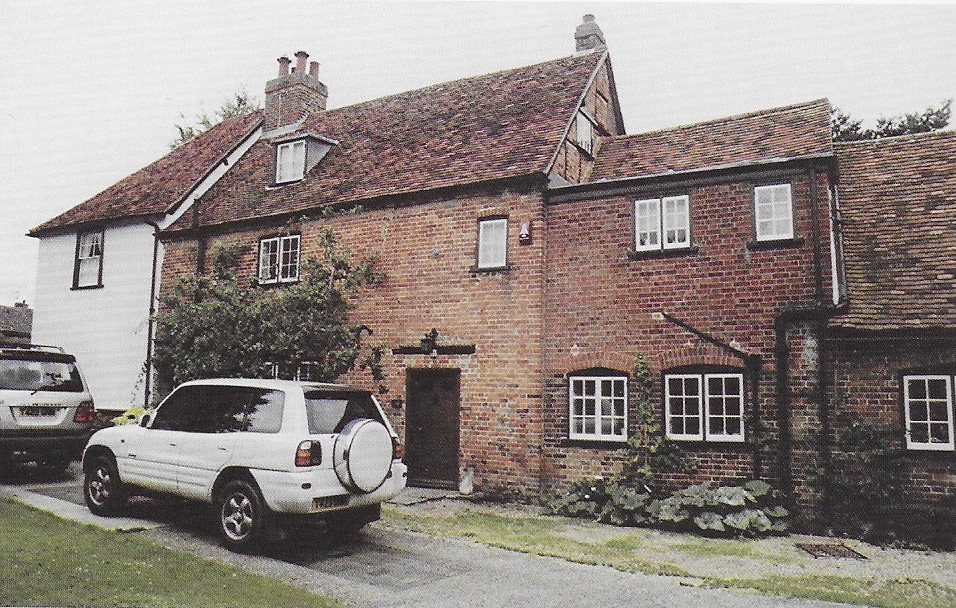
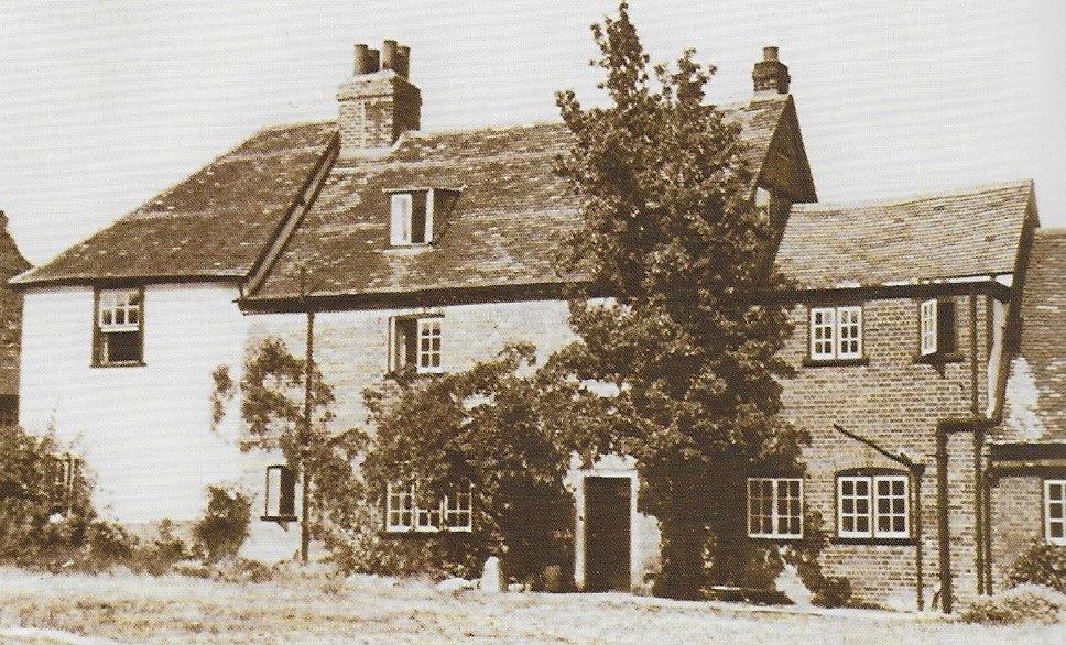
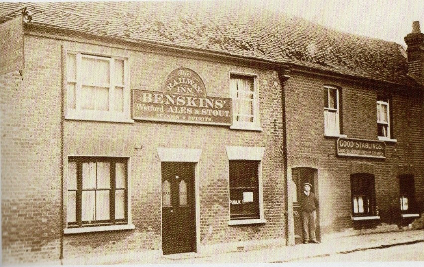
Continue walking up the High Street. Can you see this building on the opposite side of the road?
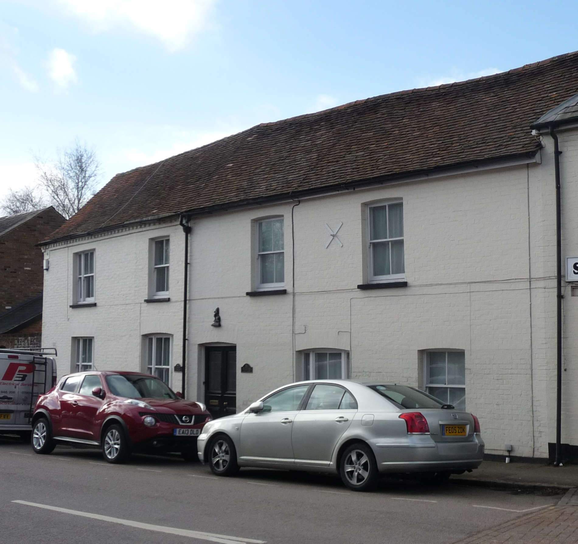
No.16, High Street is a very old building (over 400 years) and used to be a pub called The Lamb and then it became what? Look at the photo below.
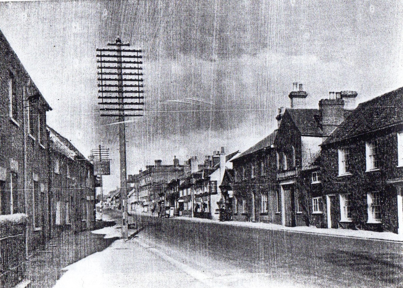
Carry on walking until you get to the junction of Fish Street and the High Street. Look across the road and you will see “The Hub” on the corner. The next old photo shows the corner of Fish Street and the High Street in the early 1900’s.
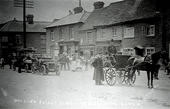
- What was this building on the corner? Look at the man sitting on the horse drawn cart in the photo. That should give you a clue.
- Is this building there now?
- Why do you think it isn’t there any more?
Now continue your walk up to the place where you started at Waterend Lane. Why not try some other walks around the village?